

- Usage in publication:
-
- Lombard Limestone*
- Modifications:
-
- Overview
- AAPG geologic province:
-
- Montana folded belt
Summary:
Is a new formation in the Montana folded belt province assigned to Snowcrest Range Group defined in Chapter B. Represents shallow-water carbonate deposition in slightly deeper and clearer water than the underlying Kibbey Sandstone. Contains brachiopods and corals of Late Meramecian age in lower half and brachiopods and corals of Chesterian age in the upper half. Composite section. Geologic map. Correlation chart.
Source: GNU records (USGS DDS-6; Denver GNULEX).
- Usage in publication:
-
- Lombard Limestone*
- Modifications:
-
- Original reference
- Dominant lithology:
-
- Limestone
- Siltstone
- Shale
- AAPG geologic province:
-
- Montana folded belt
Summary:
B2-B3, B4-B6. Lombard Limestone of Snowcrest Range Group. The Lombard Limestone, here named, is the middle formation of the Snowcrest Range Group (new name). Crops out throughout most of southwest Montana in the Tendoy Mountains, Pioneer Mountains, Blacktail Mountains, Snowcrest Range, Ruby Range, Tobacco Root Range, northwestern part of the Gravelly Range, Elkhorn Mountains, Horseshoe Hills, and Bridger Range. Consists of a geographically restricted lower unit of poorly fossiliferous, thin to thick, indistinctly bedded lime-mudstone and packstone and an upper unit of fossiliferous, thin- to thick-bedded, skeletal lime-mudstone, wackestone, and packstone containing thin interbeds and partings of silty limestone, siltstone, and shale. Overlies the Kibbey Sandstone and underlies the Conover Ranch Formation (new name), both of the Snowcrest Range Group. At type section, unconformably underlies Tyler Formation of Amsden Group. Is equivalent to the Otter and Heath Formations of the Big Snowy Group and to part of the Tyler Formation of the Amsden Group in central Montana, to the South Creek and Surrett Canyon Formations in east-central Idaho, and to the Railroad Canyon Formation (new name) in the Beaverhead Range, Idaho and Montana. Thickness is 49.7 m at the type section and attains 130 m. Age is Late Mississippian (late Meramecian to late Chesterian) (Mamet Foraminifer Zone 15 and Sando and Bamber Coral Zone IV to Mamet Foraminifer Zone 19).
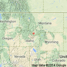
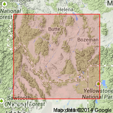
Type section: exposures 1 km north of Lombard Station, in S/2 sec. 7, T. 4 N., R. 3 E., Toston 7.5-min quadrangle, Broadwater Co., southwestern MT.
Source: Publication; US geologic names lexicon (USGS Bull. 1565, p. 181-182).
For more information, please contact Nancy Stamm, Geologic Names Committee Secretary.
Asterisk (*) indicates published by U.S. Geological Survey authors.
"No current usage" (†) implies that a name has been abandoned or has fallen into disuse. Former usage and, if known, replacement name given in parentheses ( ).
Slash (/) indicates name conflicts with nomenclatural guidelines (CSN, 1933; ACSN, 1961, 1970; NACSN, 1983, 2005, 2021). May be explained within brackets ([ ]).