

- Usage in publication:
-
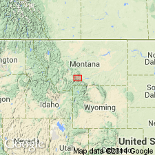
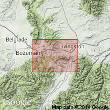
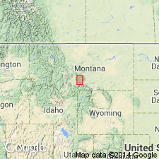
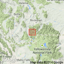
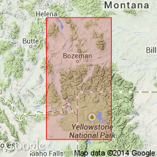
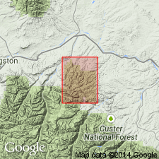
- Livingston formation*
- Modifications:
-
- Named
- Dominant lithology:
-
- Sandstone
- Conglomerate
- Shale
- AAPG geologic province:
-
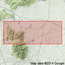
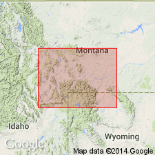
- Montana folded belt
Summary:
Named for exposures base of mountains south of Yellowstone River near Livingston, Park Co, MT, Montana folded belt province. No type locality designated. Unconformably overlies Laramie Formation. Composed of 7,000 ft sandstone, grit, clay, conglomerate made up of debris from andesitic lava and other volcanic rocks. Shown across northwest, central, east part geologic map. Covered by Fort Union formation in Crazy Mountains north of report area. Best exposures found Madison, Jefferson Ranges. Divided into leaf beds, conglomerates, volcanic agglomerates. Leaf beds make up basal part and best section 280+ ft thick measured at Blue rim in canyon walls west Boulder river where interbedded gray massive sandstone, conglomerate, interbedded dark-gray shale with abundant plant remains present. Thickness of leaf beds increases to 2,000 ft to west. Volcanic agglomerates in middle at least 2,000 ft thick, thinning west. They: are best developed near Boulder river; weather into unusual forms; are gray to brown; contain andesitic fragments that decrease in size to north. Upper part of purple, micaceous shale, sandstone, grit intercalated with conglomerate of volcanics, gneiss, quartzite, limestone, granite, shale, sandstone pebbles recognized by red soil, is more than 2,000 ft thick. Thickness of conglomerate increases to west at east front of Bridger Range. Fresh- and brackish-water mollusks (listed), plant remains. Cretaceous age.
Source: GNU records (USGS DDS-6; Denver GNULEX).
- Usage in publication:
-
- Livingston formation*
- Modifications:
-
- Areal extent
- AAPG geologic province:
-
- Montana folded belt
Summary:
Pg. 551-557, 652-669, 741-764. Livingston formation. A lithologic unit, of limited geographic extent, consisting of andesitic material, 1,000 to 7,000+/- feet thick, and includes equivalents of (descending order) Lebo andesitic member of Fort Union formation, Lance formation, Lennep sandstone, Bearpaw shale, and Judith River and Claggett formations. The underlying beds (called Laramie by Weed) are in reality Eagle sandstone. Age is Late Cretaceous and Eocene.
[GNC remark (ca. 1938, US geologic names lexicon, USGS Bull. 896, p. 1202): This is present generally approved definition.]
Source: US geologic names lexicon (USGS Bull. 896, p. 1201-1202).
- Usage in publication:
-
- Livingston Group*
- Modifications:
-
- Revised
- AAPG geologic province:
-
- Montana folded belt
Summary:
Raised in Park Co, MT in Montana folded belt province to group rank and divided into (ascending order): Cokedale, Miner Creek, Billman Creek, and Hoppers Formations, all new. The basal ridge-forming sandstone of the Miner Creek named Sulphur Flats Sandstone Member. Thins eastward from 6,445 ft at Cokedale to 2,700 ft at Columbus, MT. Contains marine and nonmarine beds. Overlies Eagle Sandstone and underlies Fort Union Formation. Of Late Cretaceous age, ranging from Campanian to Maestrichtian. Correlation chart.
Source: GNU records (USGS DDS-6; Denver GNULEX).
- Usage in publication:
-
- Livingston Group*
- Modifications:
-
- Overview
- AAPG geologic province:
-
- Central Montana uplift
- Montana folded belt
Summary:
History summary. List of plant and microfossils. Chemical analyses. Correlation chart. Geologic map. Divided into Cokedale, Miner Creek, Billman Creek, and Hoppers Formations. Measured sections of type sections of four formations described. Is a thick (2,750 to 6,445 ft) alternating series of coarse- and fine-grained continental deposits in the Crazy Mountains basin of Gallatin and Park Cos, Montana folded belt province and Sweet Grass, Stillwater and Yellowstone Cos, Central Montana uplift, that change rapidly both vertically and horizontally. Probably a fluvial channel and floodplain deposit. Characterized by poor sorting, angularity of grains, cross-bedding, mudstone pebble conglomerates, presence of freshwater gastropods and pelecypods, dinosaur bones, leaf debris. Change in grain size may be due to differential uplift on basin margin. Many sandstones in group are conglomeratic, mainly andesite. Heavy minerals sillimanite, corundum, staurolite and garnet indicate a Precambrian source. Coarse-grained deposits thin eastward. Of Late Cretaceous, Campanian and Maestrichtian age.
Source: GNU records (USGS DDS-6; Denver GNULEX).
- Usage in publication:
-
- Livingston Group*
- Modifications:
-
- Geochronologic dating
- Overview
- Revised
- AAPG geologic province:
-
- Montana folded belt
Summary:
Two new formations placed in lower part of Livingston Group. Maudlow Formation occurs only in Gallatin Co, and is divisible into eight members (A-H). Sedan Formation is mapped in Park, Gallatin, and Meagher Cos., and is divisible into the lower welded tuff, Parkman Sandstone equivalent, middle sandstone (includes Sulphur Flat Sandstone equivalent) and mudstone members, and Bearpaw Shale and Lennep Sandstone Members (new rank). Maudlow overlies Telegraph Creek Formation at type. Sedan overlies Eagle Sandstone and underlies Billman Creek Formation of Livingston Group at type. Palynomorphs (Maudlow and Sedan), ammonites (Sedan), and leaves (Sedan), and two radiometric dates of 78.9 +/-1 and 74.9 +/-1 m.y. (Maudlow) are evidence for age assignments of Late Cretaceous, Santonian, and Campanian. Billman Creek Formation, youngest formation of Livingston in the Sedan area, is Maestrichtian age.
Source: GNU records (USGS DDS-6; Denver GNULEX).
- Usage in publication:
-
- Livingston Formation*
- Modifications:
-
- Age modified
- Areal extent
- Biostratigraphic dating
- Revised
- AAPG geologic province:
-
- Montana folded belt
Summary:
Is divided into (ascending) informal lower, middle, and upper member in the Madison Range in southwestern MT in the Montana folded belt province. Is revised in rank from group to formation and areally restricted as a formation to the Madison Range. Group rank is maintained elsewhere. Age refinement based on palynological and isotopic dating. Maximum age is about mid-Maestrichtian. Palynological evidence dates the lower part of lower member near the boundary of the PSEUDOPLICAPOLLIS NEWMANII and AQUILAPOLLENITES SENONICUS biozones (estimated absolute age about 81 my). Potassium-argon dates on biotite from welded tuff units within the upper part of the lower member yield ages of 79.8 +/-2.9 my and 76.8 +/-2.5 my. Radiometric dating of laccolithic dike rocks that post-date deformation of Livingston indicates an age of about 68-69 my, providing a minimum age.
Source: GNU records (USGS DDS-6; Denver GNULEX).
- Usage in publication:
-
- Livingston Formation*, Group*
- Modifications:
-
- Biostratigraphic dating
- Age modified
- AAPG geologic province:
-
- Montana folded belt
Summary:
Term Livingston Formation used in Madison Range, MT for Cretaceous rocks stratigraphically above the Everts Formation and below the Sphinx Conglomerate. Term Livingston Group used in the Livingston area, Montana folded belt province, for Cretaceous rocks stratigraphically above the Eagle Sandstone. Can be divided into formations in the Livingston area; palynomorphs were collected from the Cokedale and Miner Creek Formations of the Livingston Group. Ages assigned range from middle Santonian to early Maastrichtian. The Cokedale Formation at the base has palynomorphs of no older than middle Santonian and of middle to late Campanian age in the middle. The overlying Miner Creek Formation has palynomorphs of early Maastrichtian age in its middle part. Correlation chart.
Source: GNU records (USGS DDS-6; Denver GNULEX).
- Usage in publication:
-
- Livingston Group*
- Modifications:
-
- Mapped 1:50k
- AAPG geologic province:
-
- Central Montana uplift
Summary:
Mapped in parts of several quads in Sliderock Mountain area, Sweet Grass Co, MT, Central Montana uplift. Divided into three informal parts. Lower part consists of texturally and compositionally immature volcaniclastic sedimentary rocks of pale-olive, interbedded sandstone, siltstone, and shale; at least 50 m thick (base not exposed). Middle part consists of light-gray to brownish-gray, flaggy, poorly sorted and moderately welded pyroclastic flow deposits; base consists of reworked pyroclastic flow deposit of moderately well-sorted, medium- to coarse-grained green sandstone; at least 50 m thick (base not exposed). Upper part consists of clast-supported lahar deposits of poorly sorted, bouldery mudflows; individual mudflows are massive and tens of meters thick; forms prominent rubbly cliffs; correlated with sedimentary deposits of Livingston Group elsewhere; derived from disaggregation of lavas erupted from Sliderock Mountain stratovolcano; at least 300 m thick. Younger than basaltic andesite lava flows of Derby Ridge of Late Cretaceous age; older than intrusives and flows of Late Cretaceous age. Minimum age of lahars is 77+-1 Ma (Late Cretaceous) based on age of diorite stock of Sliderock Mountain (du Bray and Harlan, 1993, GSA Abs., v.25, no. 5, p. 32).
Source: GNU records (USGS DDS-6; Denver GNULEX).
For more information, please contact Nancy Stamm, Geologic Names Committee Secretary.
Asterisk (*) indicates published by U.S. Geological Survey authors.
"No current usage" (†) implies that a name has been abandoned or has fallen into disuse. Former usage and, if known, replacement name given in parentheses ( ).
Slash (/) indicates name conflicts with nomenclatural guidelines (CSN, 1933; ACSN, 1961, 1970; NACSN, 1983, 2005, 2021). May be explained within brackets ([ ]).