The National Geologic Map Database is migrating to a new infrastructure. We apologize for any service disruptions during this process.
|
|---|


- Usage in publication:
-
- Livingston conglomerate
- Modifications:
-
- Original reference
- Dominant lithology:
-
- Conglomerate
- AAPG geologic province:
-
- Appalachian basin
Summary:
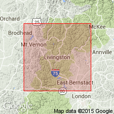
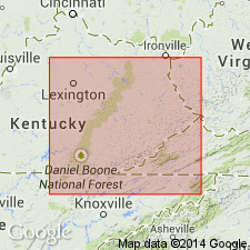
Pg. 28. Livingston conglomerate. Conglomerate in Lee formation [of Pottsville group] in district somewhat central about Livingston, Rockcastle County, southeastern Kentucky, that can not be positively identified with Rockcastle conglomerate. Rests on or close to Lower Carboniferous limestone and appears to fill erosion channels in it. [Age is Pennsylvanian.]
Source: US geologic names lexicon (USGS Bull. 896, p. 1202).
- Usage in publication:
-
- Livingston conglomerate
- Modifications:
-
- Principal reference
- Dominant lithology:
-
- Conglomerate
- Sandstone
- AAPG geologic province:
-
- Appalachian basin
Summary:
Livingston conglomerate [of Pottsville group]. The very pebbly conglomerate showing up suddenly at mouth of Roundstone Creek, Rockcastle County, southeastern Kentucky, and extending in a narrow belt up the drainage area of this stream to the head and over into headwaters of Silver Creek, and which also appears in patches on Horse Creek and has been somewhat doubtfully correlated by Campbell with his Rockcastle, appears to writer to be in all probability a different lens of sandstone. It lies in a channel cut out of St. Louis limestone, and is doubtfully of marine origin. The name Livingston conglomerate is suggested for it. [Age is Pennsylvanian.]
Source: US geologic names lexicon (USGS Bull. 896, p. 1202).
- Usage in publication:
-
- Livingston conglomerate
- Modifications:
-
- Areal extent
- AAPG geologic province:
-
- Appalachian basin
Summary:
Pg. 90. Livingston conglomerate in Lee formation. A channel of conglomerate sandstone at base Pennsylvanian; in Lee formation, below Rockcastle conglomerate.
Source: US geologic names lexicon (USGS Bull. 1200, p. 2200-2201).
- Usage in publication:
-
- Livingston Conglomerate Member*
- Modifications:
-
- Revised
- AAPG geologic province:
-
- Appalachian basin
Summary:
Livingston Conglomerate of Miller (1910) adopted as Livingston Conglomerate Member of Lee Formation. Consists of sandstone, conglomeratic, interstratified and intergrading with sandstone and with conglomerate, chiefly yellowish-orange, limonite-stained; composed of subangular fine to medium grains of clear quartz; very sparse to very abundant well-rounded pebbles, mostly less than 1 inch in diameter, composed of clear quartz and pinkish-gray chert. Sparse impressions of woody material. In lensing sets, commonly several feet thick and several tens of feet long, of horizontal- and cross-beds, commonly 2 to 4 inches thick. Base is an erosional unconformity; about 60 feet of relief on this channeling contact within the quadrangle. Thickness is 0 to 80 feet. Underlain by Newman Limestone; overlain by higher parts of Lee Formation.
Source: GNU records (USGS DDS-6; Reston GNULEX).

- Usage in publication:
-
- Livingston Conglomerate Member
- Modifications:
-
- Revised
- AAPG geologic province:
-
- Appalachian basin
Summary:
The Rockcastle Sandstone and the Livingston Conglomerate, as mapped in KY, are here designated formal members of the Bee Rock Sandstone. The Bee Rock is raised in rank and assigned to the Breathitt Group. The Lee Formation is "dropped" from usage.
Source: GNU records (USGS DDS-6; Reston GNULEX).
For more information, please contact Nancy Stamm, Geologic Names Committee Secretary.
Asterisk (*) indicates published by U.S. Geological Survey authors.
"No current usage" (†) implies that a name has been abandoned or has fallen into disuse. Former usage and, if known, replacement name given in parentheses ( ).
Slash (/) indicates name conflicts with nomenclatural guidelines (CSN, 1933; ACSN, 1961, 1970; NACSN, 1983, 2005, 2021). May be explained within brackets ([ ]).