
- Usage in publication:
-
- Littleton Formation*
- Modifications:
-
- Overview
- AAPG geologic province:
-
- New England province
Summary:
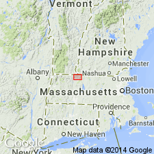
Used as Littleton Formation of Early Devonian age. Extends from southern NH into several areas of central northern MA. Consists of black to gray aluminous mica schist, quartzose schist, and aluminous phyllite.
Source: GNU records (USGS DDS-6; Reston GNULEX).
- Usage in publication:
-
- Littleton Formation*
- Modifications:
-
- Age modified
- Biostratigraphic dating
- AAPG geologic province:
-
- New England province
Summary:
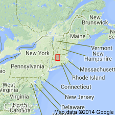
The age of the Littleton is restricted to Early Devonian. Conodonts indicative of earliest Devonian 'woschmidti' to 'eurekaensis' Zones recovered from regionally metamorphosed marbles of the lower amphibolite facies of the Fitch Formation at the fossil locality near Bernardston, MA, refine the age of the Fitch in this area and extend the regional upper age limit of the Fitch, and confirm the existence of the inverted limb of the Bernardston nappe. Extending the age of the Fitch to Early Devonian restricts the lower age range of the Littleton Formation, which unconformably overlies the Fitch. The Lochkovian age of the Fitch, in conjunction with the time required for post-Fitch pre-Littleton erosion, makes a pre-late Helderberg (earliest Lochkovian) age for any part of the Littleton Formation very unlikely.
Source: GNU records (USGS DDS-6; Reston GNULEX).
- Usage in publication:
-
- Littleton Formation*
- Modifications:
-
- Revised
- Areal extent
- AAPG geologic province:
-
- New England province
Summary:
Report text and figures deal extensively with areal extent of Littleton in MA, but footnotes [added to the report just before the report went to press] indicate two major restrictions to the use of the Littleton [these changes are not reflected on the MA State bedrock geologic map]: 1) Recent stratigraphic interpretations in the Monadnock (Thompson, 1985) and Hinsdale (Elbert, 1986) areas, NH, and remapping in the Mt. Grace area (Robinson, 1987), MA, have shown that garnet quartzite and iron formation mapped as Littleton Formation in the Pelham-Shutesbury syncline in MA, are now assigned to the Perry Mountain Formation, [here geographically extended to MA.] 2) Littleton Formation rocks in the belt that enters MA from NH east of the Keene gneiss dome and extending to southwest of Ware, and rocks in the Amherst inlet where Littleton and Partridge are complexly interfolded, are here assigned to the Rangeley Formation [here geographically extended to MA]. [Papers presented as chapters in U.S. Geological Survey Professional Paper 1366 are intended as explanations and (or) revisions to MA State bedrock geologic map of Zen and others (1983) at scale of 1:250,000.]
Source: GNU records (USGS DDS-6; Reston GNULEX).
- Usage in publication:
-
- Littleton Formation*
- Modifications:
-
- Age modified
- AAPG geologic province:
-
- New England province
Summary:
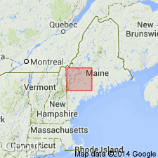
Early Devonian age determined on basis of fossils and correlation with Lower Devonian Carrabassett Formation. Geographically extended into Rumford and Bryant Pond quads, ME.
Source: GNU records (USGS DDS-6; Reston GNULEX).
- Usage in publication:
-
- Littleton Formation*
- Modifications:
-
- Areal extent
- AAPG geologic province:
-
- New England province
Summary:
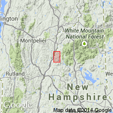
Littleton Formation occurs as youngest formation in both Piermont allochthon sequence and in Bronson Hill autochthonous sequence. Stratigraphy differs radically from that of Hadley (1942, 1950), White and Billings (1952), in Mt. Cube and Woodsville 15-min quads, respectively, and revisions of Rumble (1942) east of Connecticut River. Fundamental difference is that Moench recognizes seven formations (plus members) that constitute Piermont allochthon. Hadley (1942) mapped all of these as Albee Formation, a name not used in this report. Rocks previously mapped as Albee are reassigned to stratigraphic equivalents of Quimby (Upper Ordovician?), Greenvale Cove (Lower Silurian), Rangeley (Lower Silurian), Perry Mountain (Silurian), Smalls Falls (Upper Silurian), Madrid (Upper Silurian?), and Littleton (Lower Devonian) Formations, whose type localities, except for Littleton, are near Rangeley, ME (Moench and Boudette, 1987). Bronson Hill autochthonous sequence, separated from Piermont allochthon by Foster Hill sole fault, consists of the mainly basaltic facies of the lower member of Ammonoosuc Volcanics (Middle Ordovician), Partridge Formation (Middle Ordovician), Clough Quartzite (Lower Silurian), Fitch Formation (Upper Silurian), and Littleton Formation (Lower Devonian). Report includes geologic map and correlation chart.
Source: GNU records (USGS DDS-6; Reston GNULEX).
- Usage in publication:
-
- Littleton Formation
- Modifications:
-
- Overview
- AAPG geologic province:
-
- New England province
Summary:
At the base of the Littleton in the Alton quad, southeastern NH, is a thin, coarse-grained grit or conglomerate with gray and rusty-weathering lithic fragments of the Smalls Falls Formation, informally named the Wild Goose Grits by Eusden and others (1987). Unit represents a basal Littleton transgressive deposit on a disconformity. Littleton may have been 2.5 km thick in this area before erosion. The Wild Goose Grits are 100 to 300 m thick. Early Devonian Littleton is top of known Paleozoic sequence. Overlies Madrid Formation.
Source: GNU records (USGS DDS-6; Reston GNULEX).
- Usage in publication:
-
- Littleton Formation*
- Modifications:
-
- Revised
- AAPG geologic province:
-
- New England province
Summary:
Mica schist and biotite granulite country rocks that host talc deposits were previously mapped as Peterborough Member of Early Devonian Littleton Formation by Greene (1970). More recent work to the north by Nielson (1981) and in Massachusetts (Zen and others, 1983) has cast doubt on age and correlation of these rocks, which may be Silurian or Ordovician.
Source: GNU records (USGS DDS-6; Reston GNULEX).
- Usage in publication:
-
- Littleton Formation*
- Modifications:
-
- Age modified
- Biostratigraphic dating
- Areal extent
- AAPG geologic province:
-
- New England province
Summary:
In Bronson Hill anticlinorium, includes main body, and separately mapped mixed volcanic member, volcaniclastic sandstone member, limy sandstone lens, and a sandstone and conglomerate member at Dalton Mountain. In central Maine trough, mapped as undivided pelitic schist and graded beds of metasandstone and metasiltstone. Broadly equivalent to Seboomook Group; probably coeval with formations of Moose River Group. Contains small unmapped parts of Mount Blue, Hildreths, and Carrabassett Formations of Seboomook Group in Bethel and adjacent quads. In areas of migmatitic gneiss, lower part of Littleton locally may contain remnants of Madrid Formation; elsewhere, contact with Madrid is abruptly gradational and conformable. Age is Early Devonian (late Siegenian and Emsian) based on fossil data. In Littleton quad, brachiopods, pelecypods, gastropods, and TENTACULITES found in main body at six localities indicate an Emsian (Schoharian) age (Billings and Cleaves, 1934; Boucot and Arndt, 1960; Boucot and Rumble, 1978, 1980). No paleontological evidence of earlier Early Devonian in this area (Harris and others, 1983). In Moosilauke quad, brachiopods found in several lenses of limy sandstone lens indicate a late Siegenian (Oriskanian) age, although and early Emsian (Esopusian) age cannot be ruled out. In Whitefield quad, shelly fauna at two localities in sandstone and conglomerate at Dalton Mountain indicate an Emsian (Schoharian) age.
Source: GNU records (USGS DDS-6; Reston GNULEX).
- Usage in publication:
-
- Littleton Formation*
- Modifications:
-
- Overview
- Age modified
- AAPG geologic province:
-
- New England province
Summary:
Used as Early Devonian (Siegenian) Littleton Formation. Mapped as 10 unnamed subdivisions and one undivided unit. Undivided Littleton consists of gray metapelite and metawacke with subordinate metavolcanics generally, but not everywhere, conformable with underlying Fitch or Madrid Formations. Fossiliferous in western NH. Subdivisions include a lower unnamed member probably correlative with Carrabassett Formation of northwestern ME; metaconglomerate and quartzite that is locally fossiliferous (at Dalton Mountain); graphitic-sulfidic metashale in Piermont allochthon of northwestern NH; calc-silicate rock that is locally fossiliferous (at Mt. Moosilauke) and is possibly equivalent in part to Hildreths Formation of ME; epiclastic or resedimented metavolcanic sediments; metabasaltic greenstone or amphibolite; metarhyolite, some of it in subvolcanic intrusions; a unit consisting of rhyolitic and keratophyric metatuff and meta-agglomerate, volcaniclastic metagraywacke, and minor basalt; volcanic lentils, both mafic and felsic; and an upper unnamed member consisting of light-gray metaturbidite with common coticule, lithologically identical to, and probably correlative with Seboomook Formation of ME. Ironbound Mountain Formation is a probable facies equivalent to lower part of Littleton. Report includes geologic map and correlation chart, cross sections, and four 1:500,000-scale derivative maps.
Source: GNU records (USGS DDS-6; Reston GNULEX).
For more information, please contact Nancy Stamm, Geologic Names Committee Secretary.
Asterisk (*) indicates published by U.S. Geological Survey authors.
"No current usage" (†) implies that a name has been abandoned or has fallen into disuse. Former usage and, if known, replacement name given in parentheses ( ).
Slash (/) indicates name conflicts with nomenclatural guidelines (CSN, 1933; ACSN, 1961, 1970; NACSN, 1983, 2005, 2021). May be explained within brackets ([ ]).

