The National Geologic Map Database is migrating to a new infrastructure. We apologize for any service disruptions during this process.
|
|---|


- Usage in publication:
-
- Limerock Canyon Formation*
- Modifications:
-
- Named
- Dominant lithology:
-
- Sandstone
- Conglomerate
- Limestone
- Breccia
- Lava
- Tuff
- AAPG geologic province:
-
- Paradox basin
Summary:
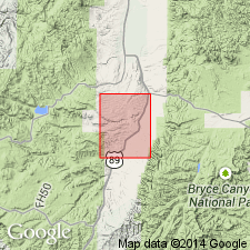
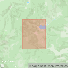
Some volcaniclastic fluvial, lacustrine, and tuffaceous rocks formerly assigned to the upper part of the white member of the Claron Formation, or to an unnamed sequence above the white member, and beneath the Needles Range Group, are named Limerock Canyon Formation. The lower contact is placed at top of a white to green, vuggy, nodular limestone (Claron) and at the base of a green, fine- to medium-grained, tuffaceous sandstone (Limerock Canyon). Upper contact is with welded ash-flow tuffs of the Wah Wah Springs Tuff of Needles Range Group, or with Isom Formation where Needles Range is absent. Mapped in west-central and southern part of Hatch quad., Garfield Co, UT in the Paradox basin. Present in the Markagunt Plateau and Red Hills area west of Hatch quad. Correlation chart. Type section is a composite of exposures at two localities --1.) Measured in NE1/4 NE1/4 sec 25, T36S, R6W where unit is 124.9 ft thick, lower contact covered by Quaternary fill and upper surface is erosional; 2.) Measured in NE1/4 NW1/4 sec 36, T36S, R6W where unit is 241.6 ft thick, and it overlies white member of Claron and top of section is eroded. Six reference sections designated. Named for Limerock Canyon in southwest part of quad. Consists mainly of tuffaceous, mature to immature wacke interbedded with calcareous mudstone or marlstone, tuffaceous volcanic arenite, tuffaceous siltstone airfall tuff, tuffaceous conglomerate, and minor amounts of shale and tuffaceous limestone, chalcedony as pods and lenses up to 3 ft thick. Ranges from olive green to white to black. Extensively bioturbated Burrow casts. About 250 ft thick. Few reliable total thicknesses. K-Ar age determinations from upper part of 33.1 Ma on biotite from a welded tuff and 29.1 +/-Ma and 30.4 Ma on hornblende from a volcanic arenite. Age of upper part is Oligocene; age of lower part is not known; it may be Oligocene too, or as old as Eocene.
Source: GNU records (USGS DDS-6; Denver GNULEX).
- Usage in publication:
-
- Limerock Canyon Formation*
- Modifications:
-
- Geochronologic dating
- AAPG geologic province:
-
- Paradox basin
Summary:
Pg. 21 (pamphlet). Limerock Canyon Formation. An air-fall tuff near middle of formation yielded a U-Pb age (zircon) of 20.52 +/-0.49 Ma (citing Utah Geol. Survey and Apatite to Zircon, Inc., 2013, Utah Geol. Survey Open-File Rpt., no. 621). Age is considered early Miocene.
Source: Publication.
For more information, please contact Nancy Stamm, Geologic Names Committee Secretary.
Asterisk (*) indicates published by U.S. Geological Survey authors.
"No current usage" (†) implies that a name has been abandoned or has fallen into disuse. Former usage and, if known, replacement name given in parentheses ( ).
Slash (/) indicates name conflicts with nomenclatural guidelines (CSN, 1933; ACSN, 1961, 1970; NACSN, 1983, 2005, 2021). May be explained within brackets ([ ]).