

- Usage in publication:
-
- Lillydale shale
- Modifications:
-
- Named
- Dominant lithology:
-
- Shale
- AAPG geologic province:
-
- Appalachian basin
Summary:
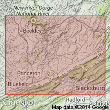
Lillydale shale, named in this report, is dark green or greenish gray at top; black and carbonaceous at base. Shale is fissile and includes lenses of iron carbonate and limestone. Contains marine fossils. Thickness ranges from 80 to 125 ft. Underlies Glenray limestone and overlies Greenbrier series. Basal member of Bluefield group. Includes Edray sandstone, 0 to 50 ft above base. Type locality is in Monroe Co. and unit is also observed in Mercer and Summers Cos., WV, and in Tazewell Co., VA. Can be traced to head of Greenbrier Valley. Age is Mississippian.
Source: GNU records (USGS DDS-6; Reston GNULEX).
- Usage in publication:
-
- Lillydale Shale
- Modifications:
-
- Overview
- Revised
- AAPG geologic province:
-
- Appalachian basin
Summary:
Informal division of Mauch Chunk Group into upper and lower parts is used in this report. Lower Mauch Chunk includes Lillydale Shale and laterally equivalent Webster Springs Sandstone, and overlying Reynolds Limestone. [Bluefield Formation is not used in this report.] Upper Mauch Chunk Group is undifferentiated.
Source: GNU records (USGS DDS-6; Reston GNULEX).

- Usage in publication:
-
- Lillydale Shale Member
- Modifications:
-
- Overview
- AAPG geologic province:
-
- Appalachian basin
Summary:
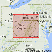
Bluefield Formation is divided into three formal members in VA --Lillydale Shale Member, Glenray Limestone Member, and Indian Mills Sandstone Member. The Lillydale is described in southwest VA as dark- to greenish-gray, micaceous shale, black and carbonaceous at the base. The shale contains many lenses of siderite and a few sandstone beds. Thickness varies between 80 and 130 ft. Known as the "Pencil Cave shale" by drillers. Age is Late Mississippian (Chesterian).
Source: GNU records (USGS DDS-6; Reston GNULEX).
For more information, please contact Nancy Stamm, Geologic Names Committee Secretary.
Asterisk (*) indicates published by U.S. Geological Survey authors.
"No current usage" (†) implies that a name has been abandoned or has fallen into disuse. Former usage and, if known, replacement name given in parentheses ( ).
Slash (/) indicates name conflicts with nomenclatural guidelines (CSN, 1933; ACSN, 1961, 1970; NACSN, 1983, 2005, 2021). May be explained within brackets ([ ]).