- Usage in publication:
-
- Lemhi quartzite*
- Modifications:
-
- Named
- Dominant lithology:
-
- Quartzite
- AAPG geologic province:
-
- Northern Rocky Mountain region
Summary:
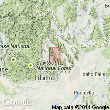
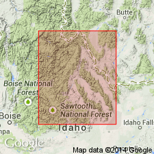
Named from the Lemhi Range, Custer and Lemhi Cos, ID, in Northern Rocky Mountain region where it is extensively exposed. Considered basal formation of Belt series. No type locality designated. Exposed only in T14N, R24E in east part of quad. Is principally grayish-green, impure, compact, hard quartzite with subordinate purple and maroon argillaceous beds. Color used to distinguish Lemhi (green) from overlying Swauger quartzite (lavender), the newly named upper formation of Belt in this quad. Is 90 percent quartz with scattered plagioclase (as much as 10 percent), and minor amounts of sericite, chlorite, apatite, and locally green biotite and tourmaline. Argillaceous beds are softer and more schistose than the quartzite. Although argillaceous beds are widely distributed, they make up less than 10 percent. Probably several thousand ft thick. Base not exposed. No known fossils. Regarded as pre-Cambrian. Rocks of similar lithology and stratigraphic position (Yellowjacket formation) also assigned to pre-Cambrian. Geologic map and cross sections.
Source: GNU records (USGS DDS-6; Denver GNULEX).
- Usage in publication:
-
- Lemhi Quartzite
- Modifications:
-
- Revised
- AAPG geologic province:
-
- Northern Rocky Mountain region
Summary:
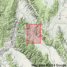
Revised in that Lemhi Quartzite of Belt Series is younger than the newly named Apple Creek Phyllite of the Belt. Lemhi is widespread in quad. Geologic map and cross sections. As much as 10,000 ft estimated to be present; base not exposed. Is in fault contact with the younger Swauger Quartzite of Belt. Report area is in Northern Rocky Mountain region. Precambrian age.
Source: GNU records (USGS DDS-6; Denver GNULEX).
- Usage in publication:
-
- Lemhi Quartzite*
- Modifications:
-
- Areal extent
- AAPG geologic province:
-
- Northern Rocky Mountain region
Summary:
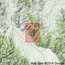
Divided into 3 units (ascending): unit D, a gray and tan, fine- to medium-grained, feldspathic quartzite; unit C, a gray to green, finely laminated siltite and locally thin beds of gray feldspathic quartzite; unit B, a medium- to dark-gray, banded, fine-grained, feldspathic quartzite. Unit D mapped around Goat Mountain in central part of quad in Lemhi Co, ID. Unit C mapped around Mollie Gulch in southeast corner of map in Lemhi Co. Unit B is mapped southeast of Eightmile Creek in southeast part of quad and on either side of the Continental Divide in Lemhi Co, ID and adjoining Beaverhead Co, MT, in the Northern Rocky Mountain region. Is overlain by Swauger Formation. Of Precambrian age.
Source: GNU records (USGS DDS-6; Denver GNULEX).
- Usage in publication:
-
- Lemhi Group*
- Modifications:
-
- Revised
- AAPG geologic province:
-
- Northern Rocky Mountain region
Summary:
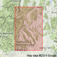
Formerly called "Lemhi quartzite of Belt series." Removed from Belt Supergroup and raised to group rank. The Belt Supergroup was deposited in Belt basin whereas the east-central Idaho rocks were deposited in Belt miogeocline. Composed of fine-grained feldspathic quartzite and argillitic siltite divisible into five map units: Inyo Creek (base), West Fork, and Big Creek (new names), Apple Creek (formerly the Apple Creek Phyllite of Anderson, 1961), and Gunsight (new) Formations. Has grains of black, heavy minerals mainly magnetite and a little mica on bedding surface. Is about 20,000 ft (6,100 m) thick. Overlies Yellowjacket Formation; underlies Swauger Formation. Exposed in southern part of a belt 150 mi (from Snake River plain northward to ID-MT State line, in Northern Rocky Mountain region). Deposited in a miogeocline. Tentatively correlated with Ravalli Group, Helena and Wallace Formations, and lower Missoula Group of Belt Supergroup. Assigned a Precambrian Y age.
Source: GNU records (USGS DDS-6; Denver GNULEX).
- Usage in publication:
-
- Lemhi Group
- Modifications:
-
- Contact revised
- AAPG geologic province:
-
- Northern Rocky Mountain region
Summary:
Revised in that a newly named, but informally designated unit, the Hayden Creek diamictite beds recognized as lying between the Big Creek Formation below and the Apple Creek Formation above. The upper and lower contacts of the Hayden Creek are gradational. Report area is in the Hayden Creek area, Lemhi Co, ID in Northern Rocky Mountain region.
Source: GNU records (USGS DDS-6; Denver GNULEX).
For more information, please contact Nancy Stamm, Geologic Names Committee Secretary.
Asterisk (*) indicates published by U.S. Geological Survey authors.
"No current usage" (†) implies that a name has been abandoned or has fallen into disuse. Former usage and, if known, replacement name given in parentheses ( ).
Slash (/) indicates name conflicts with nomenclatural guidelines (CSN, 1933; ACSN, 1961, 1970; NACSN, 1983, 2005, 2021). May be explained within brackets ([ ]).

