- Usage in publication:
-
- Left Fork coal beds*
- Modifications:
-
- First used
- Dominant lithology:
-
- Coal
- AAPG geologic province:
-
- Las Vegas-Raton basin
Summary:
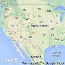
First use of name; intent to name not stated. Are two coal beds about 70-80 ft apart that crop out near base of upper, coal-bearing zone of Raton Formation (in central part of Raton coal field, Colfax Co, NM, Las Vegas-Raton basin), and are exposed on the steeply dipping east flank of the Vermejo Park anticline in Left Fork of York Canyon and in Canadian River Canyon. The dip flattens rapidly and much of the area underlain by the Left Fork beds is relatively flat lying. The coal is of excellent quality. Lower bed is about 1,200-1,250 ft above Upper Cretaceous Trinidad Sandstone and about 900-950 ft above base of Raton Formation. Becomes as thick as 10 ft throughout several sq mi, but splits and thins to south toward Vermejo River. Upper bed is also 10 ft thick and is more consistent and extensive. Thins to south, but appears to persist for several mi; to north, near the state line, it splits and contains many shale partings. The Upper York mine was just opened on this upper bed; both beds will eventually be mined. Coal beds in Raton Formation may prove to be the most economically significant in the coal field. Special circumstances of deposition control the accumulation of thick coal deposits; because these conditions are of a regional nature, occurrence of one thick coal at a particular stratigraphic position in one area should provide a clue to position of other similar deposits elsewhere in basin. Is of Paleocene age.
Source: GNU records (USGS DDS-6; Denver GNULEX).
For more information, please contact Nancy Stamm, Geologic Names Committee Secretary.
Asterisk (*) indicates published by U.S. Geological Survey authors.
"No current usage" (†) implies that a name has been abandoned or has fallen into disuse. Former usage and, if known, replacement name given in parentheses ( ).
Slash (/) indicates name conflicts with nomenclatural guidelines (CSN, 1933; ACSN, 1961, 1970; NACSN, 1983, 2005, 2021). May be explained within brackets ([ ]).

