The National Geologic Map Database is migrating to a new infrastructure. We apologize for any service disruptions during this process.
|
|---|


- Usage in publication:
-
- Lee Flat limestone*
- Modifications:
-
- Original reference
- Dominant lithology:
-
- Limestone
- AAPG geologic province:
-
- Great Basin province
Hall, W.E., and MacKevett, E.M., Jr., 1958, Economic geology of the Darwin quadrangle, Inyo County, California: California Division of Mines Special Report, no. 51, 73 p., (incl. geologic maps)
Summary:
Pg. 7 (table 1), 8-9, pl. 2; [see also USGS Prof. Paper 368, 1962]. Lee Flat limestone. Predominantly thin-bedded medium- to dark-gray limestone. Locally limestone is broken by thin sandy iron-stained partings or by thin beds and lenses of chert. Estimated to be more than covered by basalt and alluvium, and faulting in exposed section vitiates estimate. At least 520 feet thick at type locality where it conformably overlies Perdido formation. Underlies Keeler Canyon formation of Pennsylvanian and Permian age. Nonfossiliferous; age derived from stratigraphic position; occupies same stratigraphic position that upper part of Perdido formation and Rest Spring shale occupy in Quartz Spring area and Ubehebe Peak quadrangle; the Lee Flat, then, represents facies change from clastic section of siltstone, shale, and minor limestone in the latter areas to fine-grained limestone in Darwin quadrangle. Age is Late Mississippian and Pennsylvanian(?).
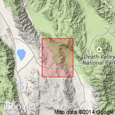
Type section: trends south from 5,280 ft near top of prominent hill 0.9 mi S. 36 deg. E. of main shaft of Lee mine, Darwin quadrangle, central lnyo Co., southern CA, to contact with alluvium at foot of hill at an altitude of 5,000 ft. Named from exposures near Lee Flat, alluviated area east of Santa Rosa Hills.
Source: US geologic names lexicon (USGS Bull. 1200, p. 2137).
- Usage in publication:
-
- Lee Flat Limestone Member
- Modifications:
-
- Revised
- AAPG geologic province:
-
- Great Basin province
Summary:
Lee Flat Limestone Member of Perdido Formation. Lee Flat Limestone reduced in rank to member of Perdido Formation and restricted to transitional zone area (notably northern Santa Rosa Hills area, Darwin quadrangle, Inyo County, eastern California), which separates the predominantly siliceous rocks (foredeep basin) to west (notably in Quartz Spring area) from the predominantly calcareous (shelf-margin and platform) rocks to east (notably in Argus and Panamint Ranges). Consists of medium- to dark-gray, commonly silty limestone in internally laminated beds 2 to 8 cm thick. Silicified portions of many beds weather to resemble chert. Pelmatozoan debris is increasingly abundant near top. [Thickness 200+ feet.] Rocks mapped as Lee Flat Limestone by Hall and MacKevett (1962) in the carbonate facies region of the Argus and Panamint Ranges, Inyo County, eastern California, are included in Santa Rosa Hills Limestone (new). Fossils. Age is Late Mississippian (Visean) based on conodonts (identified by R. Miller and H.R. Lane, 1976, personal commun.).
Source: Publication.
- Usage in publication:
-
- Lee Flat Limestone*
- Lee Flat Limestone Member
- Modifications:
-
- [Abandoned]
- AAPG geologic province:
-
- Great Basin province
Summary:
[†Lee Flat Limestone, as mapped by Hall and MacKevett (USGS Prof. Paper 368, 1962) in Argus and Panamint Ranges, Darwin quadrangle, Inyo County, California, replaced with Santa Rosa Hills Limestone. †Lee Flat Limestone Member of Perdido Formation, as used by Dunne and others (GSA Bull., v. 92, no. 1, 1981), northern Santa Rosa Hills, Inyo County, California, replaced with unnamed limestone member of Perdido Formation (later included in Stone Canyon Formation, see Stevens and others, USGS Bull. 1988-J, 1996). See Santa Rosa and Stone Canyon.]
Source: Inferred from publication.
For more information, please contact Nancy Stamm, Geologic Names Committee Secretary.
Asterisk (*) indicates published by U.S. Geological Survey authors.
"No current usage" (†) implies that a name has been abandoned or has fallen into disuse. Former usage and, if known, replacement name given in parentheses ( ).
Slash (/) indicates name conflicts with nomenclatural guidelines (CSN, 1933; ACSN, 1961, 1970; NACSN, 1983, 2005, 2021). May be explained within brackets ([ ]).