- Usage in publication:
-
- Lead Bell Shale*
- Modifications:
-
- Named
- Dominant lithology:
-
- Claystone
- Sandstone
- AAPG geologic province:
-
- Snake River basin
Summary:
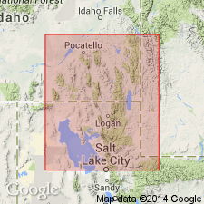
Named for abandoned Lead Bell mine. Type area is in slopes northeast of crest of Portneuf Range from north side of Baldy Mountain along west edge of T10S, R39E north to northwest corner to township in Bancroft quad. Type section in the incompletely exposed section measured in NE1/4 SW1/4 sec 7, T10S, R39E, Bannock Co, ID, Snake River basin. Consists of claystone (fissile, dark gray to black near bottom to green and tan, thinly laminated, fossiliferous, forms tan slopes, is the most abundant), siltstone (argillaceous, tan and pink), sandstone (fine-grained), and limestone (light- to medium-gray, Girvanella-bearing, oolitic, includes some subaphanitic layers). Is 400-460 ft thick. Overlies Twin Knobs Formation (new); underlies Bancroft Limestone (new). Forms strike valleys on east flank Portneuf Range in Bancroft quad. Divisible into Spence Tongue (at base) which is reassigned from Ute Limestone to Lead Bell, and an upper tongue, Cub Tongue (at top) (new). Is of middle Middle Cambrian age; contains trilobites at several horizons in Lead Bell.
Source: GNU records (USGS DDS-6; Denver GNULEX).
For more information, please contact Nancy Stamm, Geologic Names Committee Secretary.
Asterisk (*) indicates published by U.S. Geological Survey authors.
"No current usage" (†) implies that a name has been abandoned or has fallen into disuse. Former usage and, if known, replacement name given in parentheses ( ).
Slash (/) indicates name conflicts with nomenclatural guidelines (CSN, 1933; ACSN, 1961, 1970; NACSN, 1983, 2005, 2021). May be explained within brackets ([ ]).

