The National Geologic Map Database is migrating to a new infrastructure. We apologize for any service disruptions during this process.
|
|---|


- Usage in publication:
-
- Lazaretto Creek Formation
- Modifications:
-
- Named
- Dominant lithology:
-
- Sand
- Sandstone
- Limestone
- AAPG geologic province:
-
- South Georgia sedimentary province
Summary:
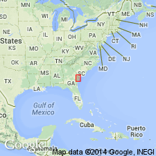
Name Lazaretto Creek Formation is here proposed for a calcareous sand, sandstone, and sandy limestone in the shallow subsurface of the northern coastal area of GA, occurring from Chatham Co. south to Glynn Co. Has been referred to previously only as "undifferentiated Oligocene" by Furlow (1969). In addition to the type section on Tybee Island, a reference section is designated at the site of the core Petit Chou 1 (GGS-1164) near the western end of Petit Chou Island (also known as Beach Hammock Island), Chatham Co. The parastratotype occurs in the interval 159 ft to 215 ft in this core. Unit ranges from an unconsolidated, incoherent, calcareous quartz sand to a soft, friable, very calcareous quartz sandstone; to a friable, moderately indurated to unconsolidated, sandy, fine- to medium-grained, calcarenitic limestone. Subordinate lithic components include clay minerals, phosphate, and glauconite. Macrofossils are rare and consist only of mollusks. Thickness ranges from 56 ft (17 m) at the reference section to 70 ft (21 m) at the type section. The Lazaretto Creek grades laterally westward into the Suwannee Limestone, which is redefined in this report. Disconformably overlies the Ocala Group. May grade laterally eastward under the continental shelf into the Cooper Formation or may pinch out under the continental shelf. Disconformably underlies the Parachucla Formation or the Marks Head Formation. Age is early Oligocene (late Vicksburgian, Rupelian) based on benthic forams and correlation with the Byram Formation.
Source: GNU records (USGS DDS-6; Reston GNULEX).
For more information, please contact Nancy Stamm, Geologic Names Committee Secretary.
Asterisk (*) indicates published by U.S. Geological Survey authors.
"No current usage" (†) implies that a name has been abandoned or has fallen into disuse. Former usage and, if known, replacement name given in parentheses ( ).
Slash (/) indicates name conflicts with nomenclatural guidelines (CSN, 1933; ACSN, 1961, 1970; NACSN, 1983, 2005, 2021). May be explained within brackets ([ ]).