- Usage in publication:
-
- Langston formation*
- Modifications:
-
- Original reference
- Dominant lithology:
-
- Limestone
- AAPG geologic province:
-
- Wasatch uplift
Summary:
Pg. 6, 7. Langston formation. Massive-bedded bluish-gray limestone with many round concretions. Thickness 107 feet in Blacksmith Fork Canyon, Cache County, northeastern Utah, and 30 feet west of Liberty, Bear Lake County, southeastern Idaho. Middle Cambrian fauna. Most readibly accessible locality is in Blacksmith Fork, Cache County, northeastern Utah, but strike of beds carries formation into valley of Langston Creek, Bear Lake County, southeastern Idaho. Underlies Ute formation and overlies Brigham formation [quartzite].
Source: US geologic names lexicons (USGS Bull. 896, p. 1145-1146).
- Usage in publication:
-
- Langston limestone*
- Modifications:
-
- Revised
- AAPG geologic province:
-
- Wasatch uplift
Summary:
Pg. 1114-1115, 1117 (fig. 4), 1119-1120. Langston limestone. Walcott's Blacksmith Fork section emended. Langston consists of series of interbedded dull-tan, blue- and white-gray limestones, and dolomites which weather to red brown, and a basal 75- to 80-foot zone of white-gray calcareous quartzitic thin-bedded sandstone, 75-foot zone of buff-weathering thick-bedded dolomite occurs 68 feet below top of formation. Thickness 575 feet in type section which was measured on spurs that form sides of lower one-half mile of North Cottonwood Canyon on north side of Blacksmith Fork. Overlies Brigham quartzite; underlies Ute limestone (emended). [Age is Middle Cambrian (Albertan).]
Walcott's Blacksmith Fork section emended: measured on spurs that form sides of lower 0.5 mi of North Cottonwood Canyon on north side of Blacksmith Fork, [in SW/4 sec. 8, T. 10 N., R. 3 E., Porcupine Reservoir 7.5-min quadrangle, Cache Co., northeastern UT].
Source: US geologic names lexicon (USGS Bull. 1200, p. 2101-2102).
- Usage in publication:
-
- Langston formation
- Modifications:
-
- Revised
- AAPG geologic province:
-
- Wasatch uplift
Summary:
Pg. 1132-1133, pl. 1; see also J.S. Williams and G.B. Maxey, 1941, Amer. Jour. Sci., v. 239, no. 4, 279-281. Langston formation. In Logan quadrangle, Utah, includes Spence shale (formerly considered member of Ute formation) near base. At type locality, essentially two tan-weathering dolomites with an intermediate limestone member. Thicknesses 340 to 380 feet. Northward formation as a whole thickens slightly, but basal dolomite thins and disappears as PTARMIGANIA limestone and Spence shale appear and thicken at base of formation. Overlies Brigham quartzite; underlies Ute formation. [Age is Middle Cambrian.]
Source: US geologic names lexicon (USGS Bull. 1200, p. 2101-2102).
- Usage in publication:
-
- Langston formation
- Modifications:
-
- Revised
- AAPG geologic province:
-
- Wasatch uplift
Summary:
Pg. 649-650, 654-655, 656, 657-658, 662, 663, 664, 665, 669-671, 673 (fig. 3). Langston formation. Subdivided to include Naomi Peak limestone member (new). Several measured sections given. Section on north side of High Creek Canyon, sec. 11, T. 14 N., R. 2 E., near Richmond, Utah, considered most typical. Here both Naomi Peak and Spence members are present. Thickness 484 feet. Overlies Pioche formation. Some beds formerly assigned to Ophir and Maxfield formations are here assigned to Langston. Lower and Middle Cambrian.
Source: US geologic names lexicon (USGS Bull. 1200, p. 2101-2102).
- Usage in publication:
-
- Langston Dolomite*
- Modifications:
-
- Redescribed
- Dominant lithology:
-
- Dolomite
- AAPG geologic province:
-
- Wasatch uplift
Summary:
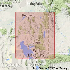
Revised and applied to dominantly dolomite sequence between High Creek Limestone below and Ute Limestone above. Formal name redescribed from Langston Formation to Langston Dolomite. Is present on east side of Bear River Range north to Mill Creek, Bear Lake Co and at Nelson Creek, Caribou Co, ID on Wasatch uplift. Assigned a Middle Cambrian age.
Source: GNU records (USGS DDS-6; Denver GNULEX).
- Usage in publication:
-
- Langston Dolostone*
- Modifications:
-
- Redescribed
- Dominant lithology:
-
- Dolostone
- AAPG geologic province:
-
- Great Basin province
Summary:
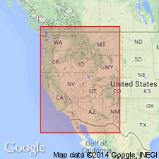
Is redescribed as dolostone. The name "dolostone" is used for rocks composed predominantly of the mineral "dolomite" on Figure 2 and throughout this chapter, although in the literature it has been common practice to use dolomite rather than dolostone in formal names of dolomitic formations and members. Occurs in stratigraphic column for north-central UT (Great Basin province). Overlies Geertsen Canyon Quartzite (Lower Cambrian); overlain by Ute Limestone (Middle Cambrian). Assigned to Middle Cambrian.
Source: GNU records (USGS DDS-6; Denver GNULEX).
For more information, please contact Nancy Stamm, Geologic Names Committee Secretary.
Asterisk (*) indicates published by U.S. Geological Survey authors.
"No current usage" (†) implies that a name has been abandoned or has fallen into disuse. Former usage and, if known, replacement name given in parentheses ( ).
Slash (/) indicates name conflicts with nomenclatural guidelines (CSN, 1933; ACSN, 1961, 1970; NACSN, 1983, 2005, 2021). May be explained within brackets ([ ]).

