The National Geologic Map Database is migrating to a new infrastructure. We apologize for any service disruptions during this process.
|
|---|


- Usage in publication:
-
- Lampasas series
- Modifications:
-
- Original reference
- AAPG geologic province:
-
- Bend arch
- Llano uplift
Summary:
Pg. 66 (fig. 1), 81-82. Lampasas series. Proposed for beds younger than Morrow but older than type Strawn. Series forms extensive wedge between eastward-dipping type Marble Falls and westward-dipping Strawn beds. Type Marble Falls belongs to Morrow series, but Marble Falls beds in McCulloch and Kimble Counties are for most part believed to be post-Morrow. In southeastern Oklahoma, regional unconformities at top of Morrow and at base of Savanna are considered as marking lower and upper boundaries of Lampasas. Upper Pottsville and lower Allegany beds of older classifications included in Lampasas. Includes Big Saline (new) and Smithwick groups. Epoch marks first appearance of family FUSULINIDAE, possibly excepting genus STAFELLA. Development of FUSIELLA and FUSULINELLA occurred during Big Saline time and early types of WEDEKINDELLINA and FUSULINA species during Smithwick epoch. Genus MESOLUBUS, characteristic of Strawn (Des Moines) series, is thought to be absent in Lampasas. Report includes stratigraphic chart.
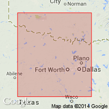
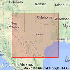
Named from Lampasas Co., TX. Best outcrops of beds are in western Lampasas and eastern San Saba Counties near village of Bend. McAnnelly's Bend in vicinity of village of Bend has been used as type area of Bend division.
Source: US geologic names lexicon (USGS Bull. 1200, p. 2092); supplemental information from GNU records (USGS DDS-6; Denver GNULEX).
- Usage in publication:
-
- Lampasas series
- Modifications:
-
- Principal reference
- AAPG geologic province:
-
- Fort Worth syncline
Summary:
Pg. 156-164. Lampasas series. Type section and correlatives discussed. Proposed that Lampasas-Strawn boundary in Brazos River outcrop section be placed at base of conglomerate which rests on Dennis Bridge limestone at Dennis highway bridge in southwestern Parker County, Texas. Placement of Connoquenessing, Mercer, and Clarion groups of Pennsylvanian in Kanawha series (upper Pottsville) favors inclusion of approximately equivalent Big Saline, Smithwick, and Parks groups in correlative series of Midcontinent region.
Source: US geologic names lexicon (USGS Bull. 1200, p. 2092).
- Usage in publication:
-
- Lampasas series
- Modifications:
-
- Not used
Summary:
Pg. 76. Lampasas series. Name Lampasas has been applied by Cheney in place of restricted Bend. Type outcrops designated by Cheney are same as those near Bend, type locality for the Bend. Seems confusing to substitute a new name for Bend, a term long in good usage by State and Government surveys.
Source: US geologic names lexicon (USGS Bull. 1200, p. 2092).
- Usage in publication:
-
- Lampasas series
- Modifications:
-
- Not used
Summary:
Pg. 181-186. Lampasas series. Not appropriate as series name because in type area it is only partly exposed and because, as defined it includes beds of Des Moines age and excludes part of Marble Falls which is post-Morrow in age.
Source: US geologic names lexicon (USGS Bull. 1200, p. 2092).
For more information, please contact Nancy Stamm, Geologic Names Committee Secretary.
Asterisk (*) indicates published by U.S. Geological Survey authors.
"No current usage" (†) implies that a name has been abandoned or has fallen into disuse. Former usage and, if known, replacement name given in parentheses ( ).
Slash (/) indicates name conflicts with nomenclatural guidelines (CSN, 1933; ACSN, 1961, 1970; NACSN, 1983, 2005, 2021). May be explained within brackets ([ ]).