- Usage in publication:
-
- La Motte sandstone
- Modifications:
-
- Original reference
- Dominant lithology:
-
- Sandstone
- AAPG geologic province:
-
- Ozark uplift
Summary:
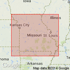
Pg. 331, 347-358. La Motte sandstone [Lamotte sandstone]. Great body of sandstone in southeastern Missouri. Occurs in St. Francois, Madison, and Ste. Genevieve Counties. Consists of soft, friable white sandstone, sometimes yellow or brown at surface. Total thickness not known; is at least 250 feet. Immediately overlying Archean crystallines about Mine La Motte Station, but overlying Cambrian Iron Mountain conglomerate in Iron Mountain district, St. Francois County. Underlies St. Francois or St. Joseph limestone. Age is early Silurian (Ozark age). Report includes correlation table, geologic map.
[Named from Mine La Motte Station, Madison Co., in southeastern MO.]
[ca. 1938, written "Lamotte" instead of "La Motte."]
Source: US geologic names lexicon (USGS Bull. 896, p. 1140); Missouri lexicon (Thompson, 2001, Missouri Geol. Survey Rpt. Inv., no. 73, p. 162); supplemental information from GNU records (USGS DDS-6; Denver GNULEX).
- Usage in publication:
-
- La Motte sandstone
- Modifications:
-
- Overview
Keyes, C.R., 1896, The geological occurrence of clays: Missouri Geological Survey, v. 11, p. 35-48.
Summary:
Pg. 35-47. Consists of sandstone, some shale and clay, with conglomerate at base. Underlies Frederickstown dolomite and unconformably overlies Algonkian crystallines.
Source: US geologic names lexicon (USGS Bull. 896, p. 1140).
- Usage in publication:
-
- La Motte sandstone
- Modifications:
-
- Age modified
- AAPG geologic province:
-
- Ozark uplift
Wheeler, H.A., 1896, Clay deposits: Missouri Bureau of Geology and Mines Report, v. 11, 622 p.
Summary:
La Motte sandstone. In southeast Missouri contains a basal conglomerate composed of waterworn pebbles from underlying crystalline rocks. Thin seam of shale at base. Overlies Algonkian crystalline rocks. Underlies Frederickstown dolomite. Age is Cambrian.
Source: Modified from GNU records (USGS DDS-6; Denver GNULEX).
- Usage in publication:
-
- La Motte sandstone*
- Modifications:
-
- Overview
- AAPG geologic province:
-
- Ozark uplift
Summary:
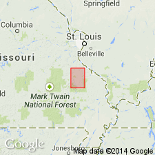
La Motte sandstone. A more complete description of the unit. Report area in southeast Missouri, Ozark uplift. Thick massive sandstone; beds composed of quartz grains. Sometimes matrix is limy. Thinly bedded or flaggy near top; grades into sandy limestone and alternating beds of limestone and sandstone. Near base often coarse-textured, usually soft and friable, often false bedded. Color generally yellow or reddish, sometimes white. Thickness 400 feet. Underlies St. Joseph limestone and overlies Archean rocks or Iron Mountain conglomerate. Age is Early Silurian.
Source: US geologic names lexicon (USGS Bull. 896, p. 1140); supplemental information from GNU records (USGS DDS-6; Denver GNULEX).
- Usage in publication:
-
- La Motte sandstone
- Modifications:
-
- Revised
- AAPG geologic province:
-
- Ozark uplift
Summary:
Pg. 51-53. La Motte sandstone. In southeast Missouri, the La Motte sandstone is revised to include Iron Mountain conglomerate. The conglomerate called Iron Mountain conglomerate by Winslow (1896) should properly be part of La Motte sandstone. It cannot be considered a distinct geologic terrane unless the original signification of title be wholly changed and restricted to the conglomerates encircling the peak of Iron Mountain alone. On same horizon of unconformity and over a large area similar conglomerates occur. They are usually of local extent, and may properly be regarded as local basal facies of La Motte sandstone. Age is Cambrian.
Source: US geologic names lexicon (USGS Bull. 896, p. 1140); supplemental information from GNU records (USGS DDS-6; Denver GNULEX).
- Usage in publication:
-
- La Motte sandstone
- Modifications:
-
- Areal extent
- AAPG geologic province:
-
- Ozark uplift
Summary:
Pg. 21. La Motte sandstone, 0 to 300 feet thick, includes, in St. Francois Mountains, a conglomerate which has been called Pilot Knob conglomerate and Iron Mountain conglomerate. Some regard it as Algonkian, others as a part of La Motte sandstone. It is not older than La Motte sandstone.
Source: US geologic names lexicon (USGS Bull. 896, p. 1140).
- Usage in publication:
-
- Lamotte sandstone
- Modifications:
-
- Areal extent
- AAPG geologic province:
-
- Ozark uplift
- Forest City basin
- Cherokee basin
Summary:
Extended in subsurface through most of Missouri (Ozark uplift, Forest City basin, and Cherokee basin). Is well-bedded, coarse- to fine-grained, yellow, gray, or brown friable sandstone. Shale and conglomerate lenses occur; transitional greenish dolomite beds near top. Thickness is 50 to 400 feet. Overlies Precambrian; underlies Bonneterre formation. Age is Late Cambrian.
Source: GNU records (USGS DDS-6; Denver GNULEX).
- Usage in publication:
-
- Lamotte sandstone
- Modifications:
-
- Revised
Summary:
Pg. 250 (table 1), 254. Lamotte sandstone. Underlies Tom [Taum] Sauk [limestone] member (new) of Bonneterre formation. [See also Taum Sauk.]
Source: US geologic names lexicon (USGS Bull. 1200, p. 2091).
- Usage in publication:
-
- LaMotte sandstone
- Modifications:
-
- Areal extent
- AAPG geologic province:
-
- Anadarko basin
- Central Kansas uplift
Summary:
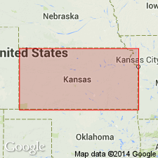
In western Kansas, Anadarko basin, Central Kansas uplift, basal sandstone variously called "Basal sand," Reagan sand, or LaMotte sandstone. Underlies Arbuckle; overlies Precambrian rocks. Thickness in one well 330 feet. Composed of white sand with well-rounded grains; basal part arkosic. Age is Cambrian.
Source: GNU records (USGS DDS-6; Denver GNULEX).
- Usage in publication:
-
- Lamotte sandstone
- Modifications:
-
- Areal extent
- AAPG geologic province:
-
- Lincoln anticline
Summary:
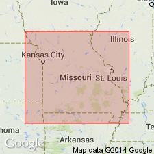
Lamotte sandstone. Present in subsurface of Ralls County, northeast Missouri. Thickness 330 feet. Overlies Precambrian; underlies Bonneterre formation. Age is Late Cambrian.
Source: Modified from GNU records (USGS DDS-6; Denver GNULEX).
- Usage in publication:
-
- Lamotte sandstone
- Modifications:
-
- Areal extent
- AAPG geologic province:
-
- Forest City basin
Summary:
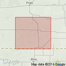
Occurs in subsurface of northeast Kansas, Forest City basin. Thickness is 0 to 60 feet. Unconformably overlies Precambrian rocks. Underlies Bonneterre dolomite. Age is Late Cambrian. Report includes columnar sections.
Source: Modified from GNU records (USGS DDS-6; Denver GNULEX).
- Usage in publication:
-
- Lamotte sandstone
- Modifications:
-
- Overview
- AAPG geologic province:
-
- Ozark uplift
Branson, E.B., 1944, The geology of Missouri: University of Missouri Studies, v. 19, no. 3, 535 p.
Summary:
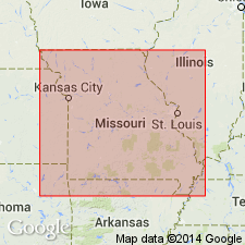
Pg. 16-18. Lamotte sandstone. Gives an overview of lithology and history of the Lamotte in Missouri. Detailed lithology from a well near Bonne Terre. Lamotte is oldest Cambrian formation that appears at surface in Missouri. No complete section exposed. Consists largely of quartz grains varying in color through light-gray, reddish brown, red, green, and shades of yellow. Shale layers a few inches thick common throughout formation. Reagan sandstone of Oklahoma and Hickory sandstone of Texas are probably in part correlatives. Deadwood sandstone of the Black Hills and Flathead sandstone of Wyoming represent similar conditions and time of formation. Overlies Precambrian; unconformably underlies Bonneterre dolomite. Generally accepted age is Late Cambrian.
Source: US geologic names lexicon (USGS Bull. 1200, p. 2091); supplemental information from GNU records (USGS DDS-6; Denver GNULEX).
- Usage in publication:
-
- Lamotte sandstone*
- Modifications:
-
- Areal extent
- AAPG geologic province:
-
- Chautauqua platform
- Cherokee basin
- Ozark uplift
Summary:
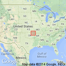
Occurs in subsurface of northeast Oklahoma, southeast Kansas, and southwest Missouri, in Cherokee basin, Chautauqua platform, and on Ozark uplift. Composed of medium to coarse, rounded, frosted quartz grains with a bed of arkose at base. Thickness is 0 to 200 feet. Underlies Bonneterre dolomite; overlies Precambrian. Age is Late Cambrian.
Source: GNU records (USGS DDS-6; Denver GNULEX).
- Usage in publication:
-
- Lamotte sandstone*
- Modifications:
-
- Areal extent
- AAPG geologic province:
-
- Las Vegas-Raton basin
Summary:
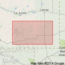
Lamotte sandstone. Occurs in subsurface of Las Animas arch, Colorado; is the basal Paleozoic sandstone. Thickness 15 feet in Otero County; tentatively recognized in Las Animas County. Report includes correlation chart.
Source: Modified from GNU records (USGS DDS-6; Denver GNULEX).
- Usage in publication:
-
- Lamotte sandstone
- Modifications:
-
- Areal extent
- AAPG geologic province:
-
- Cherokee basin
- Forest City basin
- Central Kansas uplift
- Sedgwick basin
- Anadarko basin
Summary:
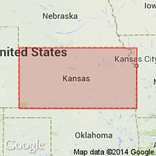
Has widespread occurrence in subsurface of eastern and western Kansas. Recognized in Cherokee basin, Forest City basin, Sedgwick basin, Anadarko basin, and Central Kansas uplift. Consists of coarse, subangular to rounded, arkosic sand becoming finer in upper part and grading into overlying Bonneterre dolomite. Thickness is 0 to 130 feet. Unconformably overlies Precambrian. Age is Late Cambrian. Report includes columnar sections, cross sections, correlation table.
Source: Modified from GNU records (USGS DDS-6; Denver GNULEX).
- Usage in publication:
-
- Lamotte sandstone
- Modifications:
-
- Areal extent
- AAPG geologic province:
-
- Salina basin
- Sedgwick basin
- Central Kansas uplift
Summary:
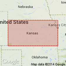
Locally occurs in subsurface of Salina basin, Sedgwick basin, and Central Kansas uplift in Kansas, and south-central Nebraska, but is absent in broad areas of central Kansas. Is a coarse, angular to rounded, poorly sorted sand; 0 to 80 feet thick. Underlies Bonneterre dolomite; unconformably overlies Precambrian rocks. Age is Late Cambrian. Report includes columnar table, cross section.
Source: Modified from GNU records (USGS DDS-6; Denver GNULEX).
- Usage in publication:
-
- Lamotte sandstone
- Modifications:
-
- Areal extent
- AAPG geologic province:
-
- Denver basin
- Las Animas arch
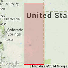
Summary:
Occurs in subsurface of Kiowa, Cheyenne, and Yuma Counties, eastern Colorado, Denver basin and Las Animas arch. Consists of white, coarse, subrounded quartz grains; lower part contains some feldspar grains. Glauconite common throughout. Thickness is 16 to 85 feet. Sand also called Reagan sandstone and Sawatch sandstone. Age is Late Cambrian (Croixan). Report includes cross section.
Source: Modified from GNU records (USGS DDS-6; Denver GNULEX).
- Usage in publication:
-
- Lamotte sandstone*
- Modifications:
-
- Areal extent
- AAPG geologic province:
-
- Anadarko basin
- Las Animas arch
- Palo Duro basin
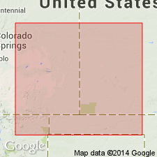
Summary:
Occurs in the subsurface in most of southwest Kansas, southeast Colorado, and the Oklahoma Panhandle in the Anadarko basin, Las Animas arch, and Palo Duro basin. Thickness from 0 to 72 feet, increasing to north. Texture grades from fine to coarse in same direction. Consists of white, subround to subangular quartz grains; contains glauconite; very dolomitic in places; grades upward into Bonneterre dolomite. Unconformably overlies Precambrian rocks. Age is Late Cambrian.
Source: GNU records (USGS DDS-6; Denver GNULEX).
- Usage in publication:
-
- Lamotte sandstone
- Modifications:
-
- Overview
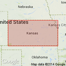
Summary:
Pg. 106 (fig. 42), 120 (fig. 51), 122. Lamotte sandstone. The sand grains composing the Lamotte are ill sorted, rounded to angular, and coarse to fine. Arkosic material occurs in lower part adjacent to Pre-Cambrian rocks. The Lamotte sandstone was deposited unconformably on a complex of Pre-Cambrian rocks which formed an uneven surface of very low relief. The formation is widespread in Kansas beneath the Bonneterre but locally Bonneterre overlaps on the Pre-Cambrian surface. Thicknesses of 80 to 130 feet have been reported in southeastern Kansas but the average thickness is about 20 feet. Occurs in subsurface of Kansas. Age is Cambrian.
Source: Publication.
- Usage in publication:
-
- Lamotte sandstone
- Modifications:
-
- Biostratigraphic dating
- AAPG geologic province:
-
- Ozark uplift
Summary:
In Madison County, Missouri, Ozark uplift, tracks identified as CLIMACTICHNITES and PROTICHNITES found in the lower part of the Lamotte indicate age of early Late Cambrian. Correlated with Mount Simon sandstone of Wisconsin and Potsdam sandstone of New York. Age is Late Cambrian.
Source: Modified from GNU records (USGS DDS-6; Denver GNULEX).
- Usage in publication:
-
- Lamotte sandstone*
- Modifications:
-
- Areal extent
- AAPG geologic province:
-
- Anadarko basin
Summary:
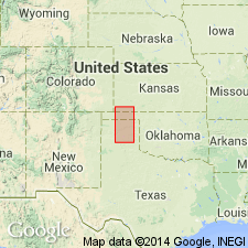
Described from well in Roberts County, Texas, in the Anadarko basin. Is 86 feet thick. Upper 50 feet consists of dolomitic sandstone; lower 36 feet consists of glauconitic, conglomeratic sandstone. Correlated with Reagan sandstone of Oklahoma and Sawatch quartzite of Colorado. Underlies Arbuckle; overlies Precambrian. Age is Cambrian.
Source: Modified from GNU records (USGS DDS-6; Denver GNULEX).
- Usage in publication:
-
- Lamotte sandstone
- Modifications:
-
- Areal extent
- AAPG geologic province:
-
- Denver basin
- Las Animas arch
- Chadron arch
Summary:
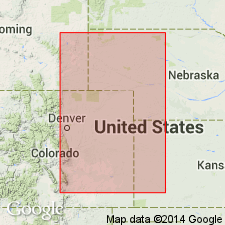
Lamotte sandstone. Occurs in subsurface of eastern Colorado, western Kansas, and northwestern Nebraska. Lithologic equivalents are Sawatch, Ignacio, Lodore, and Deadwood sandstones. Overlies Precambrian; underlies Cambro-Ordovician Arbuckle limestones. Age is Late Cambrian. Report includes isopach map.
Source: GNU records (USGS DDS-6; Denver GNULEX).
- Usage in publication:
-
- Lamotte(?) formation
- Modifications:
-
- Areal extent
- AAPG geologic province:
-
- Upper Mississippi embayment
Summary:
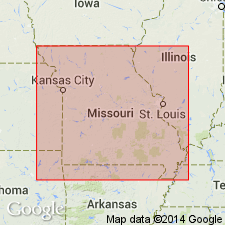
Uses Lamotte(?) formation. An unfossiliferous quartzite which may be a correlative of the Lamotte sandstone was penetrated in Strake well (log no. 1, Pemiscot County) and Marr well (log no. 11, Stoddard County). Also encountered quartzite in lower part of well in Lake County, Tennessee (Markham well, log no. T6). Consists of dark-gray, extremely fine-grained, hard and compact, and somewhat calcareous and dolomitic quartzite. [Gradationally underlies] a limestone and calcareous and dolomitic shale that contain fossils commonly found in outcrop exposures of the Bonneterre formation near Farmington, Missouri. Lower part of Bonneterre is somewhat quartzitic and contact with underlying quartzite is gradational. Because of this gradational contact, its stratigraphic position, and geographic proximity to known Lamotte, in Ozark escarpment to the northwest, this quartzite is believed to be equivalent to Lamotte sandstone. It may later prove to be equivalent to Middle Cambrian quartzite of Alabama.
Source: Modified from GNU records (USGS DDS-6; Denver GNULEX).
- Usage in publication:
-
- Lamotte sandstone
- Modifications:
-
- Areal extent
- AAPG geologic province:
-
- Illinois basin
Summary:
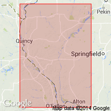
In subsurface of western Illinois, Illinois basin, basal Cambrian sandstone is called Lamotte sandstone. Correlates with [Mount Simon] sandstone. Overlies Precambrian; underlies [Bonneterre] formation. Age is Cambrian.
Source: GNU records (USGS DDS-6; Denver GNULEX).
- Usage in publication:
-
- Lamotte formation
- Modifications:
-
- Overview
- AAPG geologic province:
-
- Lincoln anticline
- Ozark uplift
Summary:
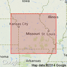
(Paleozoic Era; Cambrian System by W.C. Hayes and R.D. Knight, p. 14-15, 16-17 (fig. 3).) Lamotte formation. Predominantly light-gray, white, yellow, brown, or red quartzose sandstone that in many places grades laterally into arkose and conglomerate. Red to purple silty shale locally present; lenses of arenaceous dolomite are scattered through the upper part of the formation. Thickness up to 500 feet. Exposures limited to St. Francois Mountain area in Madison, Ste. Genevieve, Iron, and southeastern Washington Counties, Missouri. Widespread in subsurface, notably in Barry, Howell, Laclede, and Ralls Counties, Missouri. Is quarried for dimension stone. Age is Late Cambrian.
Source: Publication.
- Usage in publication:
-
- Lamotte Sandstone
- Modifications:
-
- Overview
- AAPG geologic province:
-
- Ozark uplift
Summary:
Report provides detailed petrologic study of the Lamotte Sandstone in southeastern Missouri, Ozark uplift. Lamotte is a time-transgressive marine orthoquartzite containing arkose sandstone and conglomerate in lower part. Reagan Sandstone and [Mount Simon] Sandstone are time-transgressive equivalents. Overlies Precambrian rocks; grades into overlying Bonneterre Dolomite. Age is Late Cambrian. Report includes isopach map, geologic map.
Source: Modified from GNU records (USGS DDS-6; Denver GNULEX).
- Usage in publication:
-
- Lamotte Sandstone
- Modifications:
-
- Overview
Summary:
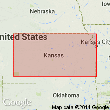
(Paleozoic Era; [Cambrian through Mississippian Systems] by E.D. Goebel, p. 12.) Lamotte Sandstone. The Lamotte is a basal Paleozoic sandstone. The sand grains composing the Lamotte are poorly sorted, rounded to angular, and coarse to fine. Quartzose sandstone, dolomitic sandstone, quartz-glauconite sandstone, arkose, and feldspathic sandstone are the dominant rock types, Arkosic material occurs in the lower part adjacent to Precambrian rocks. The Lamotte Sandstone was deposited unconformably on a complex of Precambrian rocks that formed an uneven surface of low relief. The formation is widespread in Kansas beneath the Bonneterre, but locally the Lamotte is absent and the Bonneterre lies on the Precambrian. Absence of the Lamotte locally in the area of the Central Kansas uplift and the Cambridge arch is attributed to post-depositional erosion. Thicknesses of 80 to 130 feet have been reported in southeastern Kansas, and as much as 175 feet in western Kansas, but the average thickness is about 40 feet. [Age is Late Cambrian.]
Source: Publication.
- Usage in publication:
-
- Lamotte Sandstone
- Modifications:
-
- Age modified
- AAPG geologic province:
-
- Ozark uplift
Summary:
Recent work shows that Lamotte Sandstone may be partly pre-Late Cambrian.
Source: GNU records (USGS DDS-6; Denver GNULEX).
- Usage in publication:
-
- Lamotte Sandstone
- Modifications:
-
- Age modified
- AAPG geologic province:
-
- Ozark uplift
Summary:
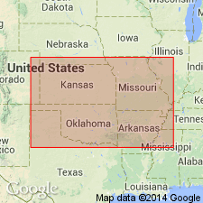
Lamotte Sandstone. Present in subsurface of southern Missouri. Thickness extremely irregular, reflects paleotopography of underlying Precambrian. Pinches out to west along Taney-Stone County line, Missouri, or may in part merge with time-transgressive Reagan Sandstone. Underlies Bonneterre Formation; overlies Precambrian. Age is Middle Cambrian(?); is older than CEDARIA zone.
Source: Missouri lexicon (Thompson, 2001, Missouri Geol. Survey Rpt. Inv., no. 73, p. 162); GNU records (USGS DDS-6; Denver GNULEX).

- Usage in publication:
-
- Lamotte Sandstone
- Modifications:
-
- Overview
- AAPG geologic province:
-
- Ozark uplift
Summary:
Table on p. 39 shows current preference of the Illinois Geol. Survey is to use Mt. Simon [Mount Simon] Sandstone instead of Lamotte Sandstone.
Source: GNU records (USGS DDS-6; Denver GNULEX).
- Usage in publication:
-
- Lamotte Sandstone
- Modifications:
-
- Overview
Summary:
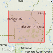
Pg. 18. Lamotte Sandstone. Is predominantly a quartzose sandstone that in many places grades laterally into arkose and conglomerate. Pebbles and boulders of felsite are chief constituents of the conglomerates which immediately overlie Precambrian rocks in many places. Color of the sandstone ranges from light-gray or white to yellow, brown, or red. Red to purple, silty shale is locally present, and lenses of arenaceous dolomite are scattered throughout upper part of formation. Thickness 200 feet in Howell County, 300 feet in Laclede County; 125 feet in Barry County, and 340 feet in Ralls County. Maximum thickness about 500 feet in depressions between Precambrian ridges and knobs. Where formation onlaps these knobs and hills, it pinches out and is overlapped by younger formations. Exposures of Lamotte generally restricted to St. Francois Mountain area, Madison, Ste. Genevieve, Iron, and southwestern Washington Counties. Is persistent in subsurface throughout Missouri, except on Precambrian highs. Has been quarried for dimension stone in St. Francois Mountain area.
Source: Publication.
- Usage in publication:
-
- Lamotte Formation*
- Modifications:
-
- Overview
- AAPG geologic province:
-
- Illinois basin
- Ozark uplift
Summary:
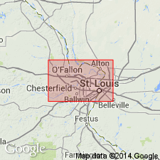
Lamotte Formation. Present in subsurface, St. Louis area, Missouri and Illinois. Age is Late Cambrian (Croixan).
Source: Modified from GNU records (USGS DDS-6; Denver GNULEX).
- Usage in publication:
-
- Lamotte Sandstone*
- Modifications:
-
- Overview
- AAPG geologic province:
-
- Ozark uplift
Summary:
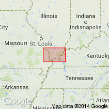
Deep boreholes in Paducah quadrangle penetrated Cambrian (Croixan) Lamotte Sandstone of Missouri or the correlative Mount Simon Sandstone of Illinois.
Source: GNU records (USGS DDS-6; Denver GNULEX).
- Usage in publication:
-
- Lamotte Sandstone
- Modifications:
-
- Overview
Summary:
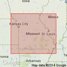
Pg. 162. Dake (1930, [Missouri Bur. Geol. and Mines, 2nd ser., v. 23,] p. 44) stated "The name is derived from old Mine La Motte [Madison County, Missouri], and was proposed by Winslow for the series of basal sandstones overlying the crystallines and below the limestone beds [Bonneterre Formation] in which lead ores are found." A specific type section has never been designated. Winslow (1894, p. 347) stated "Immediately overlying the Archean [Precambrian] crystallines is a great body of sandstone. This sandstone we have named the La Motte sandstone, and we consider it the basal member of the series." He regarded the "La Motte" to be Silurian in age. The lowest (and oldest) formation of the Upper Cambrian Series, the Lamotte is overlain by carbonates of the Bonneterre Formation and underlain by Precambrian rocks. It has been used essentially the way it was first defined, except that it is now written "Lamotte" instead of "La Motte." It is equivalent to the [Mount Simon] Sandstone of states to the north.
Source: Publication.
For more information, please contact Nancy Stamm, Geologic Names Committee Secretary.
Asterisk (*) indicates published by U.S. Geological Survey authors.
"No current usage" (†) implies that a name has been abandoned or has fallen into disuse. Former usage and, if known, replacement name given in parentheses ( ).
Slash (/) indicates name conflicts with nomenclatural guidelines (CSN, 1933; ACSN, 1961, 1970; NACSN, 1983, 2005, 2021). May be explained within brackets ([ ]).

