

- Usage in publication:
-
- Lake Vermilion Formation*
- Modifications:
-
- Overview
- AAPG geologic province:
-
- Lake Superior region
Summary:
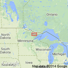
Part of greenstone-granite terrane of northern MN in the Lake Superior region. Consists of (decreasing abundance): 1) graywacke member--mostly graywacke with felsic-intermediate pyroclastic rocks; 2) felsic volcaniclastic member--partly reworked dacitic tuff and agglomerate; 3) mixed volcaniclastic member--felsic-intermediate tuff breccia; and 4) basaltic lavas. Exceeds 3000 m in thickness. Overlies Ely Greenstone and underlies Newton Lake Formation in western part of Vermilion district. Generalized geologic map, geologic evolution chart. Is Precambrian W in age.
Source: GNU records (USGS DDS-6; Denver GNULEX).
For more information, please contact Nancy Stamm, Geologic Names Committee Secretary.
Asterisk (*) indicates published by U.S. Geological Survey authors.
"No current usage" (†) implies that a name has been abandoned or has fallen into disuse. Former usage and, if known, replacement name given in parentheses ( ).
Slash (/) indicates name conflicts with nomenclatural guidelines (CSN, 1933; ACSN, 1961, 1970; NACSN, 1983, 2005, 2021). May be explained within brackets ([ ]).