- Usage in publication:
-
- Lagarto division
- Modifications:
-
- Original reference
- Dominant lithology:
-
- Claystone
- Sandstone
Dumble, E.T., 1894, The Cenozoic deposits of Texas: Journal of Geology, v. 2, no. 6, p. 549-567.
Summary:
Pg. 560. Lagarto division. Light-colored clays (lilac, lavender, sea green, greenish brown, and mottling of these colors) and sands of different character from those of Lapara division. These clays contain quantities of semicrystalline limestone pebbles with manganese dendritions. Upper part usually a sandstone. Underlies Reynosa division and overlies Lapara division. Assigned to Pliocene.
[Named from Lagarto Creek, in Live Oak Co., where it is typically exposed (see Duessen, 1924, USGS Prof. Paper 126).]
Source: US geologic names lexicon (USGS Bull. 896, p. 1130).

- Usage in publication:
-
- Lagarto clay*
- Modifications:
-
- Areal extent
- AAPG geologic province:
-
- Gulf Coast basin
Summary:
Pg. 21, 100, etc. Lagarto clay. Light-colored or mottled pink and green clays, with numerous lime nodules; stained heavily with manganese in places. Strings of limestone extend downward into the clay where it is capped by limestone. Includes also sands and sandstones. Thickness 346 to 647 feet. Unconformably underlies Reynosa formation and overlies (conformably?) Lapara sand in Nueces Valley, but north of San Antonio River it rests unconformably on Oakville sandstone. [Age is Miocene(?).]
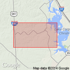
Named by Dumble from Lagarto Creek, in Live Oak Co., TX, where it is typically exposed.
Source: US geologic names lexicon (USGS Bull. 896, p. 1130).

- Usage in publication:
-
- Lagarto formation
- Modifications:
-
- Principal reference
- Revised
- AAPG geologic province:
-
- Gulf Coast basin
Summary:
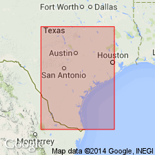
Pg. 530, 753, 754, errata dated Dec. 11, 1933. Lagarto Formation. Dumble's Lagarto included beds both younger and older than Lapara sand, as it included all beds between Oakville and Lissie formations. The beds on Lagarto Creek unconformably overlie Lapara sand, and are here treated as middle member of Goliad formation (new), under the name Lagarto Creek beds. The beds below Lapara sand and above Oakville are here called Lagarto formation, although the beds on Lagarto Creek are now included in overlying Goliad formation. The Lagarto formation as here restricted is 500 to 1,000 feet thick (2,500 feet in wells), and rests on Oakville sandstone. [For further details see Plummer's report.]
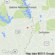
Type section (Lagarto restricted): exposures along Brenham-Houston Highway just west of Brazos River bridge, Washington Co., TX.
[GNC remark (ca. 1936, US geologic names lexicon, USGS Bull. 896, p. 1130): The USGS uses the restricted definition of Lagarto clay described above, i.e. for the beds unconformably underyling Goliad sand (of which Lapara sand is basal member) and overlying Oakville sandstone.]
Source: US geologic names lexicon (USGS Bull. 896, p. 1130).

- Usage in publication:
-
- Lagarto clay
- Modifications:
-
- Areal extent
- AAPG geologic province:
-
- Gulf Coast basin
Summary:
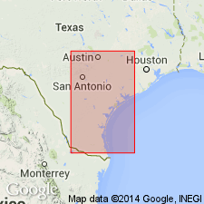
Pg. 977-1011. Lagarto clay. Geographically restricted to exclude outcrops around Burkeville, [Newton County], Texas. On basis of new age determinations, it is believed that term Fleming formation is applicable to these beds. [Age is Miocene(?).]
Source: US geologic names lexicon (USGS Bull. 1200, p. 2070-2071).

- Usage in publication:
-
- Lagarto member
- Modifications:
-
- Revised
Summary:
Pg. 1724-1725, 1727. Lagarto Member of Goliad Formation (=Dumble's Lagarto); Lagarto Member of Cuero Formation. Lagarto of Dumble considered member of Goliad formation. Lagarto (emended) by Plummer, 1933 (Univ. Texas Bull., no. 3232) is discarded. Part of section assigned to Lagarto (emended) is here included in Cuero formation (new). Unit termed Lower Lagarto by Weeks, 1933 (AAPG Bull., v. 17, no. 5) herein assigned to Cuero formation (new). Goliad is considered Pliocene.
Source: US geologic names lexicon (USGS Bull. 896, p. 1130).
For more information, please contact Nancy Stamm, Geologic Names Committee Secretary.
Asterisk (*) indicates published by U.S. Geological Survey authors.
"No current usage" (†) implies that a name has been abandoned or has fallen into disuse. Former usage and, if known, replacement name given in parentheses ( ).
Slash (/) indicates name conflicts with nomenclatural guidelines (CSN, 1933; ACSN, 1961, 1970; NACSN, 1983, 2005, 2021). May be explained within brackets ([ ]).

