- Usage in publication:
-
- Ladron Member*
- Modifications:
-
- Original reference
- Dominant lithology:
-
- Limestone
- AAPG geologic province:
-
- Orogrande basin
Summary:
Pg. 17-19. Ladron Member of Kelly Limestone. Gray crinoid-bryozoan wackestone and packstone with gray nodular chert. Thickness 21.5 m. In the Ladron Mountains, consists of basal arenaceous lime mudstone to quartz sandstone, 0.1 to 0.3 m thick, overlain by 15 m of light-gray bryozoan-echinoderm-brachiopod wackestone and packstone. Is top member of Kelly Limestone. Disconformably overlies Caloso Member; unconformably underlies shale and conglomerate of the Pennsylvanian Sandia Formation. Fossils [listed]. Megafossils described by Armstrong (1958). Microfossils found in thin sections from the Ladron Member are of zone 9; a latest Tournaisian age established on first occurence of PRISCELLA, PSEUDOTAXIS, and TETRATAXIS. Age is Early Mississippian (Tournaisian; Osagean; Keokuk).
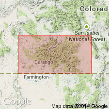
Type locality (=Kelly Limestone type section): outcrop on crest of Magdalena Mountains, [northeast of Kelly], in NE/4 SW/4 sec. 31, T. 2 S., R. 3 W., [Magdalena 7.5-min quadrangle], Socorro Co., central NM.
Named from Ladron Mountains, north of Magdalena Mountains.
Source: Publication; US geologic names lexicon (USGS Bull. 1564, p. 89); Changes in stratigraphic nomenclature, 1976 (USGS Bull. 1435-A, p. A52).

- Usage in publication:
-
- Ladron Member*
- Modifications:
-
- Age modified
- AAPG geologic province:
-
- Orogrande basin
Summary:
As the upper member of Kelly Limestone, lower part (51 ft) of Ladron is assigned to zone 9, Tournaisian, and the upper 8 ft to zone 14, Visean. The two parts are separated by an unconformity. Unconformably overlies Caloso Member of Kelly. Unconformably underlies Sandia Formation. Basal 1 inch marked by zone of spherical quartz sandstone that is overlain in sequence by shoaling-upward units --10 ft of crinoidal packstone, 6 ft of microbial mats and stromatolitic, dolomitic lime mudstone, and 43 ft of thick-bedded, cherty, crinoidal wackestone and packstone. Conodonts (listed) identified from upper part of middle to late Meramecian or Visean age. Correlation chart. Measured section.
Source: GNU records (USGS DDS-6; Denver GNULEX).
For more information, please contact Nancy Stamm, Geologic Names Committee Secretary.
Asterisk (*) indicates published by U.S. Geological Survey authors.
"No current usage" (†) implies that a name has been abandoned or has fallen into disuse. Former usage and, if known, replacement name given in parentheses ( ).
Slash (/) indicates name conflicts with nomenclatural guidelines (CSN, 1933; ACSN, 1961, 1970; NACSN, 1983, 2005, 2021). May be explained within brackets ([ ]).

