The National Geologic Map Database is migrating to a new infrastructure. We apologize for any service disruptions during this process.
|
|---|


- Usage in publication:
-
- La Muda limestone member*
- Modifications:
-
- Revised
Summary:
The La Muda limestone of Berkey (1915) is here revised as the La Muda limestone member of the Frailes formation. Consists of gray, fine-grained, thick-bedded pure limestone made up of Foraminifera, Radiolaria, and algae. Forms lenticular bodies in the lower part of the Frailes. Overlies the Tortugas andesite or the Guaynabo formation in some areas. Age is Late Cretaceous based on fossils.
Source: GNU records (USGS DDS-6; Reston GNULEX).
- Usage in publication:
-
- La Muda Formation*
- Modifications:
-
- Revised
- AAPG geologic province:
-
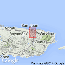
- Caribbean region
Summary:
The La Muda Limestone Member of the Frailes Formation is here revised as the La Muda Formation and includes the discontinuous sequence of bedded strata that overlie the Tortugas Andesite in the Aguas Buenas quadrangle. Contains lenses and pods of limestone at the base and in some places is entirely limestone. Also contains sandstone and siltstone and a massive conglomerate member at the base. Age is Late Cretaceous (Maastrichtian) based on fossils.
Source: GNU records (USGS DDS-6; Reston GNULEX).

- Usage in publication:
-
- La Muda Formation*
- Modifications:
-
- Overview
- AAPG geologic province:
-
- Caribbean region
Summary:
The La Muda Formation occurs in eastern Puerto Rico and consists of calcareous sandstone that ranges to arenaceous limestone. Contains interbeds of coarse conglomerate and, locally, massive limestone. Maximum thickness is 90 meters. The La Muda is of Late Cretaceous age.
Source: GNU records (USGS DDS-6; Reston GNULEX).
For more information, please contact Nancy Stamm, Geologic Names Committee Secretary.
Asterisk (*) indicates published by U.S. Geological Survey authors.
"No current usage" (†) implies that a name has been abandoned or has fallen into disuse. Former usage and, if known, replacement name given in parentheses ( ).
Slash (/) indicates name conflicts with nomenclatural guidelines (CSN, 1933; ACSN, 1961, 1970; NACSN, 1983, 2005, 2021). May be explained within brackets ([ ]).