The National Geologic Map Database is migrating to a new infrastructure. We apologize for any service disruptions during this process.
|
|---|


- Usage in publication:
-
- Kwagunt Formation
- Modifications:
-
- First used
- AAPG geologic province:
-
- Plateau sedimentary province
Summary:
First use of the Kwagunt Formation of the Chuar Group. Age is late Precambrian.
Source: GNU records (USGS DDS-6; Menlo GNULEX).
- Usage in publication:
-
- Kwagunt Formation
- Modifications:
-
- [Principal reference]
- Dominant lithology:
-
- Shale
- Sandstone
- Dolomite
- Limestone
- AAPG geologic province:
-
- Plateau sedimentary province
- Southern Rocky Mountain region
Summary:
Pg. 1244 (table 1), 1250-1252, geol. map (fig. 1), columnar section (fig. 2). Kwagunt Formation of Chuar Group. Mostly shale with lesser sandstone, dolomite, limestone. Subdivided into newly named members (descending): Walcott, about 838 feet; Awatubi, about 1,128 feet; and Carbon Butte, about 252 feet [see entries under individual members]. Total thickness about 2,218 feet. Underlies Sixty Mile [Sixtymile] Formation (new), top formation of Chuar Group [chart accompanying geol. map (fig. 1) shows the Sixtymile excluded from Chuar Group]. Overlies Galeros Formation (new) of Chuar Group. Fossils. Age is late Precambrian.
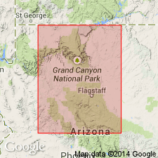
[Type locality not stated.] Entire formation exposed from lower parts of Kwagunt Canyon northwestward to summit of Nankoweap Butte [Nankoweap Mesa and Point Imperial 7.5-min quadrangles], eastern Grand Canyon, Grand Canyon National Park, Coconino Co., northern AZ.
Named from Kwagunt Canyon [in Nankoweap Mesa, Cape Solitude, and Walhalla Plateau 7.5-min quadrangles], eastern Grand Canyon, Grand Canyon National Park, Coconino Co., northern AZ. [Labeled Kwagunt Valley on some topographic maps.]
[Additional locality information from USGS GNIS database and USGS historical topographic map collection TopoView, accessed on September 22, 2024.]
Source: Publication; supplemental information from US geologic names lexicon (USGS Bull. 1520, p. 170).
- Usage in publication:
-
- Kwagunt Formation*
- Modifications:
-
- Adopted
- AAPG geologic province:
-
- Plateau sedimentary province
Summary:
Kwagunt Formation of the Chuar Group of the Grand Canyon Supergroup is adopted. Age is late Precambrian.
Source: GNU records (USGS DDS-6; Menlo GNULEX).
- Usage in publication:
-
- Kwagunt Formation*
- Modifications:
-
- Age modified
- AAPG geologic province:
-
- Plateau sedimentary province
Summary:
Age of the Kwagunt Formation is modified from late Precambrian to: Proterozoic Y.
Source: GNU records (USGS DDS-6; Menlo GNULEX).
- Usage in publication:
-
- Kwagunt Formation*
- Modifications:
-
- Age modified
- AAPG geologic province:
-
- Southern Rocky Mountain region
Summary:
Is the upper formation of Chuar Group of Grand Canyon Supergroup. Overlies Galeros Formation of Chuar; unconformably underlies Sixtymile Formation. Is 627 m thick. Age designation of Proterozoic Y changed to Late Proterozoic, the age term applied to rocks younger than 900 Ma and older than 570 Ma. Change in age designation made to Kwagunt and its Carbon Butte (base), Awatubi, and Walcott Members in the Southern Rocky Mountain region of northern AZ. Columnar section.
Source: GNU records (USGS DDS-6; Denver GNULEX).
- Usage in publication:
-
- Kwagunt Formation*
- Modifications:
-
- Overview
- AAPG geologic province:
-
- Southern Rocky Mountain region
Summary:
CHUARIA-bearing acritarchs and vase-shaped chitinozoan-like microfossils, algal filaments, unicells have been reported from the Kwagunt Formation of Chuar Group of Grand Canyon Supergroup in the northern AZ Southern Rocky Mountain region. Strata bearing these fossils predate the Windermere Supergroup. Stratigraphic chart. Correlation chart. Late Proterozoic age.
Source: GNU records (USGS DDS-6; Denver GNULEX).
For more information, please contact Nancy Stamm, Geologic Names Committee Secretary.
Asterisk (*) indicates published by U.S. Geological Survey authors.
"No current usage" (†) implies that a name has been abandoned or has fallen into disuse. Former usage and, if known, replacement name given in parentheses ( ).
Slash (/) indicates name conflicts with nomenclatural guidelines (CSN, 1933; ACSN, 1961, 1970; NACSN, 1983, 2005, 2021). May be explained within brackets ([ ]).