

- Usage in publication:
-
- Kuparuk Formation
- Modifications:
-
- Named
- Biostratigraphic dating
- Dominant lithology:
-
- Sandstone
- Siltstone
- Mudstone
- AAPG geologic province:
-
- Alaska Northern region
Summary:
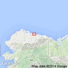
Named after Kuparuk River which flows north into Gwydwr Bay. Type section designated in Ugnu State No.1 well at depths between 6262 and 5890 ft, Kuparuk oil field, northernmost edge of Alaskan North Slope. (Has been called Kuparuk River sands.) Included as middle formation in Ugnuravik Group (new). Correlation chart shows distribution in wells in Colville-Prudhoe basin. Informally subdivided into lower and upper members. Lower member (units A and B) consists of thin to very thinly interbedded sandstone, siltstones, and mudstones. Upper member (units C and D) consists of massive sandstone and siltstone in Unit C and silty mudstone in unit D. Upper member is locally unconformable on lower member. Overlies Miluveach Formation (new); underlies Kalubik Formation (new) (both of Ugnuravik Group. Age is Early Cretaceous based on dinoflagellates of Valanginian to Barremian Age.
Source: GNU records (USGS DDS-6; Menlo GNULEX).
- Usage in publication:
-
- Kuparuk Formation*
- Modifications:
-
- Adopted
- AAPG geologic province:
-
- Alaska Northern region
Summary:
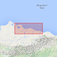
Kuparuk Formation of Carman and Hardwick (1983) is herein adopted. Type section designated in interval (6262 to 5890 ft) in Ugnu State No.1 well, sec.22 T12N R9E, Beechey Point quad, northern AK. Shorter name preferable to Kuparuk River Formation of Jamison and others (1980). Overlies Kingak Shale; underlies regional unconformity. Shown in generalized time-stratigraphic cross section as of Early Cretaceous (Neocomian) age. [Note that formation is not adopted as part of Ugnuravik Group ---Disregard this note. It certainly has been "adopted". See USGS DDS-6 Geonames (GNC 2/14/03)].
Source: GNU records (USGS DDS-6; Menlo GNULEX).
For more information, please contact Nancy Stamm, Geologic Names Committee Secretary.
Asterisk (*) indicates published by U.S. Geological Survey authors.
"No current usage" (†) implies that a name has been abandoned or has fallen into disuse. Former usage and, if known, replacement name given in parentheses ( ).
Slash (/) indicates name conflicts with nomenclatural guidelines (CSN, 1933; ACSN, 1961, 1970; NACSN, 1983, 2005, 2021). May be explained within brackets ([ ]).