

- Usage in publication:
-
- Kona dolomite*
- Modifications:
-
- Named
- Dominant lithology:
-
- Dolomite
- Slate
- Graywacke
- AAPG geologic province:
-
- Michigan basin
Summary:
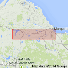
Kona dolomite (new name) consists chiefly of cherty dolomite, interstratified with layers of slate, graywacke, and quartzite, and gradational sediments. Thickness 700 ft, but possibly 1,400 ft. Conformably underlies Wewe slate. Grades into underlying Mesnard quartzite. Composes Kona Hills, on eastern shore of Goose Lake in northwestern MI. Age is Precambrian (early Huronian).
Source: GNU records (USGS DDS-6; Reston GNULEX).
- Usage in publication:
-
- Kona Dolomite*
- Modifications:
-
- Overview
- AAPG geologic province:
-
- Lake Superior region
- Wisconsin arch
Summary:
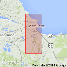
Pg. 37-45. Kona Dolomite. Placed in the Chocolay Group of the Animikie series. Present in the Marquette and Sands 7.5-min quadrangles, Marquette County, northwestern Michigan (Lake Superior region). Consists chiefly of massive to thin-bedded dolomite and quartzose dolomite, and of interlaminated dolomite and chert. Algal structures are widespread and are associated with oolites in a few places, indicative of shallow-water deposition. White-weathering and red dolomitic quartzite and a few thin beds of laminated orange and brown ferruginous quartz-feldspar siltite are locally noteworthy units. Thickness 1,000 to 1,200 feet. Conformably underlies Wewe Slate of Chocolay Group. Conformably overlies Mesnard Quartzite of Chocolay Group. At many places, a thin, generally poorly exposed slate marks the base of the Kona; occurs between the vitreous quartzite of the Mesnard and characteristic dolomite or chert-dolomite of the Kona. Kona is considered to be directly correlative with the Randville Dolomite of Dickinson and Iron Counties, Michigan (James, 1958). Age is considered middle Precambrian (Animikie Series). Report includes geologic maps, correlation chart.
Source: Publication; Changes in stratigraphic nomenclature, 1968 (USGS Bull. 1294-A, p. A10).
- Usage in publication:
-
- Kona Dolomite*
- Modifications:
-
- Overview
- AAPG geologic province:
-
- Lake Superior region
Summary:
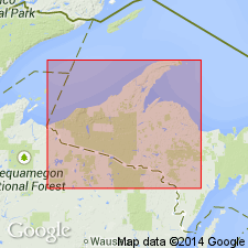
Pg. 2845 (fig. 2, stratigraphic chart compiled from Leith and others, 1935; James, 1958; Gair and Thaden, 1968). Kona Dolomite of Chocolay Group of Marquette Range Supergroup (new; replaces †Animikie series of James, 1958, south of Lake Superior, in Michigan and Wisconsin). Present in Marquette Range, northwestern Michigan. Overlies Mesnard Quartzite and underlies Wewe Slate, both of Chocolay Group. Age is middle Precambrian.
Source: Publication.
- Usage in publication:
-
- Kona Dolomite*
- Modifications:
-
- Overview
- Revised
- Dominant lithology:
-
- Dolomite
- Argillite
- Quartzite
- Slate
- Breccia
- AAPG geologic province:
-
- Lake Superior region
Summary:
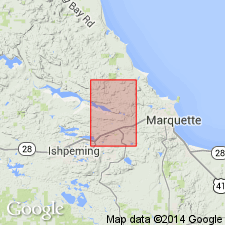
Is middle Precambrian formation mapped in narrow east-west trending belt on north limb of Eagle Mills syncline west of Teal Lake across southern part of Negaunee quadrangle, Marquette Co, MI (Lake Superior region). Is formation within Chocolay Group (revised) of Marquette Range Supergroup (revised) in Marquette syncline. Overlies Mesnard Quartzite (revised); overlain by Wewe Slate. Map unit described as pinkish-gray fine- to medium-grained crystalline dolomite, locally cherty, and thin beds of purplish-gray argillite and argillaceous dolomite near Morgan Pond. Light-gray to white quartzite, interbedded with purplish-gray ferruginous, sericitic slate and chert breccia west of Negaunee Cemetery. Is 800 to 1,200 ft thick. Revised in that the three highest units (of seven) of Mesnard Quartzite as mapped by Seaman (in Van Hise and Leith, 1911, p. 19)--red quartzite, purple slate, and cherty quartzite--are placed in Kona Dolomite herein (see table 7 for historic comparison).
Source: GNU records (USGS DDS-6; Denver GNULEX).
- Usage in publication:
-
- Kona Dolomite
- Modifications:
-
- Revised
- AAPG geologic province:
-
- Michigan basin
Summary:
Kona Dolomite of Chocolay Group of Marquette Range Supergroup. Authors use nomenclature of G.L. Taylor (1972, Michigan Tech Univ., Ph.D. dissertation). Kona Dolomite comprises (ascending) gray argillite, lower quartzite, cherty dolomite, gray-green argillite, middle quartzite, /Big Cusp algal dolomite member, Valley member, color-banded dolomite, upper quartzite, Ragged Hills member, and upper dolomite.
[According to U.S. Board on Geographic Names (1993), Big Cusp is not a geographic name.]
Source: GNU records (USGS DDS-6; Reston GNULEX).
For more information, please contact Nancy Stamm, Geologic Names Committee Secretary.
Asterisk (*) indicates published by U.S. Geological Survey authors.
"No current usage" (†) implies that a name has been abandoned or has fallen into disuse. Former usage and, if known, replacement name given in parentheses ( ).
Slash (/) indicates name conflicts with nomenclatural guidelines (CSN, 1933; ACSN, 1961, 1970; NACSN, 1983, 2005, 2021). May be explained within brackets ([ ]).