

- Usage in publication:
-
- Knob Lick granite
- Modifications:
-
- Named
- Dominant lithology:
-
- Granite
- AAPG geologic province:
-
- Midcontinent region
Summary:
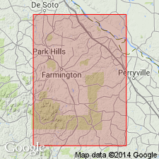
Pg. 18, 19, 24. Knob Lick granite. Rather coarse-grained, very compact granite of reddish to bluish color (near town of Syenite), in texture approaching porphyritic. Consists of quartz and feldspar with relatively rare biotite and hornblende; accessory minerals include apatite, zircon, and magnetite. Thickness 400 feet. Exposed south and west of Knoblick Mountain, St. Francois and Madison Counties, Missouri (Midcontinent region). Occupies an area of about 50 sq mi making it the largest single surface exposure of granite in Missouri. Described from measured section on Little St. Francis River, north of Fredericktown, as red, coarse-grained granite, grading into porphyry, thickness 20 feet; unconformably underlies LaMotte sandstone. In Mine La Motte district, underlies Iron Mountain porphyry with gradational contact. Author considers Iron Mountain porphyry as "the upper or surface representative of the [Knob Lick]." Is oldest exposed unit; age is Archean. Report includes chemical data.
Named from Knob Lick, St. Francis Co., MO. [According to GNU records (USGS DDS-6; Denver GNULEX, Dec. 27, 1991), spelled Knoblick on geologic map; unit is named from Knoblick Mountain where unit is best exposed; type locality not designated.]
[GNC remark (ca. 1938, US geologic names lexicon, USGS Bull. 896, p. 1113): Knob Lick granite is now considered by Missouri geologists to be probably Algonkian (Josiah Bridge, 1930, personal commun.).]
Source: US geologic names lexicon (USGS Bull. 896, p. 1113); supplemental information from GNU records (USGS DDS-6; Denver GNULEX).
- Usage in publication:
-
- Knoblick granite
- Modifications:
-
- Revised
- AAPG geologic province:
-
- Midcontinent region
Summary:
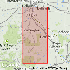
Pg. 44. Knoblick granite of Brevos group. Assigned to the Bevos group. Is a mottled light pinkish-gray to bluish-gray, fine- to medium-grained granite with small pinkish-gray potash feldspar phenocrysts. Contains numerous xenoliths. Quartz is sparsely developed, megascopically. Hornblende and biotite occur in small clusters scattered throughout and normally make up at least 10 percent of the rock; they are more abundant in this rock than in the other granites of the area. Exposures are scarce, low, and rounded; occupy a roughly lens-shaped pattern on southeast and east flank of Knob Lick Mountain, St. Francois Mountains, St. Francois County, southeastern Missouri. Good exposures may be found in quarries on northeast flank of Knob Lick Mountain and a few small quarries in western part of village of Knob Lick. This granite shows greater variability in mineralogy and texture over relatively shorter distances than any of the other granites; from the mottled gray and red contact granite on Knob Lick Mountain to the "blue" granite exposed north of Knob Lick-Syenite Road. The "blue" granite, from which the name Syenite may have been derived, is considered typical. On north side of Knob Lick Mountain, typical Knoblick grades upward into overlying pink Butler Hill granite of Bevos group. Gradation supports conclusion that Breadtray, Butler Hill, Silvermine, and Knoblick granites are differentiates of a common magmatic body which crystallized in place. Formed during later phase (of 2) of batholithic intrusion. Age is Precambrian.
See C.E. Robertson, 1995, Precambrian rocks, IN T.L. Thompson, Stratigraphic succession in Missouri (revised-1995), Missouri Division of Geology and Land Survey, 2nd series, v. 40 Revised, p. 5-14.
Source: Strat. succession in Missouri (Thompson, 1995, p. 12-13); GNU records (USGS DDS-6; Denver GNULEX).
- Usage in publication:
-
- Knoblick Granite
- Modifications:
-
- Revised
- AAPG geologic province:
-
- Midcontinent region
Summary:
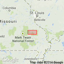
Knoblick Granite (referred to in table 1 as "Silvermine-Knoblick Granites"), one of seven Precambrian Y plutonic rock units assigned to the /St. Francois Mountains Intrusive Suite (revised). [Previously assigned to Bevos Group by Tolman and Robertson (1969); status of Bevos not discussed.] Present in St. Francois Mountains, southeast Missouri (Midcontinent region). Younger than "Slabtown-Stono Granites" (revised) of St. Francois Mountains; older than Graniteville Granite (revised) of St. Francois Mountains. Age is Precambrian Y. Nomenclature listed in table 1.
[Conflicts with nomenclature guidelines (ACSN, 1970; NACSN, 1983, 2005, 2021): name St. Francois Mountains applied concurrently to two different units in same area.]
Source: Modified from GNU records (USGS DDS-6; Denver GNULEX).
- Usage in publication:
-
- Knoblick granite
- Modifications:
-
- Overview
- AAPG geologic province:
-
- Midcontinent region
Summary:
Mapped in central St. Francois Mountains, southeast MO, Midcontinent region. [Not clear if authors intended stratigraphic units within study area to be formal or informal.] Unit is texturally, mineralogically, and chemically similar to medium-grained variety of Silvermine granite though it is somewhat finer-grained and sphene is not as abundant; hand specimens of the two rocks cannot be distinguished. Mapped undivided with low-silica plutons (which include Stono, Silvermine, Slabtown, and Knoblick Granites of Tolman and Robertson, 1969, and are mapped as "Ring Plutons of Butler Hill Caldera"). Low-silica plutons occur around margin of larger, high-silica Butler Hill granite (revised); contacts are not well enough exposed to determine intrusive relationships except that Butler Hill is intruded by Silvermine. Shown on map explanation to be younger than "Butler Hill-Breadtray Granite" map unit; older than "Hypabyssal Intrusives of Western St. Francois Mountains" map unit (which includes Munger Granite Porphyry and Carver Creek Granite of Tolman and Robertson (1969)). Intrudes Lake Killarney formation; everywhere that contacts are observed, plutonic rocks are younger than, and intrude, volcanic rocks of St. Francois Mountains. Proterozoic age.
[Authors' intentions are unclear as to which, if any, of the geologic units discussed should have formal status.]
Source: GNU records (USGS DDS-6; Denver GNULEX).
For more information, please contact Nancy Stamm, Geologic Names Committee Secretary.
Asterisk (*) indicates published by U.S. Geological Survey authors.
"No current usage" (†) implies that a name has been abandoned or has fallen into disuse. Former usage and, if known, replacement name given in parentheses ( ).
Slash (/) indicates name conflicts with nomenclatural guidelines (CSN, 1933; ACSN, 1961, 1970; NACSN, 1983, 2005, 2021). May be explained within brackets ([ ]).