

- Usage in publication:
-
- Kirkman limestone*
- Modifications:
-
- Named
- Dominant lithology:
-
- Limestone
- AAPG geologic province:
-
- Wasatch uplift
Summary:
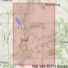
Named for exposures in the Right Fork of Hobble Creek at mouth of Kirkman Hollow, south of Provo, Utah Co, UT on the Wasatch uplift. No type locality designated. Consists of gray to black, in part sandy, fetid limestone that is commonly finely laminated. Locally contains oolitic phosphate. Some outcrops show brecciation with recemented angular fragments of finely laminated limestone oriented in diverse directions. Estimated to be more than 500 ft thick at type. Maximum thickness indicated to be about 1,350 ft on Left Fork of Hobble Creek. Thins rapidly southward. Is only 75 ft thick in Spanish Fork. Variation in thickness may be attributable to deposition on an uneven surface. Has not been recognized to north in Park City district. Overlies Oquirrh formation. Underlies Diamond Creek sandstone (new). Thought to grade laterally and vertically into Diamond Creek. Of Permian age.
Source: GNU records (USGS DDS-6; Denver GNULEX).
- Usage in publication:
-
- Kirkman formation
- Modifications:
-
- Contact revised
- AAPG geologic province:
-
- Wasatch uplift
- Great Basin province
Summary:
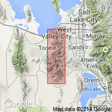
Lower contact revised in that Kirkman overlies the newly named Clinker formation in the Bingham district, Salt Lake Co (Wasatch uplift) and Tooele Co (Great Basin province), UT. Its upper contact with Diamond Creek sandstone thought to be conformable. Consists of dark gray, weathered-light-gray, fine-grained, laminated limestone. Has some lenses of coarse-grained, well-rounded quartzose sand[stone] and silt [stone], and local intraformational breccia. Locally fossiliferous--brachiopods, fusulinids. Fusulinids (SCHWAGERINA and PSSEUDOSCHWAGERINA) date it as Early Permian, Wolfcampian. Cross sections. Geologic map. Mapped in Ts3 and 4S, Rs2 and 3W.
Source: GNU records (USGS DDS-6; Denver GNULEX).
For more information, please contact Nancy Stamm, Geologic Names Committee Secretary.
Asterisk (*) indicates published by U.S. Geological Survey authors.
"No current usage" (†) implies that a name has been abandoned or has fallen into disuse. Former usage and, if known, replacement name given in parentheses ( ).
Slash (/) indicates name conflicts with nomenclatural guidelines (CSN, 1933; ACSN, 1961, 1970; NACSN, 1983, 2005, 2021). May be explained within brackets ([ ]).