- Usage in publication:
-
- Kiamitia clays
- Modifications:
-
- Original reference
- Dominant lithology:
-
- Clay
- AAPG geologic province:
-
- Ouachita folded belt
- South Oklahoma folded belt
- Strawn basin
Summary:
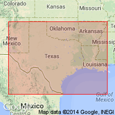
Pg. 504, 515. Kiamitia clays or Schloenbachia beds, basal formation of Washita division in Comanche series in southern Indian Territory Oklahoma and northern Texas. Are noted to occur as far south as Williamson County, Texas. Comprised of marly clays, often stiff and black before oxidation, alternating with firm, hard, thin dimension layers of almost all shells (abundant GRYPHAEA PITCHERI and SCHLOENBACHIA ACUTECARINATUS) embedded in a matrix of yellow lime. Represents a shallower deposition than the chalky Caprina beds (new). Underlies Duck Creek chalk (new) and overlies Goodland limestone (new) of Fredericksburg division [= Comanche Peak division of Shumard]. Age is Early Cretaceous. Is noted that the first fossils collected from the American Lower Cretaceous (Comanche series) were from these beds near Fort Towson, Oklahoma, by Dr. G. Pitcher in 1830.
Named from historic plains of the Kiamitia [correctly spelled Kiamichi] River near Fort Towson, Choctaw Co., OK.
Source: US geologic names lexicon (USGS Bull. 896, p. 1091); supplemental information from GNU records (USGS DDS-6; Denver GNULEX).

- Usage in publication:
-
- Kiamichi formation
- Modifications:
-
- Overview
Summary:
In southern Oklahoma overlies Goodland limestone and underlies Caddo limestone. C.N. Gould (1925, Oklahoma Geol. Survey Bull., no. 35, p. 98), stated that thickness in Oklahoma is variable up to 150 feet. Some authors now include this formation in Fredericksburg group. For history of name, see under Fredericksburg group.
Source: US geologic names lexicon (USGS Bull. 896, p. 1091).
- Usage in publication:
-
- Kiamichi formation
- Modifications:
-
- Overview
Summary:
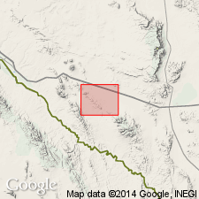
Pg. 601 (fig. 2). Geologic map of Sierra Blanca area, Texas, shows Kiamichi as upper formation of Fredericksburg group. Overlies Finlay formation; underlies Washita group.
Source: US geologic names lexicon (USGS Bull. 1200, p. 2003-2004)
- Usage in publication:
-
- Kiamichi formation
- Modifications:
-
- Biostratigraphic dating
Summary:
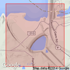
Discussion of bearing of FORAMINIFERA and OSTRACODA on Lower Cretaceous Fredericksburg-Washita boundary of north Texas. On the basis of ostracode affinities, Kiamichi is uppermost formation of Fredericksburg group. At exposure studied, there is no conclusive physical evidence of hiatus between Kiamichi and overlying Duck Creek formation. Contact with underlying Goodland not exposed.
Source: US geologic names lexicon (USGS Bull. 1200, p. 2003-2004)
- Usage in publication:
-
- Kiamichi formation
- Modifications:
-
- Overview
Summary:
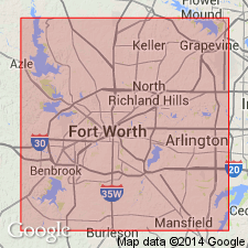
Pg. 13 (table 2), 27-31, pls. In Tarrant County, Texas, the Kiamichi, uppermost formation of Fredericksburg group, crops out in narrow sloping band in bluffs overlooking Clear Fork and West Fork of Trinity River. Consists of dark-blue to brownish-yellow marl, thin limestone, and flaggy sandstone. Lower half is marly, contains thin limestone and sandstone layers, overlain by 8 feet of thin limestone ledges alternating with marl in which [oyster] GRYPHAEA NAVIA is abundant and distinctive. Upper part is marly and less fossiliferous. Thickness 0 to 40 feet; thins southward. Overlies Goodland limestone; underlies Duck Creek formation.
Source: US geologic names lexicon (USGS Bull. 1200, p. 2003-2004)
- Usage in publication:
-
- Kiamichi formation
- Modifications:
-
- Overview
Summary:
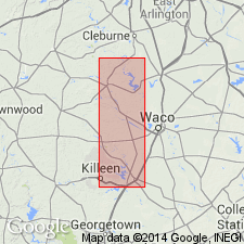
Pg. 105-130. Described in central Texas where it is uppermost formation in Fredericksburg group. Enclosed by Edwards limestone below and Georgetown limestone above. Thickness 25 feet near Blum in Hill County; thins southward along outcrop and disappears in southern McLennan County. Twenty stratigraphic sections measured and described from surface exposures in southern Fort Worth Prairie in Hill, Bosque, Coryell, McLennan, and Belt Counties, Texas.
Source: US geologic names lexicon (USGS Bull. 1200, p. 2003-2004)
- Usage in publication:
-
- Kiamichi clay member
- Modifications:
-
- Revised
Summary:
Pg. 88, 90, pl. 14. In this report [Grand and Black Prairies, east-central Texas], Kiamichi clay is considered basal member of Georgetown limestone; underlies Duck Creek member. Generally found in outcrops on streams that have cut into underlying Edwards and Comanche Peak formations. Thickness as much as 10 feet; consists of black to dark-gray clays with several 6- to 10-inch limestone beds.
Source: US geologic names lexicon (USGS Bull. 1200, p. 2003-2004)

- Usage in publication:
-
- Kiamichi formation
- Modifications:
-
- Revised
- AAPG geologic province:
-
- Fort Worth syncline
Summary:
Pg. 9 (fig. 3), 12 (fig. 4), 22-24, pls. 1, 2. Kiamichi formation. In this report [Fort Worth-Weatherford area], Kiamichi is considered basal formation in Washita group. Consists chiefly of yellow and bluish-gray calcareous and arenaceous marls, flaggy limestone, and fissile sandstones. Thickness 25 to 35 feet. Underlies Duck Creek formation, possible unconformity; overlies Benbrook limestone member (new) of Goodland formation.
Source: US geologic names lexicon (USGS Bull. 1200, p. 2003-2004)
- Usage in publication:
-
- Kiamichi(?) Formation*
- Modifications:
-
- Areal extent
- Mapped 1:62.5k
- Dominant lithology:
-
- Limestone
- AAPG geologic province:
-
- Permian basin
Summary:
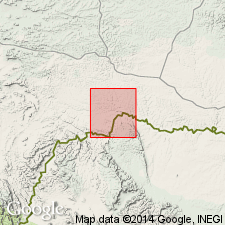
Is provisionally extended as mapped in eastern Brewster and southwest Terrell Counties, Texas, along Rio Grande, in Permian basin. Overlies Edwards Limestone; underlies Georgetown Limestone. Map unit described as medium-gray, thin-bedded limestone and clayey limestone, very finely or not visibly crystalline, fossiliferous, fetid, nodular-weathering. Exposed in Rio Grand Canyon; about 50 feet thick. Age is Early Cretaceous.
Source: GNU records (USGS DDS-6; Denver GNULEX).
- Usage in publication:
-
- Kiamichi Formation
- Modifications:
-
- Mapped 1:250k
- Dominant lithology:
-
- Clay
- Limestone
- Sandstone
- AAPG geologic province:
-
- Fort Worth syncline
- Ouachita folded belt
- Strawn basin
Summary:
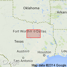
Kiamichi Formation. Clay and limestone in alternating units 0.1 to 5 feet thick; some sandstone. Clay, calcareous, olive brown, weathers yellowish brown, constitutes about two-thirds of formation. Limestone mostly aphanitic and bioclastic, locally burrowed, medium gray to yellowish gray; weathers yellowish brown. Sandstone, fine-grained, moderately well-sorted, calcareous, burrowed, beds 0.1 to 0.2 foot thick, medium gray; weathers yellowish brown. Marine megafossils are GRYPHAEA; some PECTEN in sandstone. Thickness 20 to 50 feet, thins southward. Lies above Edwards Limestone and below Duck Creek Formation. Age is Early Cretaceous.
[Mapped in Bosque, Erath, Hill, Hood, Johnson, Parker, Somervell, Tarrant, and Wise Cos., eastern TX.]
Source: Publication.

- Usage in publication:
-
- Kiamichi Formation
- Modifications:
-
- Mapped 1:250k
- Dominant lithology:
-
- Marl
- Limestone
- Clay
- AAPG geologic province:
-
- Fort Worth syncline
- South Oklahoma folded belt
Summary:
Pamphlet [p. 6]. Kiamichi Formation. In Texas, marl and limestone; mostly marl, yellowish-gray to medium-gray, shaly, in part sandy, carbonaceous; limestone, gray, sandy, platy, fossiliferous; some thin beds of fissile sandstone. In Oklahoma, mostly black, shaly clay. Thickness 20 to 50 feet. Lies above Goodland Limestone or, where absent, Walnut Clay. Lies below Duck Creek Formation (Texas) or Caddo Formation (Oklahoma). Age is Early Cretaceous.
[Mapped in mostly continuous exposures in northern part and in western half of map sheet; in Cooke, Denton, Grayson, Montague, and Wise Cos., central northern TX, and Love and Marshall Cos., southeastern OK.]
Source: Publication.
- Usage in publication:
-
- Kiamichi Shale
- Modifications:
-
- Mapped 1:250k
- Dominant lithology:
-
- Shale
- Sandstone
- Limestone
- AAPG geologic province:
-
- Permian basin
Summary:
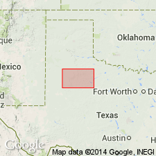
Is Lower Cretaceous formation mapped in southwestern part of map sheet in Lynn County, Texas (northeastern Permian basin). Mapped undivided with overlying Duck Creek Shale (Lower Cretaceous) around Twin and Double Lakes. Separately mapped around Guthrie and Tahoka Lakes. Overlies Edwards Limestone (Lower Cretaceous). Kiamichi described as interbedded shale, sandstone, and limestone. Shale, sandy in lower part, thin-bedded, dark-gray, yellowish-brown, weathers grayish-yellow. Sandstone, fine-grained, calcareous, light-gray to grayish-yellow. Limestone, minor amount, slightly sandy, light-gray to yellowish-gray. Marine megafossils. Exposed thickness 10 to 30 feet.
Source: GNU records (USGS DDS-6; Denver GNULEX).
For more information, please contact Nancy Stamm, Geologic Names Committee Secretary.
Asterisk (*) indicates published by U.S. Geological Survey authors.
"No current usage" (†) implies that a name has been abandoned or has fallen into disuse. Former usage and, if known, replacement name given in parentheses ( ).
Slash (/) indicates name conflicts with nomenclatural guidelines (CSN, 1933; ACSN, 1961, 1970; NACSN, 1983, 2005, 2021). May be explained within brackets ([ ]).

