The National Geologic Map Database is migrating to a new infrastructure. We apologize for any service disruptions during this process.
|
|---|


- Usage in publication:
-
- Kialagvik formation*
- Modifications:
-
- Named
- Biostratigraphic dating
- Dominant lithology:
-
- Sandstone
- Shale
- Conglomerate
- AAPG geologic province:
-
- Alaska Southwestern region
Capps, S.R., 1923, The Cold Bay district [Alaska]: U.S. Geological Survey Bulletin, 739, p. 77-116.
Summary:
Named for narrow belt along shore of Kialagvik Bay from point near mouth of Pass Creek to southwest end of bay. Consists of few hundred ft of sandstone, sandy shale, and conglomerate that form bluffs along beach and extend short distance inland. Unconformably underlies Shelikof formation (new). Fossil collection identified by T.W. Stanton is rich in ammonites and is considered to be of Middle Jurassic age.
Source: GNU records (USGS DDS-6; Menlo GNULEX).
- Usage in publication:
-
- Kialagvik formation*
- Modifications:
-
- Revised
- Age modified
- Areal extent
- AAPG geologic province:
-
- Alaska Southwestern region
Summary:
On Iniskin Peninsula unit is divided into (ascending): siltstone member and Gaikema sandstone member. Rocks were included by Moffitt (1927) in Tuxedni sandstone of Middle Jurassic age. However, age is now considered Early Jurassic on basis of its fossil content.
Source: GNU records (USGS DDS-6; Menlo GNULEX).
- Usage in publication:
-
- Kialagvik Formation*
- Modifications:
-
- Areal extent
- AAPG geologic province:
-
- Alaska Southwestern region
Summary:
Kialagvik Formation (Middle Jurassic) no longer recognized on Iniskin Peninsula (Kirschner and Minard, 1948). Rocks are reassigned to Red Glacier Formation and Gaikema Sandstone, both in lower part of Tuxedni Group in this report. [see correlation chart].
Source: GNU records (USGS DDS-6; Menlo GNULEX).
- Usage in publication:
-
- Kialagvik Formation*
- Modifications:
-
- Revised
- AAPG geologic province:
-
- Alaska Southwestern region
Summary:
Upper contact of Kialagvik Formation with Shelikof Formation raised to coincide with Smith's (1926) defined boundary [thus extending Kialagvik at expense of Shelikof].
Source: GNU records (USGS DDS-6; Menlo GNULEX).
- Usage in publication:
-
- Kialagvik Formation*
- Modifications:
-
- Overview
- AAPG geologic province:
-
- Alaska Southwestern region
Summary:
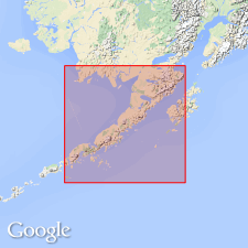
Kialagvik Formation. Principal reference section here designated along south side of Short Creek, [in T. 32 S., R. 44 W., Ugashik B-2 quadrangle (scale 1:63,360), southwestern AK]; section from VABM Creek [in sec. 34] westward about 2 km into east side of sec. 32, and continuing northeastward up ridge into sec. 28. Thickness is about 790 m.
Source: Modified from GNU records (USGS DDS-6; Menlo GNULEX).
For more information, please contact Nancy Stamm, Geologic Names Committee Secretary.
Asterisk (*) indicates published by U.S. Geological Survey authors.
"No current usage" (†) implies that a name has been abandoned or has fallen into disuse. Former usage and, if known, replacement name given in parentheses ( ).
Slash (/) indicates name conflicts with nomenclatural guidelines (CSN, 1933; ACSN, 1961, 1970; NACSN, 1983, 2005, 2021). May be explained within brackets ([ ]).