The National Geologic Map Database is migrating to a new infrastructure. We apologize for any service disruptions during this process.
|
|---|


- Usage in publication:
-
- Kessler limestone
- Modifications:
-
- Original reference
- Dominant lithology:
-
- Limestone
- AAPG geologic province:
-
- Arkoma basin
Summary:
Pg. 103-105. Kessler limestone, uppermost (of 10) of Lower Carboniferous or Mississippian beds. Thin-bedded shaly limestone, gray to reddish brown, with occasional light streaks. Thickness 10 to 15 feet. Underlies Millstone grit formation (Coal Measures) and overlies coal-bearing shale in Washington County, northwestern Arkansas. Report includes geologic map of Washington County, stratigraphic table, columnar sections.
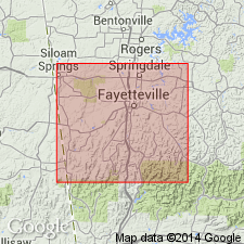
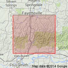
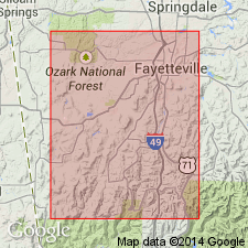
Named from its occurrence in Kessler Mountain, in T. 16 N., R. 30 W., southwest of Fayetteville, Washington Co., AR. Also exposed near the summit of East Mountain.
Source: US geologic names lexicon (USGS Bull. 896, p. 1087); supplemental information from GNU records (USGS DDS-6; Denver GNULEX).
- Usage in publication:
-
- Kessler limestone member*
- Modifications:
-
- Revised
- AAPG geologic province:
-
- Arkoma basin
Summary:
Kessler limestone member of Bloyd shale. Included this limestone in Morrow formation, of Pennsylvanian age (Pottsville). [Later the Morrow was made a group, divided into Bloyd shale above and Hale formation below (see entry under Purdue), and this limestone is now (ca. 1938) treated as a member of Bloyd shale. It lies 0 to 190 feet below top of the Bloyd.]
Source: US geologic names lexicon (USGS Bull. 896, p. 1087, 1424-1425).
- Usage in publication:
-
- Kessler limestone member*
- Modifications:
-
- Areal extent
- AAPG geologic province:
-
- Arkoma basin
Summary:
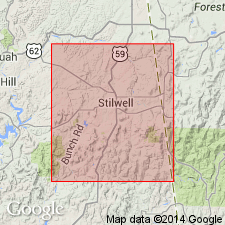
Pg. 430-432. Kessler limestone member of Bloyd shale. Geographically extended into Adair County, Oklahoma, where its maximum thickness is less than 10 or 12 feet. Lies immediately below the Atoka sandstone. Age is Early Pennsylvanian.
Source: US geologic names lexicon (USGS Bull. 1200, p. 1998).
- Usage in publication:
-
- Kessler limestone lentil
- Modifications:
-
- Revised
- AAPG geologic province:
-
- Arkoma basin
Summary:
Pg. 25-26. Kessler limestone lentil in Bloyd shale. Referred to as a lentil within Bloyd shale. Age is Early Pennsylvanian.
Source: US geologic names lexicon (USGS Bull. 1200, p. 1998).
- Usage in publication:
-
- Kessler limestone lentil
- Modifications:
-
- Revised
- AAPG geologic province:
-
- Arkoma basin
Summary:
Pg. 1942. Kessler limestone lentil in Bloyd shale. Bloyd shale consists of (ascending) Brentwood limestone member, Woolsey member (new), and an unnamed shale division which includes the Kessler limestone lentil and which represents upper half to two-thirds of formation. Kessler underlies Greenland sandstone member (new) of Atoka formation. Age is Early Pennsyvlanian.
Source: US geologic names lexicon (USGS Bull. 1200, p. 1998).
- Usage in publication:
-
- Kessler Limestone Member*
- Modifications:
-
- Age modified
Summary:
Pg. A22-A23, A54, A56-A57 (fig. 5). Kessler Limestone Member of Bloyd Formation or Bloyd Shale. Present in northwest Ozark region, Arkansas. Age changed from Early Pennsylvanian (Morrowan) to: Middle Pennsylvanian (Morrowan; early Westphalian A of Europe); foram zone 20 and ammonoid zone AXINOLOBUS MODULUS. [See also Mackenzie Gordon, Jr., and G.C. Stone, 1976, Arkansas Geol. Commission Symposium on the geology of the Ouachita Mountains, v. 1.]
Source: Publication.
For more information, please contact Nancy Stamm, Geologic Names Committee Secretary.
Asterisk (*) indicates published by U.S. Geological Survey authors.
"No current usage" (†) implies that a name has been abandoned or has fallen into disuse. Former usage and, if known, replacement name given in parentheses ( ).
Slash (/) indicates name conflicts with nomenclatural guidelines (CSN, 1933; ACSN, 1961, 1970; NACSN, 1983, 2005, 2021). May be explained within brackets ([ ]).