The National Geologic Map Database is migrating to a new infrastructure. We apologize for any service disruptions during this process.
|
|---|


- Usage in publication:
-
- Kessler Canyon Formation*
- Modifications:
-
- Named
- Dominant lithology:
-
- Quartzite
- Limestone
- Sandstone
- Dolomite
- AAPG geologic province:
-
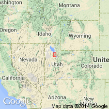
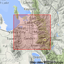
- Wasatch uplift
Summary:
Named as upper formation of Oquirrh Group (rank raised) for a north-flowing stream at north end of Oquirrh Mountains, Garfield quad, Salt Lake Co, UT, Wasatch uplift, and is part of Rogers Canyon sequence. Type section is a composite, faulted measured section in center SE1/4 sec 27, T1S, R3W, southeast to center west side NE1/4 sec 35, T1S, R3W, and in NE1/4 SE1/4 sec 30, T1S, R3W, where formation is 1,033 ft thick, and it conformably overlies Erda Formation (new) of Oquirrh and underlies Grandeur Member, Park City. Lower contact placed at base of a thick tan-brown weathering, cliff-forming quartzite. Upper contact is at base of light-gray-weathering, abundantly fossiliferous limestone that contains a well-preserved brachiopod, coral, bryozoan, and crinoid assemblage. Lower part is predominantly interbedded massive, gray-tan, fine-grained to sandy, medium-bedded to massive, well-jointed, commonly cross bedded orthoquartzite and gray thin-bedded, cherty (black or tan nodules) limestone. Upper part is poorly exposed, thin- to medium-bedded interbedded orthoquartzite, calcareous, ferruginous and dolomitic sandstone and dolomite. Fossils sparse. Has gastropods, brachiopods, bryozoans, and crinoids (listed). Of Late Pennsylvanian, Virgilian and upper part may be Early Permian, Wolfcampian age. Columnar sections. Correlation chart.
Source: GNU records (USGS DDS-6; Denver GNULEX).
- Usage in publication:
-
- Kessler Canyon Formation
- Modifications:
-
- Revised
- AAPG geologic province:
-
- Wasatch uplift
Summary:
Revised to include an additional upper 3,436 ft of section measured east of the Garfield fault. Is not considered part of the Oquirrh Group. Located mostly on downfaulted blocks of upper plate of North Oquirrh thrust. Mapped (geologic map) at northeast side of map in T3S, R3W, Salt Lake Co, UT on the Wasatch uplift. Consists in area of 1) light gray to tan or rust-brown limestone and dolomite which have been leached or partly silicified, and are arenaceous, silty, cherty, 2) tan to rust-brown orthoquartzite, sandstone, intraformational calcareous sandstone breccia, tan argillaceous siltstone. [Lithologic sequence and lithology at upper and lower contacts not described.] Has a few poorly preserved brachiopods, pelecypods, gastropods, crinoidal columnals. Age is Late Pennsylvanian. Uppermost beds may be Early Permian.
Source: GNU records (USGS DDS-6; Denver GNULEX).
For more information, please contact Nancy Stamm, Geologic Names Committee Secretary.
Asterisk (*) indicates published by U.S. Geological Survey authors.
"No current usage" (†) implies that a name has been abandoned or has fallen into disuse. Former usage and, if known, replacement name given in parentheses ( ).
Slash (/) indicates name conflicts with nomenclatural guidelines (CSN, 1933; ACSN, 1961, 1970; NACSN, 1983, 2005, 2021). May be explained within brackets ([ ]).