The National Geologic Map Database is migrating to a new infrastructure. We apologize for any service disruptions during this process.
|
|---|


- Usage in publication:
-
- Kemp clay beds
- Modifications:
-
- Original reference
- Dominant lithology:
-
- Clay
- AAPG geologic province:
-
- East Texas basin
- Ouachita folded belt
Summary:
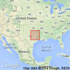
Pg. 342-344. Kemp clay beds of Navarro formation. Yellow clay, containing nodules carrying supposedly Cretaceous fossils. Extends from Trinity River north of Chatfield, [Navarro, Ellis, Henderson Tri-County boundary], to west of Stranger, Falls County, northeastern Texas. Uppermost part of Navarro formation. Overlies Corsicana beds. Cannot be defined with accuracy, nor can Cretaceous age be asserted with positiveness.
Source: US geologic names lexicon (USGS Bull. 896, p. 1080).

- Usage in publication:
-
- Kemp formation
- Modifications:
-
- Principal reference
- Revised
- Dominant lithology:
-
- Clay
- AAPG geologic province:
-
- East Texas basin
- Ouachita folded belt
Summary:
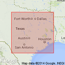
(Credited to W.S. Adkins and L.W. Stephenson.) Pg. 239, 270, 488, 495, 516. Kemp formation here restricted to upper clay member of Hill's Kemp beds, the name Corsicana formation (restricted) being applied to the underlying chalky marl member, which rests on Nacatoch sand. The presumable type locality of Kemp beds of Hill is the faulted inlier near Kemp [Kaufman County, northeastern Texas]. The Kemp formation has been in part correlated by many writers with Arkadelphia clays of Arkansas. [Age is Late Cretaceous (Gulf).]
Source: US geologic names lexicon (USGS Bull. 896, p. 1080).

- Usage in publication:
-
- Kemp clay*
- Modifications:
-
- Overview
- AAPG geologic province:
-
- East Texas basin
- Ouachita folded belt
Summary:
Kemp clay of Navarro group. The Navarro group is now divided by the USGS into (descending) Kemp clay (restricted), Corsicana marl (restricted), Nacatoch sand, and Neylandville marl. Age is Late Cretaceous (Gulf). Recognized in northeastern Texas.
Source: US geologic names lexicon (USGS Bull. 896, p. 1080).
- Usage in publication:
-
- Kemp clay*
- Modifications:
-
- Areal extent
- AAPG geologic province:
-
- East Texas basin
- Ouachita folded belt
Summary:
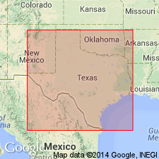
Pg. 27-30. Kemp clay of Navarro group. Youngest formation in group. Unconformably underlies Midway group; overlies Corsicana marl; in Bexar County, merges westward along strike into Escondido formation. Maximum thickness not determined; well records in Limestone County show thickness of about 370 feet, but that figure may be exceeded in places. Locally formation appears to be no more than 160 feet. [Age is Late Cretaceous (Gulf).]
Source: US geologic names lexicon (USGS Bull. 1200, p. 1988).
- Usage in publication:
-
- Kemp clay
- Modifications:
-
- Biostratigraphic dating
- AAPG geologic province:
-
- Ouachita folded belt
Summary:
Fig. 1 (corr. chart), p. 52-53. Kemp clay of Navarro group. Top formation of Navarro group, recognized between San Antonio [Bexar County] and Clarksville [Red River County] Texas. Lies above Corsicana marl and is lateral equivalent of Escondido formation (recognized southwest of San Antonio; all of Navarro group). Foraminifera described. Age is Late Cretaceous (Gulf).
Source: Publication; US geologic names lexicon (USGS Bull. 1200, p. 1988).

- Usage in publication:
-
- Kemp Clay
- Modifications:
-
- Mapped 1:250k
- Dominant lithology:
-
- Clay
- AAPG geologic province:
-
- East Texas basin
- Gulf Coast basin
Summary:
Kemp Clay [of Navarro Group]. Calcareous, locally silty, massive, thinly laminated, conchoidal fracture, medium dark gray; weathers medium gray. Thickness 80 to 200 feet; thins locally. Lies above Neylandville Formation and below Eocene Kincaid Formation of Midway Group. Age is Late Cretaceous.
[Mapped in Milam, Falls, Limestone, and Navarro Cos., eastern TX.]
Source: Publication.
- Usage in publication:
-
- Kemp Clay
- Modifications:
-
- Mapped 1:250k
- Dominant lithology:
-
- Clay
- AAPG geologic province:
-
- East Texas basin
Summary:
Kemp Clay [of Navarro Group]. Clay, dark gray to bluish gray, calcareous, silty, glauconitic, calcareous concretions common; weathers dark greenish gray and black. Upper part only crops out [thickness not stated]. Occurs below Kincaid Formation [of Midway Group]. Age is Late Cretaceous.
[Mapped in Hunt and Rains Cos., eastern TX.]
Source: Publication; supplemental information from GNU records (USGS DDS-6; Denver GNULEX).

- Usage in publication:
-
- Kemp Clay
- Modifications:
-
- Mapped 1:250k
- Dominant lithology:
-
- Clay
- Sandstone
- AAPG geologic province:
-
- East Texas basin
Summary:
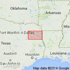
Pamphlet [p. 1]. Kemp Clay of Navarro Group. Mostly clay, medium-dark-gray, weathers to medium-gray, silty, calcareous; concretionary masses and beds of calcareous, well-indurated fine sandstone near top, some interbeds of fine sandstone near base; marine megafossils. Thickness approximately 250 feet. [Overlies Nacatoch Sand of Navarro Group; underlies Quaternary fluviatile terrace deposits.] Age is Late Cretaceous.
[Mapped south of Greenville in extreme southeast corner of map sheet, in Hunt Co., northeastern TX.]
Source: Publication.
For more information, please contact Nancy Stamm, Geologic Names Committee Secretary.
Asterisk (*) indicates published by U.S. Geological Survey authors.
"No current usage" (†) implies that a name has been abandoned or has fallen into disuse. Former usage and, if known, replacement name given in parentheses ( ).
Slash (/) indicates name conflicts with nomenclatural guidelines (CSN, 1933; ACSN, 1961, 1970; NACSN, 1983, 2005, 2021). May be explained within brackets ([ ]).