The National Geologic Map Database is migrating to a new infrastructure. We apologize for any service disruptions during this process.
|
|---|


- Usage in publication:
-
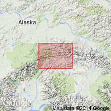
- Keevy Peak Formation*
- Modifications:
-
- Named
- Dominant lithology:
-
- Schist
- Slate
- Quartzite
- Conglomerate
- AAPG geologic province:
-
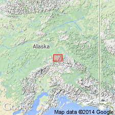
- Alaska Southern region
Summary:
Rocks originally mapped as Totatlanika Schist by Capps (1912) and as Birch Creek Schist by Wahrhaftig (1958) are named Keevy Peak Formation. Type locality designated as exposures on northwest shoulder of Keevy Peak from point on ridge 5700 ft N 40 deg W of summit to north side of saddle about 10,000 ft N 36 deg W, Healy D-3 quad, southern AK. Reference section designated at headwaters of Rogers Creek, Healy D-2 quad. Forms belt of quartz-sericite schist, black carbonaceous schist, gray and green and purple slate, black quartzite, and stretched conglomerate. Is 2500 to 3000 ft thick at type. Unconformably(?) overlies Birch Creek Schist [abandoned in 1973]. Underlies Totatlanika Schist. Is assigned to Precambrian or Paleozoic age.
Source: GNU records (USGS DDS-6; Menlo GNULEX).
- Usage in publication:
-
- Keevy Peak Formation*
- Modifications:
-
- Age modified
- AAPG geologic province:
-
- Alaska Southern region
Summary:
Age is early Paleozoic based on stratigraphic relations [with underlying unit which is early Paleozoic age in upper part].
Source: GNU records (USGS DDS-6; Menlo GNULEX).
For more information, please contact Nancy Stamm, Geologic Names Committee Secretary.
Asterisk (*) indicates published by U.S. Geological Survey authors.
"No current usage" (†) implies that a name has been abandoned or has fallen into disuse. Former usage and, if known, replacement name given in parentheses ( ).
Slash (/) indicates name conflicts with nomenclatural guidelines (CSN, 1933; ACSN, 1961, 1970; NACSN, 1983, 2005, 2021). May be explained within brackets ([ ]).