

- Usage in publication:
-
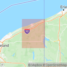
- Keefus Till
- Modifications:
-
- Named
- Dominant lithology:
-
- Till
- AAPG geologic province:
-
- Appalachian basin
Summary:
The Keefus Till is here named in Ashtabula Co., OH, where it crops out in many places and is recorded in drilling. It consists of dusky-red, hard, stony, calcareous till with pebbles and small cobbles. Overlies Devonian Chagrin Shale; underlies Titusville Till or younger tills. Thickness at type section is 3 ft. Age is Pleistocene (earliest Wisconsinan or older).
Source: GNU records (USGS DDS-6; Reston GNULEX).
For more information, please contact Nancy Stamm, Geologic Names Committee Secretary.
Asterisk (*) indicates published by U.S. Geological Survey authors.
"No current usage" (†) implies that a name has been abandoned or has fallen into disuse. Former usage and, if known, replacement name given in parentheses ( ).
Slash (/) indicates name conflicts with nomenclatural guidelines (CSN, 1933; ACSN, 1961, 1970; NACSN, 1983, 2005, 2021). May be explained within brackets ([ ]).