The National Geologic Map Database is migrating to a new infrastructure. We apologize for any service disruptions during this process.
|
|---|


- Usage in publication:
-
- Kasiska Quartzite Member*
- Modifications:
-
- Named
- Dominant lithology:
-
- Quartzite
- Argillite
- Siltstone
- AAPG geologic province:
-
- Northern Rocky Mountain region
Summary:
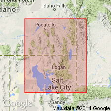
Named the lowest member of Brigham Quartzite for Kasiska Ranch, along Dempsey Creek. Is well exposed along west flank of Portneuf Range several miles east of the ranch. Type area is a belt of steep slopes and cliffs on west side crest of Portneuf Range from NW1/4 NW1/4 sec 12, T10S, R38E to NE1/4 NW14 sec 4, T11S, R39E, Bannock Co, ID in Northern Rocky Mountain region. Type section (partially exposed) is in western part sec 12, T10S, R38E. Consists of light-gray, light-tan, purple, and red quartzite in lower part. Color changes to white, pink, buff, and gray near middle, to gray, tan, and almost white at top. Ranges from very fine to granule. Is poorly sorted, with coarse grains to granules at most localities. Beds are very thin to massive; a few are cross-bedded. Cross strata dip northward. Tan, brown and green argillite and phyllitic argillite interbedded and interlaminated with quartzitic siltstone, very fine grained quartzite, and green to brown muddy sandstone make up 5-10 percent of member. Is 1,280+ ft at type (incomplete); 1,600+ ft to south. Base not exposed; upper contact placed at top of thick quartzite and base of argillaceous Windy Pass Argillite Member of Brigham. Is unfossiliferous. Lies several hundred ft below beds with Cambrian fossils. Assigned a Precambrian age. Geologic map.
Source: GNU records (USGS DDS-6; Denver GNULEX).
For more information, please contact Nancy Stamm, Geologic Names Committee Secretary.
Asterisk (*) indicates published by U.S. Geological Survey authors.
"No current usage" (†) implies that a name has been abandoned or has fallen into disuse. Former usage and, if known, replacement name given in parentheses ( ).
Slash (/) indicates name conflicts with nomenclatural guidelines (CSN, 1933; ACSN, 1961, 1970; NACSN, 1983, 2005, 2021). May be explained within brackets ([ ]).