

- Usage in publication:
-
- Kara bentonitic member*
- Modifications:
-
- Named
- Dominant lithology:
-
- Shale
- AAPG geologic province:
-
- Powder River basin
Summary:
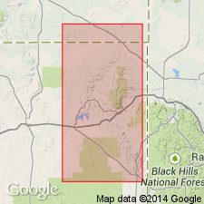
Named as a member of Pierre shale. Gray shale and gray bentonitic shale about 100 ft thick that crops out along the west flank of the Black Hills from the vicinity of Oshoto in T54N, R67W, southward to T44N, R62W, a distance of about 75 mi. Named from exposures in NW1/4 sec 2, T48N, R67W, Weston Co, WY in Powder River basin about 1 1/2 mi south of Kara, a siding on the Chicago, Burlington, and Quincy RR, about 6 mi southeast of Moorcroft, WY. At this locality, top of member is about 300 ft stratigraphically below base of Fox Hills sandstone, and base of member is estimated to be about 2,100 ft above base of Pierre shale and about 1,000 ft above Mitten black shale member of Pierre. Is 93 ft thick at type, overlain and underlain conformably by dark-gray shale of Pierre shale. Is Late Cretaceous (Campanian) in age.
Source: GNU records (USGS DDS-6; Denver GNULEX).
- Usage in publication:
-
- Kara Bentonitic Member*
- Modifications:
-
- Overview
- AAPG geologic province:
-
- Powder River basin
Summary:
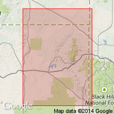
Shows outcrop, gives sections, and lists fossils collected from the member in Crook and Weston Cos., WY in Powder River basin. Is Late Cretaceous (Campanian) in age.
Source: GNU records (USGS DDS-6; Denver GNULEX).
- Usage in publication:
-
- Kara Bentonitic Member*
- Modifications:
-
- Overview
- AAPG geologic province:
-
- Powder River basin
Summary:
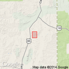
A member of Pierre Shale. Bentonite, gray bentonitic shale, and gray silty and sandy shale 36 ft thick and 1,436 ft below Fox Hills Sandstone in the Red Bird reference section for the Pierre, sec 12, T38N, R62W, north end of the Old Woman anticline, Niobrara Co, WY in the Powder River basin. Is Late Cretaceous (Campanian) in age.
Source: GNU records (USGS DDS-6; Denver GNULEX).

- Usage in publication:
-
- Kara Bentonitic Member*
- Modifications:
-
- Overview
- AAPG geologic province:
-
- Powder River basin
Summary:
Is one of the upper members of the Pierre Shale at Red Bird, Niobrara Co, WY in the Powder River basin. Of late Campanian, Late Cretaceous age. Overlies lower unnamed shale member of Pierre. Underlies upper unnamed shale member of Pierre. Correlates with upper part of Almond Formation of Rock Springs uplift, and with lower part of Lewis Shale elsewhere in Powder River basin, southeast Wind River basin, Laramie Basin, and Hanna Basin. Correlation chart; aligned with BACULITES ELIASI ammonite zone on chart.
Source: GNU records (USGS DDS-6; Denver GNULEX).
- Usage in publication:
-
- Kara Bentonitic Shale Bed
- Modifications:
-
- Revised
- AAPG geologic province:
-
- Powder River basin
Summary:
Rank and affiliation changed--formerly Kara Bentonitic Member of Pierre Shale. Assigned in this report as Kara Bentonitic Shale Bed of Teckla Sand Member (new) of Lewis Shale. Is bentonitic gray shale 42 ft thick in the type well of the Teckla Sand Member of Lewis Shale in SW1/4 sec 10, T41N, R70W, Campbell Co, WY in Powder River basin. Overlain and underlain by unnamed sandstone beds of Teckla Sand Member. Map shows approximate extent in southeastern Powder River basin, WY. Is Late Cretaceous (Campanian) in age.
Source: GNU records (USGS DDS-6; Denver GNULEX).
For more information, please contact Nancy Stamm, Geologic Names Committee Secretary.
Asterisk (*) indicates published by U.S. Geological Survey authors.
"No current usage" (†) implies that a name has been abandoned or has fallen into disuse. Former usage and, if known, replacement name given in parentheses ( ).
Slash (/) indicates name conflicts with nomenclatural guidelines (CSN, 1933; ACSN, 1961, 1970; NACSN, 1983, 2005, 2021). May be explained within brackets ([ ]).