The National Geologic Map Database is migrating to a new infrastructure. We apologize for any service disruptions during this process.
|
|---|


- Usage in publication:
-
- Judd Hollow tongue*
- Modifications:
-
- Original reference
- Dominant lithology:
-
- Sandstone
- Siltstone
- Claystone
- AAPG geologic province:
-
- Plateau sedimentary province
Summary:
Pg. 33, 63, 66-67, 69, pl. 2. Judd Hollow Tongue of Carmel Formation of San Rafael Group. Name applied to horizontally bedded sandstone in lower part of Carmel. Cross-bedded sandstone correlative with upper part of Navajo sandstone is herein named Thousand Pockets tongue. Consists of dark- to red-brown fine- to medium-grained limy sandstone and siltstone in horizontal beds 2 to 6 feet thick. Thickness 32 feet at type section; 20 feet on Cedar Mountain; 168 feet at Lick Wash close to its junction with main mass of Carmel. Conformably underlies Thousand Pockets tongue. Age is Middle and Late Jurassic. Recognized in southeastern Utah and northeastern Arizona.
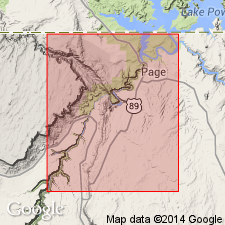
Type section [see corrected type (Peterson and Pipiringos, 1979)]: north side of Judd Hollow, in NW/4 sec. 31, T. 43 S., R. 2 E., [approx. Lat. 37 deg. 01 min. 53 sec. N., Long. 111 deg. 44 min. 14 sec. W.], Kane Co., southern UT. [Lat./Long. coords. from USGS GNIS database and ACME Mapper 2.0, accessed October 2, 2011.]
Source: US geologic names lexicon (USGS Bull. 1350, p. 377).
- Usage in publication:
-
- Judd Hollow Tongue*
- Modifications:
-
- Areal extent
- AAPG geologic province:
-
- Plateau sedimentary province
- South Western Overthrust
Summary:
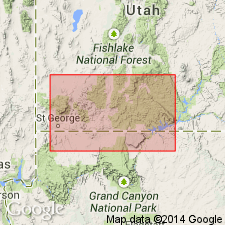
Pg. E64 (fig. 1), E66. Judd Hollow Tongue of Carmel Formation. [Recognized in Kane County, southern Utah.] Limestone of lower part of Carmel Formation passes southeastward beneath Thousand Pockets Tongue of Navajo to form Judd Hollow Tongue of Carmel (Phoenix, 1963). Thickness 100 to 200 feet on west side of Paria Valley; 50 to 100 feet on east side of valley. Pinches out near head of Judd Hollow on Paria Plateau. From west to east the limestone thins, grades from relatively pure carbonate to argillaceous limestone, and from gray to reddish gray. Interbedded red siltstone and sandstone increase eastward. Uppermost bed of limestone, which is ripple marked and oolitic near East Kaibab monocline, grades to ripple-marked limey siltstone that may be traced a little east of Judd Hollow. Fossils have been found in the tongue at the northwest end of the Paria Valley. Age is early Middle Jurassic (Bajocian).
Source: Publication; US geologic names lexicon (USGS Bull. 1350, p. 377).
- Usage in publication:
-
- Judd Hollow Tongue*
- Modifications:
-
- Areal extent
- AAPG geologic province:
-
- Paradox basin
- Plateau sedimentary province
Summary:
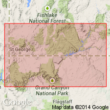
Pg. B2 (fig. 1), B11-B13, B35, B37. Judd Hollow Tongue of Carmel Formation of San Rafael Group. Type section corrected (p. B37, sec. 26, Judd Hollow) to center of W/2 sec. 36, T. 43 S., R. 1 E., [on north side of Judd Hollow, approx. Lat. 37 deg. 01 min. 38 sec. N., Long. 111 deg. 45 min. 20 sec. W.]., south side of Kaiparowits Plateau, central southern Kane County, southern Utah. Consists mainly of sandstone and siltstone; thickness about 9.9 m. Includes one thin bed of silty limestone, 0.3 m thick (=Phoenix, 1963, p. 69, sec. 3, unit 3). Considered eastern equivalent of the [unnamed] limestone member of Carmel, exposed in western Kane County. Conformably overlies Harris Wash Tongue of Page Sandstone; underlies Thousand Pockets Tongue of Page Sandstone. Several km southeast of type, grades into the cross-bedded sandstones of the Page. In a few places, base is marked by scattered or locally concentrated coarse grain- to pebble-size chert that were probably derived from underlying rocks (=J-2 unconformity of Pipiringos and O'Sullivan, 1978). Age is considered Middle Jurassic (late-middle and late Bajocian) based on stratigraphic relations.
On p. B37, authors note "According to Phoenix (1963, p. 67), the type section of the Judd Hollow Tongue and Thousand Pockets Tongue is about 1 km northeast of this locality. However, judging from the distribution of outcrops in the area, and a photo of the locality in the original report (Phoenix, 1963, p. 32, fig. 12), the type sections probably were measured here. Remeasured by Fred Peterson in 1970."
[Lat./Long. coords. from USGS GNIS database and ACME Mapper 2.0, accessed October 2, 2011.]
Source: Publication.
- Usage in publication:
-
- Judd Hollow Member
- Modifications:
-
- Areal extent
- AAPG geologic province:
-
- South Western Overthrust
- Plateau sedimentary province
Summary:
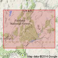
Is the basal member (of 4) of Middle Jurassic Carmel Formation. Unconformably overlies Navajo Sandstone. Eastward tongues into and overlies Harris Wash Tongue of Page Sandstone. Underlies Crystal Creek Member of Carmel. Facies map. Correlation chart. Cross sections. Is present in the western sections of southwest UT from Gunlock, Washington Co., Great Basin province east to Page, Coconino Co., AZ, Plateau sedimentary province. Has 7 facies. The first, a gypsiferous mudstone facies, dominant in lower part of member west of Hurricane Cliffs, and in part or all of member east of longitude 112 deg., consists of red-brown to yellow-gray mudstone, gypsiferous mudstone, nodular gypsum, sandy mudstone, intraformational conglomerate, and associated pelletal micrite, algal laminated dolomicrite, and quartz arenite; formed in supratidal conditions. The second, the algal-laminated dolomicrite facies, has a distribution similar to the first; is a dolomicrite and 20 - 30 % dolomite microspar; rare components include quartz silt, ostracode, pelecypod, and gastropod grains; deposited along a low energy carbonate platform. Third, a pelmicrite facies, a nearshore marine deposit on a protected shelf, consists of pelletal packstone and grainstone, and subordinate pelletal wackestone. Fourth, oosparite, a oolitic grainstone and subordinate packstone and grainstone, formed as offshore bars and tidal channel mouth bars along a shelf margin. Fifth, biomicrite facies includes pelecypod lime mudstone and pelecypod wackestone deposited below wave base. Sixth, a terrigenous mudstone facies is dominantly calcareous, sandy mudstone and claystone, nonresistant, slope-forming, structureless to finely laminated. Seventh, the basal sandstone facies is medium- to coarse-grained, moderately to well sorted; has subround to round grains; is a thin blanket sandstone; thins both east and west of the Paunsaugunt fault; derived from underlying rocks; represents initial transgression of Carmel sea.
Source: GNU records (USGS DDS-6; Denver GNULEX).
- Usage in publication:
-
- Judd Hollow Member*
- Modifications:
-
- Geochronologic dating
- AAPG geologic province:
-
- South Western Overthrust
Summary:
Upper and lower parts separately mapped in southwest UT, Great Basin province. Judd Hollow is lower member of Carmel Formation in study area. K-Ar age of 165 Ma (H. Mehnert, written commun., 1983) obtained from biotite from green tuff bed near top of upper part of Judd Hollow from a locality in SW SW sec 19, T40S, R17W, Washington Co. Overlies Temple Cap Formation; underlies Crystal Creek Member of Carmel. Middle Jurassic (Bajocian) age based on correlation with Sliderock and Rich Members of Twin Creek Limestone of northern UT.
Source: GNU records (USGS DDS-6; Denver GNULEX).
For more information, please contact Nancy Stamm, Geologic Names Committee Secretary.
Asterisk (*) indicates published by U.S. Geological Survey authors.
"No current usage" (†) implies that a name has been abandoned or has fallen into disuse. Former usage and, if known, replacement name given in parentheses ( ).
Slash (/) indicates name conflicts with nomenclatural guidelines (CSN, 1933; ACSN, 1961, 1970; NACSN, 1983, 2005, 2021). May be explained within brackets ([ ]).