The National Geologic Map Database is migrating to a new infrastructure. We apologize for any service disruptions during this process.
|
|---|


- Usage in publication:
-
- Johnson Mill graphite slate formation
- Modifications:
-
- Named
- Dominant lithology:
-
- Slate
- AAPG geologic province:
-
- Piedmont-Blue Ridge province
Summary:
Named for Johnson Mill, Albemarle Co., central VA. The name Johnson Mill formation has been used in lectures on structural geology at the University of Virginia since 1945. Consists of graphite slate containing numerous blebs and stringers of pyrite. Thickness is 250 to 400 ft. Overlies Lynchburg formation; underlies Charlottesville formation (new). Age is Precambrian.
Source: GNU records (USGS DDS-6; Reston GNULEX).
- Usage in publication:
-
- Johnson Mill formation
- Modifications:
-
- Overview
- AAPG geologic province:
-
- Piedmont-Blue Ridge province
Summary:
Johnson Mill formation included with rocks mapped as Lynchburg formation in Albemarle Co.
Source: GNU records (USGS DDS-6; Reston GNULEX).

- Usage in publication:
-
- Johnson Mill Member
- Modifications:
-
- Revised
- Overview
- Dominant lithology:
-
- Schist
- AAPG geologic province:
-
- Piedmont-Blue Ridge province
Summary:
Johnson Mill reduced in rank to member at top of Ball Mountain Formation in Lynchburg Group. Locally occupies upper 10 m of Ball Mountain Formation. Consists of graphitic schist. Age is Late Proterozoic.
Source: GNU records (USGS DDS-6; Reston GNULEX).
- Usage in publication:
-
- Johnson Mill Formation
- Modifications:
-
- Revised
- AAPG geologic province:
-
- Piedmont-Blue Ridge province
Summary:
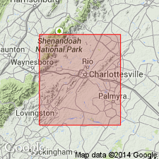
Lynchburg Group, on the southeastern limb of the Blue Ridge anticlinorium, is subdivided in this report into (ascending) Fauquier Formation, unnamed metagraywacke turbidite deposits (which combines Rockfish conglomerate formation and Lynchburg gneiss formation of Nelson, 1962), Johnson Mill Formation, and the Charlottesville Formation. Lynchburg rocks also occur in several outliers, the largest and most westerly of which is the belt containing the Mechums River Formation, which has been previously correlated with the Lynchburg. The Johnson Mill has been traced as a narrow band from the east-central boundary of the study area to Charlottesville where it ends abruptly. Unit reappears to the southwest in the Roanoke quad. [Field trip is based on reconnaissance geologic mapping in the Charlottesville 1 deg X 2 deg quad. as part of a new edition of the Geologic Map of VA to be completed by 1993.]
Source: GNU records (USGS DDS-6; Reston GNULEX).

- Usage in publication:
-
- Johnson Mill
- Modifications:
-
- Not used
- AAPG geologic province:
-
- Piedmont-Blue Ridge province
Summary:
Rocks of the Johnson Mill graphite slate formation of Nelson (1962) are mapped with unnamed graphitic phyllite and metasiltstone as part of the Lynchburg Group.
Source: GNU records (USGS DDS-6; Reston GNULEX).
- Usage in publication:
-
- Johnson Mill Member*
- Modifications:
-
- Overview
- AAPG geologic province:
-
- Piedmont-Blue Ridge province
Summary:
Ball Mountain Formation of Lynchburg Group (revised) includes Johnson Mill Member at its top south of Charlottesville, VA, according to table 9 of this report.
Source: GNU records (USGS DDS-6; Reston GNULEX).
For more information, please contact Nancy Stamm, Geologic Names Committee Secretary.
Asterisk (*) indicates published by U.S. Geological Survey authors.
"No current usage" (†) implies that a name has been abandoned or has fallen into disuse. Former usage and, if known, replacement name given in parentheses ( ).
Slash (/) indicates name conflicts with nomenclatural guidelines (CSN, 1933; ACSN, 1961, 1970; NACSN, 1983, 2005, 2021). May be explained within brackets ([ ]).