

- Usage in publication:
-
- Johns Valley shale
- Modifications:
-
- Original reference
- Dominant lithology:
-
- Shale
- AAPG geologic province:
-
- Ouachita folded belt
Summary:
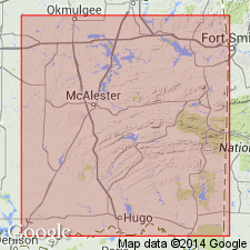
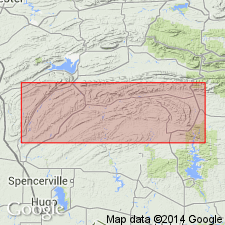
Pg. 6, 21-23, 30, 36-37. Johns Valley shale proposed for the boulder-bearing black Pennsylvanian shale of Ouachita Mountains, which is typically exposed in center of Tuskahoma syncline, particularly in N/2 T. 1 S., R. 16 E., where it rests on Jackfork sandstone and is overlain by sandy shales and sandstones referred to Atoka formation. Its lower part contains abundance of large and smaller, often fossiliferous, erratics of limestone and other sedimentary rocks that were originally parts of older formations, found in place beyond northern and western limits of Ouachita area. It is, so fas as known, confined to Ouachita area, and is not known to contain a fauna or flora of its own, but the boulders in this shale contain fossils from Canadian, Ordovician, Silurian, Devonian, Mississippian (Caney shale) and early Pennsylvanian formations of Arbuckle Mountains and I regard them as transported from that area, while Miser believes that the Mississippian Caney fauna that occurs in my Johns Valley shale lived, died, and was buried where it is now found. The Johns Valley shale also contains erratics of Wapanucka limestone of Arbuckle Mountains, which is of Pennsylvanian age, and it is therefore been included in Caney shale, but Caney is here restricted to the non-boulder-bearing black shale which contains a Mississippian (middle Meramec) fauna and is confined to north and west of Ouachita area.
Typically exposed in center of Tuskahoma syncline, particularly in N/2 T. 1 S., R. 16 E. Named from settlement (on Cane Creek, in northwest part of Pushmataha Co., about 6 mi north of Eubanks) which is now called Johns Valley, but which, at time Taff named the Caney shale, was locally known as Caney, and which Taff in 1925 stated was type locality of his Caney shale.
Source: US geologic names lexicon (USGS Bull. 896, p. 1050-1051).

- Usage in publication:
-
- Johns Valley shale*
- Modifications:
-
- Overview
- AAPG geologic province:
-
- Ouachita folded belt
Summary:
The introduction of this name into the literature, for the Pennsylvanian part of Caney shale of previous reports, and restriction of Caney to the Mississippian part of that formation, aroused considerable discussion among geologists, and resulted in several field trips to ascertain validity of the unit and its relations to neighboring formations. In 1934 the following sequence of formations was adopted by [the] USGS for the Pennsylvanian rocks of the area south and east of Ti Valley-Choctaw belt of Ouachita Mountains of Oklahoma and Arkansas (descending order): Atoka formation, 6,000 feet; Johns Valley shale (boulder-bearing black shale), 0 to 1,000 feet; Jackfork sandstone, 5,000 to 6,600 feet; Stanley shale, 6,000 to 10,000 feet; and (in western Arkansas only) Hot Springs sandstone, 0 to 200 feet; and Caney shale was restricted to Mississippian part of the strata formerly included under that name. (See H.D. Miser, 1934, AAPG Bull., v. 18, no. 8.) [available online, with subscription, from AAPG archives: http://www.aapg.org/datasystems or http://search.datapages.com]. According to Miser, Johns Valley is 10 mi north of Kosoma, Oklahoma.
Source: US geologic names lexicon (USGS Bull. 896, p. 1051).
- Usage in publication:
-
- Johns Valley shale†
- Modifications:
-
- Abandoned
Summary:
Gray and black bouldery shales exposed in Johns Valley in T1S, R16E, Pushmataha Co, OK were once thought to represent one formation and name Johns Valley was applied to them. It is now recognized that there are found exposures of three kinds and ages of shales in this area. Johns Valley can no longer be recognized as a type locality of any one formation; "therefore, Johns Valley shale has been abandoned as a valid formation name." Can be correlated definitely with Round Prairie formation (new), Wesley siliceous shale (new), and Markham Mill siliceous shale (new).
Source: GNU records (USGS DDS-6; Denver GNULEX).
- Usage in publication:
-
- Johns Valley shale
- Modifications:
-
- Overview
- AAPG geologic province:
-
- Ouachita folded belt
Summary:
Pg. 47-49. Johns Valley shale of Pennsylvanian age (some say Bendian) lies conformably between Jackfork sandstone below and Atoka formation above in normal sequence at all localities where it was observed in western Ouachita Mountains. Measured sections indicate minimum of 300 feet and maximum thickness of 900 feet. Characterized by presence of erratic and exotic boulders ranging from Cambrian to Mississippian in age.
Source: US geologic names lexicon (USGS Bull. 1200, p. 1934).
- Usage in publication:
-
- Johns Valley shale
- Modifications:
-
- Mapped 1:500k
- AAPG geologic province:
-
- Ouachita folded belt
Summary:
Mapped as Pennsylvanian.
Source: US geologic names lexicon (USGS Bull. 1200, p. 1934).
- Usage in publication:
-
- Johns Valley shale
- Modifications:
-
- Overview
- AAPG geologic province:
-
- Ouachita folded belt
Summary:
Pg. 103-106. Upper part of Johns Valley shale is partial equivalent of Mississippian Caney formation of Arbuckle province. Type locality of the Johns Valley is in bowl-shaped Johns Valley in trough of Tuskahoma syncline. Also type locality of Caney shale is along Caney Creek (originally Cane Creek) which is also in Johns Valley topographic basin. Many Mississippian fossils illustrated by Girty, 1909 (USGS Bull. 377) were collected in Johns Valley. With recognition of exotic boulders of Arbuckle and (or) Ozark facies that are embedded in the shale, Ulrich (1927) proposed name Johns Valley for the boulder-bearing shale. He acknowledged the Mississippian age of rocks containing Caney fauna, but held that they were erratics which had been transported to Johns Valley in early Pennsylvanian time. The pre-Mississippian boulders and blocks in Johns Valley are foreign to Ouachita province, but it is now believed that the so-called "Caney boulders" are sideritic concretions indeigenous to Caney, that the Caney "blocks" are substantially where the shale was deposited, and that the type Caney is in reality the lower part of the type Johns Valley as defined by Ulrich.
Source: US geologic names lexicon (USGS Bull. 1200, p. 1934).
- Usage in publication:
-
- Johns Valley shale
- Modifications:
-
- Overview
- AAPG geologic province:
-
- Ouachita folded belt
Summary:
Pg. 193-204. Formation discussed in detail. Harlton's (1938) name Round Prairie not accepted by later workers. Overlies Game Refuge sandstone; underlies Atoka formation. Thjickness 425 to 900 feet. [Age is] Mississippian to Pennsylvanian.
Source: US geologic names lexicon (USGS Bull. 1200, p. 1934).
- Usage in publication:
-
- Johns Valley shale
- Modifications:
-
- Overview
- AAPG geologic province:
-
- Ouachita folded belt
Summary:
Pg. 1829-1832. Discussion of age of Johns Valley shale, Jackfork sandstone, and Stanley shale. Geologic evidence establishes presence of both Pennsylvanian and Mississippian beds in Johns Valley shale.
Source: US geologic names lexicon (USGS Bull. 1200, p. 1934).
- Usage in publication:
-
- Johns Valley shale
- Modifications:
-
- Contact revised
- AAPG geologic province:
-
- Ouachita folded belt
- Arkoma basin
Summary:
Lower contact revised in western AR, Ouachita tectonic belt province and Arkoma basin, in that Johns Valley shale [sic] is underlain by the newly named Brushy Knob Formation of Jackfork Group. Lower contact is conformable. Correlation chart.
Source: GNU records (USGS DDS-6; Denver GNULEX).
For more information, please contact Nancy Stamm, Geologic Names Committee Secretary.
Asterisk (*) indicates published by U.S. Geological Survey authors.
"No current usage" (†) implies that a name has been abandoned or has fallen into disuse. Former usage and, if known, replacement name given in parentheses ( ).
Slash (/) indicates name conflicts with nomenclatural guidelines (CSN, 1933; ACSN, 1961, 1970; NACSN, 1983, 2005, 2021). May be explained within brackets ([ ]).