

- Usage in publication:
-
- Joachim limestone
- Modifications:
-
- Original reference
- Dominant lithology:
-
- Limestone
- AAPG geologic province:
-
- Ozark uplift
Summary:
Pg. 331, 352. Joachim limestone. Dark earthy magnesian shaly brecciated limestone, 100 feet thick; upper layers hard and dense, no chert. Overlies Crystal City [St. Peter] sandstone and underlies Trenton limestone in southeastern Missouri. [Age is Early Ordovician (Chazy).]
[Named from exposures along Joachim Creek, Jefferson Co., eastern MO.]
Source: US geologic names lexicon (USGS Bull. 896, p. 1046-1047).

- Usage in publication:
-
- Joachim Dolomite
- Modifications:
-
- Overview
- AAPG geologic province:
-
- Illinois basin
Summary:
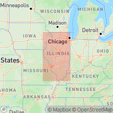
Pg. 53 (fig. O-4), 58, (fig. O-12), 61 (fig. O-15), 65-67. Joachim Dolomite of Ancell Group. Best exposed on flanks of Ozark Dome in Missouri and is subdivided into 6 members (descending, Metz, Matson, Defiance, Boles, Augusta, and Abernathy) based on exposures in that area. Only the Metz, Matson, and top of Defiance are exposed in Illinois, in Calhoun County, where the Mississippi River cuts through the Lincoln anticline. Occurs in subsurface south of line extending from near Quincy to Kankakee. North of there it has gradational contact with Starved Rock Member of St. Peter Sandstone. Thickness up to 385 feet in southernmost Illinois; thins northward by progressive termination of basal strata. Consists mostly of light-gray, argillaceous, silty or sandy dolomite, but also contains beds of brownish-gray, relatively pure dolomite, beds of sandstone and limestone, some thin shale beds, and numerous algal domes of pure dolomite. In outcrop area, chert occurs near middle of formation, but is more common in subsurface. Is uppermost formation of Ancell Group. Contains more clastic material than overlying Platteville Group strata and is lighter colored than underlying Dutchtown Limestone of Ancell Group. Age is Middle Ordovician (Champlainian; Blackriveran).
Source: Publication.
- Usage in publication:
-
- Joachim Dolomite
- Modifications:
-
- Areal extent
- AAPG geologic province:
-
- Illinois basin
- Ozark uplift
Summary:
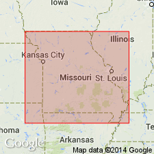
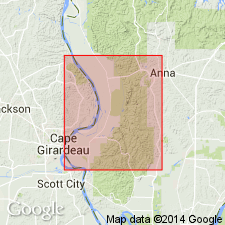
Ordovician (Champlainian) Joachim Dolomite combined with underlying Dutchtown of geologic map. Outcrops south-southeast through Perry and Cape Girardeau Cos., MO. Consists mainly of dolomite, but contains lesser amount of limestone and minor interbeds of shale and sandstone. Dolomite is light to medium gray and brown, very fine to fine grained, and partly sandy. Bedding varies from thin to thick. Limestone, found mainly in upper part of Joachim, is micritic to "finely crystalline" and medium to thick bedded. Contains mudcracks with downturned edges, raindrop impressions, rill marks, ripple marks, and disseminated gypsum and anhydrite., Chert is sparse in upper part and absent in lower part. Yellowish-brown, fine-grained sandstone occurs in beds as thick as 6 ft mainly in lower part toward the south. Thin interbeds of gray dolomitic shale are scattered throughout. On outcrop, Joachim thickens southeastward from about 130 ft to 275 ft. Southeastward thickening of combined Joachim and Dutchtown is also evident in IL subsurface, reaching combined thickness of more than 600 ft at southeastern corner of IL. Nature of lower contact is controversial; Thompson (1991) states it is conformable, Martin and others (1961) and most quadrangle mappers report it to be disconformable, and Templeton and Willman (1963) say it is gradational and intertonguing in most places except near Cape Girardeau, where evidence of a minor diastem is present.
Source: GNU records (USGS DDS-6; Reston GNULEX).
- Usage in publication:
-
- Joachim Dolomite
- Modifications:
-
- Areal extent
- AAPG geologic province:
-
- Illinois basin
- Ozark uplift
Summary:
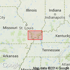
Ordovician (Mohawkian) Joachim Dolomite consists of light- to medium-gray and brown, very fine- to fine-grained, sandy dolomite containing little chert. Lesser amounts of limestone occur in upper part of formation. Thin interbeds of gray dolomitic shale are present throughout. Sandstone interbeds common in lower part. Joachim in both Humble Oil Co. No. 1 Pickel well, NW1/4SE1/4NW1/4 sec. 21, T13S, R2W, Mill Creek 7.5-min quad, IL, and Ohio Oil Co. No. 1 Cross well, NW1/4NW1/4NE1/4 sec. 21, T13S, R2W, Jonesboro 7.5-min quad, IL, is about 230 ft thick and lithologically similar to Joachim in outcrops in MO. Joachim reported to be 190 ft thick in MO part of Cape Girardeau 7.5-min quad by Satterfield (1975).
Source: GNU records (USGS DDS-6; Reston GNULEX).

- Usage in publication:
-
- Joachim Dolomite*
- Modifications:
-
- Mapped
- AAPG geologic province:
-
- Illinois basin
- Ozark uplift
Summary:
Joachim Dolomite. In St. Louis area, Missouri and Illinois, consists of 5 members (not separately mapped; basal Abernathy Member is absent), descending: (1) Metz Member, yellow-brown, laminated, shaly dolomite; (2) Matson Member, dense, dark-brown, fetid, algal dolomite; (3) Defiance Member, silty, shaly dolomite; (4) Boles Member, silty, shaly dolomite with layers of black and white chert; and (5) Augusta Member, alternating layers of shale, siltstone, and dolomitic sandstone. Total thickness 60 to 160 feet. Age is Middle Ordovician (Mohawkian).
Source: Publication.

- Usage in publication:
-
- Joachim Dolomite*
- Modifications:
-
- Areal extent
- AAPG geologic province:
-
- Ozark uplift
- Illinois basin
Summary:
Ordovician (Mohawkian) Joachim Dolomite thins northwestward along its outcrop in MO. Difficult to differentiate from Dutchtown Formation in subsurface. Extends into subsurface of IL.
Source: GNU records (USGS DDS-6; Reston GNULEX).

- Usage in publication:
-
- Joachim Dolomite*
- Modifications:
-
- Areal extent
- AAPG geologic province:
-
- Upper Mississippi embayment
Summary:
Middle Ordovician (Mohawkian) Joachim Dolomite is mapped undivided in subsurface of Upper Mississippi embayment of MO and Illinois basin of IL with Dutchtown Formation.
Source: GNU records (USGS DDS-6; Reston GNULEX).
- Usage in publication:
-
- Joachim Dolomite
- Modifications:
-
- Overview
- AAPG geologic province:
-
- Illinois basin
Kolata, D.R., 2005, Bedrock geology of Illinois: Illinois Geological Survey, no. 14.
Summary:
See also Kolata and Nimz, eds., 2010, Geol. Illinois, p. 149; T.H. Shaw, 1999, PhD dissert., City Univ. New York, 929 p. Joachim Dolomite of Ancell Group. Silty, sandy, and argillaceous dolomite with interbedded limestone, sandstone, and shale as well as anhydrite and gypsum. Thickness 0 to 450 feet in southern Illinois; 0 to 50 feet in northern Illinois. Overlies Dutchtown Limestone in southern Illinois and St. Peter Sandstone in central Illinois (both of Ancell Group); underlies Pecatonica Formation of Platteville Group. Except for several outcrops in Calhoun County, the Joachim is confined to subsurface of Illinois. Fossils (conodonts). Is time-transgressive from south (oldest) to north (youngest), ranging from late Whiterockian to early Turinian.
Source: Publication.
- Usage in publication:
-
- Joachim Dolomite*
- Modifications:
-
- Biostratigraphic dating
- AAPG geologic province:
-
- Ozark uplift
Ethington, R.L., Repetski, J.E., and Derby, J.R., 2012, Ordovician of the Sauk megasequence in the Ozark region of northern Arkansas and parts of Missouri and adjacent states; Chapter 11: American Association of Petroleum Geologists Memoir, 98, p. 275-300.
Summary:
Pg. 277 (fig. 1, compiled by R.L. Ethington, J.E. Repetski, and J.F. Taylor, with advice from J.D. Loch, J.F. Miller, and [J.R.] Derby); see also Morgan, Chap. 4, same vol., fig. 4.
Joachim Dolomite. [Age is Late Ordovician (Sandbian; late Whiterockian to Mohawkian; late Chazyan to Turinian); upper part of CAHABAGNATHUS SWEETI to upper part of BELODINA COMPRESSA conodont zone (upper part of PYGODUS ANSERINUS to AMORPHOGNATHUS TVAERENSIS conodont zone).]
Source: Publication.
For more information, please contact Nancy Stamm, Geologic Names Committee Secretary.
Asterisk (*) indicates published by U.S. Geological Survey authors.
"No current usage" (†) implies that a name has been abandoned or has fallen into disuse. Former usage and, if known, replacement name given in parentheses ( ).
Slash (/) indicates name conflicts with nomenclatural guidelines (CSN, 1933; ACSN, 1961, 1970; NACSN, 1983, 2005, 2021). May be explained within brackets ([ ]).