The National Geologic Map Database is migrating to a new infrastructure. We apologize for any service disruptions during this process.
|
|---|


- Usage in publication:
-
- Javelina Formation
- Modifications:
-
- First used
- Dominant lithology:
-
- Clay
- Sandstone
- AAPG geologic province:
-
- Permian basin
Summary:
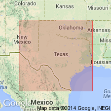
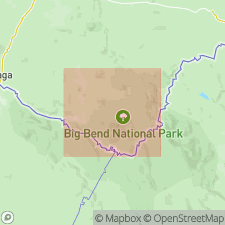
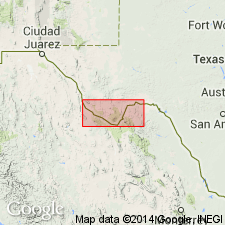
Pg. 12-33, road logs, pI. 1. Javelina Formation of Tornillo Group (revised). Present in Big Bend National Park area, Brewster County, southwestern Texas. Includes the oldest unit of Udden's (1907) Tornillo Clay. Predominantly clay unit containing some lenticular masses of yellowish-gray, yellowish-brown, and dark-brown cross-bedded sandstone. Clay is commonly bentonitic. Contains fossil wood and dinosaur bones. Thickness 350 to 850 feet. Has most characteristics of a continental deposit. May be a nonmarine equivalent to part of Navarro Group in southwest, central, and northeast Texas; comparable to Escondido Formation in Rio Grande Embayment. Overlies Aguja Formation and unconformably underlies Black Peaks Formation (new) (both of Tornillo). Locally underlies Canoe Formation (new), Burro Mesa Riebeckite Rhyolite, or Alamo Creek Basalt. Age is Late Cretaceous (Gulfian); ALAMOSAURUS sp. bones support a Maastrichtian age.
Source: US geologic names lexicon (USGS Bull. 1350, p. 368); supplemental information from GNU records (USGS DDS-6; Denver GNULEX).
- Usage in publication:
-
- Javelina Formation
- Modifications:
-
- Named
- Dominant lithology:
-
- Clay
- Sandstone
- AAPG geologic province:
-
- Permian basin
Summary:
Pg. 88-96, pIs. Javelina Formation of Tornillo Group. Formal proposal of name. Proposed for the Cretaceous part of original Tornillo Clay (herein redefined and rank raised to group). Nominally a clay unit containing some lenticular masses of yellowish-gray, yellowish-brown, and dark-brown cross-bedded sandstone. Clay mostly bentonitic and is varicolored in shades of maroon, dull gray, olive green, and dirty brown. Thickness 534 feet at type section. Gradationally overlies Aguja Formation. Unconformable below Alamo Creek Basalt. Age is Late Cretaceous.
Type section: exposed between the Park [Big Bend National Park] road and Tule Mountain, Brewster Co., southwestern TX. Named from Javelina Creek in northeastern part of Tornillo Flat, Big Bend National Park, Brewster Co., southwestern TX.
Source: US geologic names lexicon (USGS Bull. 1350, p. 368).
- Usage in publication:
-
- Javelina Formation
- Modifications:
-
- Mapped 1:250k
- Dominant lithology:
-
- Clay
- Sandstone
- AAPG geologic province:
-
- Permian basin
Summary:
Javelina Formation. Mapped in Brewster County, Texas. Consists of clay and sandstone; clay, bentonitic, mostly structureless, nodular calcareous concretions common, dull gray, olive-green, deep dark-red, dirty brown, weathers into rounded topographic forms; sandstone, lenticular bodies, cross-bedded, ripple-marked, vertebrate fossils and petrified wood common. Thicknesses measured range from 244 to 936 feet, crops out in Big Bend National Park and northward. Overlies Aguja Formation. Underlies Black Peaks Formation. Age is Late Cretaceous.
Is uppermost Upper Cretaceous formation mapped in Brewster Co, TX in southern part of Permian basin. Overlies Aguja Formation (Upper Cretaceous). Overlain by Black Peaks Formation. Consists of clay and sandstone: clay, bentonitic, mostly structureless, nodular calcareous concretions common, dull gray, olive green, deep dark-red, dirty brown, weathers into rounded topographic forms; sandstone, lenticular bodies, cross-bedded, ripple marked, vertebrate fossils and petrified wood common. Thicknesses measured range from 244-936 ft; crops out in Big Bend National Park and northward.
Source: GNU records (USGS DDS-6; Denver GNULEX).
For more information, please contact Nancy Stamm, Geologic Names Committee Secretary.
Asterisk (*) indicates published by U.S. Geological Survey authors.
"No current usage" (†) implies that a name has been abandoned or has fallen into disuse. Former usage and, if known, replacement name given in parentheses ( ).
Slash (/) indicates name conflicts with nomenclatural guidelines (CSN, 1933; ACSN, 1961, 1970; NACSN, 1983, 2005, 2021). May be explained within brackets ([ ]).