

- Usage in publication:
-
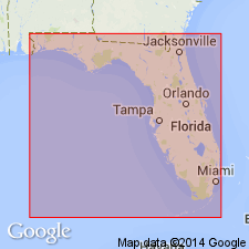
- Jackson Bluff formation
- Modifications:
-
- Named
- Dominant lithology:
-
- Sand
- Clay
- AAPG geologic province:
-
- Florida platform
Summary:
Named for Jackson Bluff on Ochlockonee River, Leon Co., panhandle of northwestern FL. Name is suggested for ECPHORA and CANCELLARIA faunizones. [No description given.] Thickness at type section is 9.5 ft. Overlies Hawthorn Formation; underlies Pleistocene sand and soil zone. At Alum Bluff, overlies Fort Preston Formation (new); underlies Miccosukee Formation (new). Age is Choctawhatchee Stage [Miocene].
Source: GNU records (USGS DDS-6; Reston GNULEX).
- Usage in publication:
-
- Jackson Bluff Formation
- Modifications:
-
- Areal extent
- AAPG geologic province:
-
- South Georgia sedimentary province
Summary:
Unit has not been recognized in any wells in Gadsden Co. The formation most likely pinches out southeast of Hwy 267 in the south-central tip of Gadsden or grades laterally into an unfossiliferous facies. In Leon Co., the Jackson Bluff is typically greenish-gray to brown, very macrofossiliferous clayey sand and sandy clay. Mollusk shells common. Throughout most of FL, underlies Citronelle and Miccosukee Formations. Age is late Pliocene.
Source: GNU records (USGS DDS-6; Reston GNULEX).
- Usage in publication:
-
- Jackson Bluff Formation*
- Modifications:
-
- Biostratigraphic dating
- AAPG geologic province:
-
- Florida platform
Summary:
Although Duplin and Raysor Formations probably include sediments deposited during several cycles, the cycles presently cannot be differentiated either by paleontologic analysis or stratigraphic position. In southeastern GA, fossils consistent with Zone PL3 of Berggren (1973) are equivalent wholly or in part to Duplin and Raysor Formations, to Rushmere Member of upper part of Yorktown Formation in southeastern VA and northeastern NC (numerous references and L.W. Ward, Virginia Museum of Natural History, 1990, written commun.), and to Jackson Bluff Formation of extreme northern FL. Figure 6 shows these equivalent relationships. Duplin Formation, used in southeastern NC and northeastern SC, is assigned late early and late Pliocene age. Raysor Formation, used in southeastern SC and all of GA, is assigned late Pliocene age. Jackson Bluff Formation, and Rushmere and Morgarts Beach Members of Yorktown Formation are assigned late Pliocene age.
Source: GNU records (USGS DDS-6; Reston GNULEX).
For more information, please contact Nancy Stamm, Geologic Names Committee Secretary.
Asterisk (*) indicates published by U.S. Geological Survey authors.
"No current usage" (†) implies that a name has been abandoned or has fallen into disuse. Former usage and, if known, replacement name given in parentheses ( ).
Slash (/) indicates name conflicts with nomenclatural guidelines (CSN, 1933; ACSN, 1961, 1970; NACSN, 1983, 2005, 2021). May be explained within brackets ([ ]).