The National Geologic Map Database is migrating to a new infrastructure. We apologize for any service disruptions during this process.
|
|---|


- Usage in publication:
-
- Jack Valley formation
- Modifications:
-
- Named
- Biostratigraphic dating
- Dominant lithology:
-
- Dolomite
- AAPG geologic province:
-
- Great Basin province
Summary:
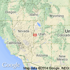
Jack Valley formation is named for exposures on the west side of Jack Valley, sec.25, T21S R15W, [Pyramid Knoll 7.5' quad], Confusion Range, Millard Co, UT. Is also exposed in the Ibex Hills (sec.15, T21S R14W) and at the head of Kings Canyon, both in the Confusion Range. Consists of argillaceous, black nodular, fossiliferous, dolomite. Ranges to 250 ft thick. Unconformably overlies the Roberts Mountain[s] formation; unconformably underlies the Decathon dolomite (new). Age is Silurian (Niagaran) based on fossils [corals].
Source: GNU records (USGS DDS-6; Menlo GNULEX).
- Usage in publication:
-
- Jack Valley Member
- Modifications:
-
- Revised
- Overview
- Areal extent
- AAPG geologic province:
-
- Wasatch uplift
- Great Basin province
Summary:
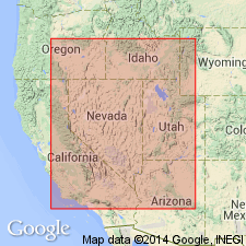
Rank reduced to member (fifth from base, of six members) of Laketown Dolostone (redescribed). Outcrops in Bear River Range, northeastern Cache Co, UT, Wasatch uplift; and southwestern UT and east-central NV at Barn Hills, Cherry Creek Range and southern part of Egan Range, Great Basin province. Not present in southern NV and Tooele Arch area. Average thickness is 110 ft. Deposited in a low-energy, subtidal environment. Overlies Portage Canyon, Gettel, or High Lake Members (all new) of Laketown; underlies Decathon Member (revised) of Laketown. Measured sections. Silurian age.
Source: GNU records (USGS DDS-6; Denver GNULEX).
For more information, please contact Nancy Stamm, Geologic Names Committee Secretary.
Asterisk (*) indicates published by U.S. Geological Survey authors.
"No current usage" (†) implies that a name has been abandoned or has fallen into disuse. Former usage and, if known, replacement name given in parentheses ( ).
Slash (/) indicates name conflicts with nomenclatural guidelines (CSN, 1933; ACSN, 1961, 1970; NACSN, 1983, 2005, 2021). May be explained within brackets ([ ]).