The National Geologic Map Database is migrating to a new infrastructure. We apologize for any service disruptions during this process.
|
|---|


- Usage in publication:
-
- Ivydell Sandstone Member*
- Modifications:
-
- Original reference
- Dominant lithology:
-
- Sandstone
- AAPG geologic province:
-
- Appalachian basin
Summary:
Pg. 22, pl. 6. Ivydell Sandstone Member of Hance Formation. Massive, light-gray, fine- to medium-grained sandstone. Lithologically similar to sandstones in Breathitt Formation except for large number of weathered white feldspar grains noted in most outcrops. Thickness up to 70 feet; 55 feet at type section. Overlies Rich Mountain coal bed of Hance Formation; [in upper part of what is now (ca. 1995) called Slatestone Formation]. Age is Middle Pennsylvanian.
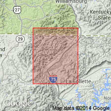
Type section: along road on left side of Kent Hollow, from town of Ivydell to broad upland, Campbell Co., northeastern TN.
[†Hance Formation formally abandoned by Rice and others, 1994 (GSA Spec. Paper, p. 115-155); Ivydell not discussed.]
Source: Publication; US geologic names lexicon (USGS Bull. 1520, p. 152).
For more information, please contact Nancy Stamm, Geologic Names Committee Secretary.
Asterisk (*) indicates published by U.S. Geological Survey authors.
"No current usage" (†) implies that a name has been abandoned or has fallen into disuse. Former usage and, if known, replacement name given in parentheses ( ).
Slash (/) indicates name conflicts with nomenclatural guidelines (CSN, 1933; ACSN, 1961, 1970; NACSN, 1983, 2005, 2021). May be explained within brackets ([ ]).