The National Geologic Map Database is migrating to a new infrastructure. We apologize for any service disruptions during this process.
|
|---|


- Usage in publication:
-
- Ironbound Mountain Formation
- Modifications:
-
- First used
- Dominant lithology:
-
- Claystone
- Slate
- Phyllite
- Sandstone
- AAPG geologic province:
-
- New England province
Summary:
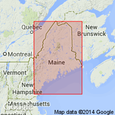
Ironbound Mountain Formation of Marvinney (1983: OF report; and in prep) is here described in Somerset Co., west-central Maine, as a dark gray claystone or siltstone slate and phyllite with quartzose and lithic sandstone. Unit includes a basal metasandstone Grenier Ponds Member and an overlying unnamed metapelite member. Thickness at type is estimated at 900 m and ranges to 5,000 m toward northwest. Overlies Frontenac Formation (Ordovician to Devonian) and conformably underlies Northeast Carry Formation (new name). Rocks previously mapped as part of the Frontenac Formation by Doyle (1967) and by Boucot and Heath (1969). Early Devonian (Gedinnian) age arbitrarily assigned by Osberg and others (1985).
Source: GNU records (USGS DDS-6; Reston GNULEX).

- Usage in publication:
-
- Ironbound Mountain Formation
- Modifications:
-
- Overview
- AAPG geologic province:
-
- New England province
Summary:
Ironbound Mountain Formation exposed in two major belts within and beyond Penobscot Lake region. Two minor strike belts are thrust faulted and contained within the region. Southeastern major belt is partly mapped into areas previously identified as Seboomook Formation. Northwestern belt is underlain entirely by the Grenier Ponds Member. Most characteristic lithology of the Ironbound Mountain is thinly bedded, well-cleaved, medium- to dark gray mudstone and siltstone slate. Beds range from 1 to 30 cm. Locally contains minor beds of matrix-supported conglomerate. Stratigraphically underlies North East [Northeast] Carry Formation. Unit may span the Silurian-Devonian boundary and range from possibly latest Pridolian to earliest Gedinnian.
Source: GNU records (USGS DDS-6; Reston GNULEX).
- Usage in publication:
-
- Ironbound Mountain Formation
- Modifications:
-
- Overview
- AAPG geologic province:
-
- New England province
Summary:
Most characteristic lithology of this formation is thinly bedded, well-foliated, medium- to dark-gray mudstone and siltstone slate. Some sections of the formation, particularly well exposed in northern NH are chaotic and probably represent soft sediment slumping. Lenses of lithic wacke, informally referred to as the Grenier Ponds lithology, are in gradational contact with the main part of the formation. Age of the Ironbound Mountain Formation of the Seboomook Group is given here as Late Silurian and Early Devonian.
Source: GNU records (USGS DDS-6; Reston GNULEX).

- Usage in publication:
-
- Ironbound Mountain Formation*
- Modifications:
-
- Named
- Dominant lithology:
-
- Slate
- Shale
- Siltstone
- Grit
- Volcanics
- AAPG geologic province:
-
- New England province
Summary:
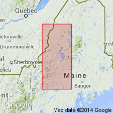
Ironbound Mountain Formation as used by Marvinney (1982 [ME Geol. Surv. Open-file Map 81-36], 1986) and Osberg and others (1985) is here introduced as a formal geologic name. Included as lower formation of Seboomook Group (rank raised) in northwestern ME. Previously mapped as Compton Formation in Quebec (St. Julien and Slivitsky, 1987); Gile Mountain Formation in Averill, VT, and Dixville, NH 15-min quads (Hatch, 1963; Meyers, 1964); Seboomook Formation in Second Connecticut Lake and Arnold Pond, NH and ME, 15-min quads (Green, 1968; Harwood, 1973); Kidderville Formation in Dixville 15-min quad (Hatch, 1963); Littleton Formation in Guildhall, VT, 15-min quad (Johansson, 1963); and Magalloway Member of Dixville Formation at Thrashers Peak, Cupsuptic, ME, 15-min quad (Harwood, 1973) (remainder of Magalloway reassigned as member of Jim Pond Formation). Well exposed along road from Pittston Farm (at west end of Penobscot Lake) to Rockwood (in Brassua Lake quad). Type locality designated as 2-km length of road between two bench marks at elev 1402 ft; northern bench mark is about 5 km southwest of Pittston Farm. Main body consists of gray to locally greenish-gray, faintly bedded, pelitic slate. Local conglomerate consisting of round clasts of slate, metasandstone, and metabasalt in matrix of dark-gray slate. Separately mapped subunits include altered slate near Deer Pond fault, magnetite-bearing shale and siltstone facies, rhyolite and microgranite intrusions, grit lenses at Halls Stream, Grenier Ponds Grit Member (name revised to emphasize lithology), basaltic to andesitic member, felsic volcanic member, and euxinic shale member. Maximum estimated thickness of 900 m. Contact with underlying sedimentary and basaltic members of Frontenac Formation of western rift sequence is conformable; contact with underlying rocks of Piermont sequence varies from conformable to probably unconformable.
Source: GNU records (USGS DDS-6; Reston GNULEX).

- Usage in publication:
-
- Ironbound Mountain Formation*
- Modifications:
-
- Mapped
- AAPG geologic province:
-
- New England province
Summary:
Ironbound Mountain Formation. Interbedded gray phyllite, in places containing feldspathic clasts, and feldspathic metasandstone, variably graded. Subdivided into informal units (separately mapped): grits at Halls Stream, felsic volcanic member, basaltic to andesitic member, euxinic metashale member, and metarhyolite and microgranite intrusions. In footnote, authors state "The Ironbound Mountain Formation was introduced by Marvinney (1983) and further described by Pollock (1987) in Maine, where it is the basal formation of the Seboomook Group. W.A. Bothner and R.H. Moench (unpub. data, 1992) now recognize the Ironbound Mountain in New Hampshire as the result of field mapping in Sherbrooke-Lewiston, Maine, N.H., and Vt., 1:250,000-scale quadrangle. It is a probable facies equivalent of the lower part of the Littleton Formation." [Lies above Silurian(?) Frontenac Formation and below Lower Devonian Gile Mountain Formation.] Age is Early Devonian.
Source: GNU records (USGS DDS-6; Reston GNULEX).
For more information, please contact Nancy Stamm, Geologic Names Committee Secretary.
Asterisk (*) indicates published by U.S. Geological Survey authors.
"No current usage" (†) implies that a name has been abandoned or has fallen into disuse. Former usage and, if known, replacement name given in parentheses ( ).
Slash (/) indicates name conflicts with nomenclatural guidelines (CSN, 1933; ACSN, 1961, 1970; NACSN, 1983, 2005, 2021). May be explained within brackets ([ ]).