

- Usage in publication:
-
- Iron Lightning Member
- Modifications:
-
- Named
- Reference
- Dominant lithology:
-
- Shale
- Silt
- Sandstone
- AAPG geologic province:
-
- Williston basin
Summary:
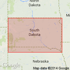
Named upper member, Maestrichtian age, of Fox Hills Formation for Indian village Iron Lightning on Moreau River. Type locality extends over 3 sq mi in parts of secs 20, 28, 29, 32, 33, T14N, R19E and sec 4, T13N, R19E, Ziebach Co, SD, Williston basin. Includes Bullhead (formerly member rank) lithofacies--thinly interbedded gray, banded, very fine grained to silty sand and silt, and locally a few bentonitic, popcorn-crusted beds that form banded badlands; a delta front platform or pro-delta slope deposit; and Colgate (formerly member rank) lithofacies--white, very fine grained, clayey, subgraywacke sandstone, some gray shale and local rusty-brown concretions that weather to steep fluted outcrops; a channel-fill and topset delta-platform deposit. Divided at type into (ascending); thickness are: Bullhead, 87 ft; Colgate, 5 ft; Bullhead, 18 ft; and Colgate, 58 ft. Is 157 ft thick at reference section (sec 9, T14N, R19E). Ranges from 58-168 ft thick. Lower contact at base of banded beds is with Timber Lake Member of Fox Hills in north and northeast exposures, and with Trail City Member of Fox Hills in west and southwest exposures. Upper contact with Hell Creek Formation placed at base of first "appreciably thick" lignite, lignitic clay or shale. Measured sections; cross sections; nomenclature chart; distribution and facies maps. Fossils (reptiles, fish, invertebrates, birds, mammals, plants, trees) from channel- and oyster-bed deposits.
Source: GNU records (USGS DDS-6; Denver GNULEX).
For more information, please contact Nancy Stamm, Geologic Names Committee Secretary.
Asterisk (*) indicates published by U.S. Geological Survey authors.
"No current usage" (†) implies that a name has been abandoned or has fallen into disuse. Former usage and, if known, replacement name given in parentheses ( ).
Slash (/) indicates name conflicts with nomenclatural guidelines (CSN, 1933; ACSN, 1961, 1970; NACSN, 1983, 2005, 2021). May be explained within brackets ([ ]).