


- Usage in publication:
-
- Iron Bog Creek Formation
- Modifications:
-
- Named
- Dominant lithology:
-
- Argillite
- Shale
- Quartzite
- Conglomerate
- AAPG geologic province:
-
- Idaho Mountains province
Summary:
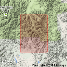
Named as the upper formation (of 6) of Copper Basin Group (rank raised), Iron Bog Creek, Custer Co, ID in the Idaho Mountains province. Type section, W1/2 sec 9 to SW1/4 NE1/4 SE1/4 sec 9, T4N, R22E, designated and measured. Is 1,500 ft thick at its type where it gradationally overlies Brockie Lake Conglomerate (new) of Copper Basin. Lower contact gradational over 800 ft. Top of formation covered at type by Challis Volcanics, talus, and alluvium. Consists of black to medium-gray interbedded silty, thin-bedded, blocky-weathering argillite and shale with minor quartzite and conglomerate. Conglomerate beds range from 3 in to 3 ft. Stratigraphic chart. No fossils collected. Middle? Pennsylvanian age suggested.
Source: GNU records (USGS DDS-6; Denver GNULEX).
- Usage in publication:
-
- Iron Bog Creek Formation*
- Modifications:
-
- Age modified
- AAPG geologic province:
-
- Idaho Mountains province
Summary:
Two partial trilobites in heretofore nonfossiliferous type section of Iron Bog Creek at Brockie Lake in Muldoon Canyon quad, Custer Co, ID (Idaho Mountains province). A. R. Ormiston (Amoco Research Center) identified fossils as ARCHEGONUS (PHILLIBOLE); Ormiston reported that subgenus has a range of Famennian (Late Devonian) through Visean (Late Mississippian). The Idaho forms most closely resemble a species from Lower Mississippian of Kentucky and Tennessee. Trilobites found 60-90 m above base of Iron Bog Creek and about 4,900 m above lowest exposed beds of Copper Basin Group.
Source: GNU records (USGS DDS-6; Denver GNULEX).
- Usage in publication:
-
- Iron Bog Creek Formation
- Modifications:
-
- Age modified
- AAPG geologic province:
-
- Idaho Mountains province
Summary:
Is the upper formation (of 6) of the Copper Basin Group in the central Pioneer Mountains, Custer Co, ID in the Idaho Mountains province. Overlies Brockie Lake Conglomerate of Copper Basin Group. Stratigraphic diagram. Age modified from Middle? Pennsylvanian to Late Mississippian. [Reason not stated.]
Source: GNU records (USGS DDS-6; Denver GNULEX).
- Usage in publication:
-
- Iron Bog Creek Member*
- Modifications:
-
- Revised
- AAPG geologic province:
-
- Snake River basin
Summary:
Rank reduced and assigned as uppermost of four members of newly named Argosy Creek Formation of Copper Basin Group (revised). Argosy Creek includes all units within Copper Basin Group above Drummond Mine Limestone: Scorpion Mountain, Muldoon Canyon, Brockie Lake Conglomerate, and Iron Bog Creek Members, all reduced from formation rank. Argosy Creek defined because upper part of Copper Basin Group is poorly exposed and abrupt facies changes make previous formation-rank units difficult to map. Occurs in area of Pioneer Mountains, Blaine Co, ID (Snake River basin) west of Copper Basin thrust fault. Includes the Iron Bog Creek of Paull and others (1972) as well as an additional 700 m of overlying strata located in type area and 200 m of correlative strata located northwest along strike from type area in northeast Lake Creek (sections 5 and 6a, b, and c, and 7 on fig 4). Mapped only in Left and Right Forks of Iron Bog Creek, Hurst Canyon, Antelope Creek and Lake Creek, Blaine Co, ID (Snake River basin) (figs 3, 4). Consists of black, silty argillite with minor interbeds of quartzite and conglomerate of Paull and others and argillite, sandstone, and conglomerate in emended upper part. Correlation charts. Overlies with gradational contact, Brockie Lake Conglomerate Member; unconformably underlies Eocene conglomerate or Challis Volcanic Group. Assigned Late Mississippian (Meramecian and Chesterian) age based on fossils.
Source: GNU records (USGS DDS-6; Denver GNULEX).
For more information, please contact Nancy Stamm, Geologic Names Committee Secretary.
Asterisk (*) indicates published by U.S. Geological Survey authors.
"No current usage" (†) implies that a name has been abandoned or has fallen into disuse. Former usage and, if known, replacement name given in parentheses ( ).
Slash (/) indicates name conflicts with nomenclatural guidelines (CSN, 1933; ACSN, 1961, 1970; NACSN, 1983, 2005, 2021). May be explained within brackets ([ ]).