The National Geologic Map Database is migrating to a new infrastructure. We apologize for any service disruptions during this process.
|
|---|


- Usage in publication:
-
- Irasburg conglomerate
- Modifications:
-
- Original reference
- Dominant lithology:
-
- Conglomerate
- AAPG geologic province:
-
- New England province
Summary:
Pg. 82. Irasburg conglomerate. As it contains beds of siliceous limestone lithologically identical with Waits River limestone it should both mark the basal member of Lower Trenton series and the great erosional unconformity on west. Its stratigraphic position is capable of 2 interpretations: (1) that it is basal member of Waits River limestone formed upon the rapidly subsiding sea floor when the sea transgressed upon pre-Cambrian schists; (2) that it is basal member of a younger series of rocks lying in narrow belt between Montpelier slate on east and pre-Cambrian schists on west. Age is Ordovician.
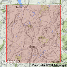
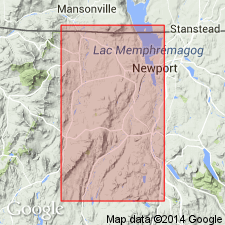
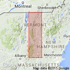
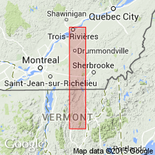
Named from Irasburg, Orleans Co., northeastern VT, where it is best represented.
Source: US geologic names lexicon (USGS Bull. 896, p. 1021-1022).
- Usage in publication:
-
- Irasburg conglomerate
- Modifications:
-
- Overview
- AAPG geologic province:
-
- New England province
Summary:
Pg. 151. Irasburg conglomerate. Lowest member of Ordovician in east Vermont. Is a limestone conglomerate discovered and named in 1904. Pebbles are all pre-Ordovician in a limestone matrix. Rests unconformably on pre-Ordovician (Cambrian?) schists.
Source: US geologic names lexicon (USGS Bull. 896, p. 1021-1022).
- Usage in publication:
-
- Irasburg conglomerate
- Modifications:
-
- Age modified
- AAPG geologic province:
-
- New England province
Summary:
Pg. 171. Irasburg conglomerate assigned to Ordovician. All its boulders are pre-Ordovician. Underlies Waits River limestone.
Source: US geologic names lexicon (USGS Bull. 896, p. 1021-1022).
- Usage in publication:
-
- Irasburg conglomerate
- Modifications:
-
- Overview
- AAPG geologic province:
-
- New England province
Summary:
Pg. 309. In Irasburg conglomerate at type locality are boulders 1 to 3 feet diameter.
Source: US geologic names lexicon (USGS Bull. 896, p. 1021-1022).
- Usage in publication:
-
- Irasburg conglomerate
- Modifications:
-
- Areal extent
- AAPG geologic province:
-
- New England province
Summary:
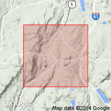
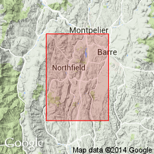
Pg. 125. Irasburg conglomerate is true basal conglomerate. Is unconformable on Cambrian schists. Has been traversed approximately 100 miles northward into Canada and southward through Irasburg and into Northfield, Vermont. In entire distance the pebbles are of Cambrian materials and the matrix Ordovician.
Source: US geologic names lexicon (USGS Bull. 896, p. 1021-1022).
- Usage in publication:
-
- Irasburg conglomerate
- Modifications:
-
- Areal extent
- AAPG geologic province:
-
- New England province
Summary:
Pg. 46; [also, C.H. Richardson and S.H. Camp, The terranes of Northfield, Vermont, p. 106, same vol.; C.H. Richardson, The terranes of Roxbury, Vermont, p. 128, same vol.]. Irasburg conglomerate as it exists in Irasburg is wanting in Roxbury, Vermont, but its geological equivalent as discovered in Northfield last summer extends into Roxbury. If Northfield were not preoccupied I would call this basal conglomerate in Northfield the Northfield conglomerate.
Source: US geologic names lexicon (USGS Bull. 896, p. 1021-1022).
- Usage in publication:
-
- Irasburg conglomerate
- Modifications:
-
- Revised
- AAPG geologic province:
-
- New England province
Summary:
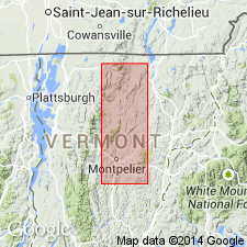
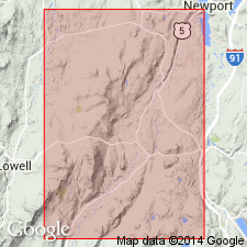
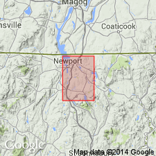
Pg. 107-110. Irasburg conglomerate. When discovered the Irasburg conglomerate was supposed to be a more or less local phase of Waits River limestone, but it is not. It carries a few plates of muscovite and biotite which are characteristic of Waits River limestone series. It has been followed into Canada for 200 miles and south through Vermont for 100+ miles. Discovery site is in bed of Lords Creek just outside southern limit of village of Irasburg, Orleans County, northeastern Vermont. The area exposed in Irasburg Township is 4 miles long and 0.5 mile wide. This conglomerate or its time equivalent can be divided into 5 more or less distinct phases: Irasburg phase, Albany phase, Northfield phase, Coventry phase, Magog, Quebec, phase. The Irasburg phase is characterized by boulders more than 2 feet diameter, by porphyritic andesites, and by granite boulders. Fossils prove the conglomerate began as early as Beekmantown. [For description of the other "phases" see under each name.]
Source: US geologic names lexicon (USGS Bull. 896, p. 1021-1022).
- Usage in publication:
-
- Irasburg conglomerate
- Modifications:
-
- Overview
- AAPG geologic province:
-
- New England province
Summary:
Pg. 346. The Irasburg, Albany, and Northfield conglomerates form base of Ordovician in eastern Vermont.
Source: US geologic names lexicon (USGS Bull. 896, p. 1021-1022).
- Usage in publication:
-
- Irasburg bed*
- Modifications:
-
- Revised
- AAPG geologic province:
-
- New England province
Summary:
The Irasburg is considered an intraformational bed in the Waits River formation and is of Middle Ordovician or later(?) age.
Source: GNU records (USGS DDS-6; Reston GNULEX).
- Usage in publication:
-
- Irasburg conglomerate [unranked]
- Modifications:
-
- Revised
- Age modified
- AAPG geologic province:
-
- New England province
Summary:
Pg. 32. Irasburg conglomerate [unranked]. Considered basal to the Barton River formation, chiefly on basis of stratigraphic position. Traced along boundary between the Barton River and Ayers Cliff formation from the bed of Black River in Irasburg village southwesterly to half a mile east of village of Albany, Orelans County, northeastern Vermont. Among the five phases into which Richardson (1929, p. 108) divided the Irasburg conglomerate, only the Irasburg and possibly the Albany phases belong to this conglomerate. Age of Barton River is considered Silurian, based on stratigraphic position.
Type locality stated to be in bed of Lords Creek and on adjacent slope to south, where Richardson (1906, p. 82) first described it.
Source: Publication; US geologic names lexicon (USGS Bull. 1200, p. 1880).
For more information, please contact Nancy Stamm, Geologic Names Committee Secretary.
Asterisk (*) indicates published by U.S. Geological Survey authors.
"No current usage" (†) implies that a name has been abandoned or has fallen into disuse. Former usage and, if known, replacement name given in parentheses ( ).
Slash (/) indicates name conflicts with nomenclatural guidelines (CSN, 1933; ACSN, 1961, 1970; NACSN, 1983, 2005, 2021). May be explained within brackets ([ ]).