- Usage in publication:
-
- Inman formation
- Modifications:
-
- Original reference
- Dominant lithology:
-
- Shale
- Limestone
- AAPG geologic province:
-
- Appalachian basin
Summary:
Pg. 2 (fig. 1), 175-179. Inman formation of Eden group. Greenish-gray, calcareous shale with zones of red shale interbedded with beds of uniformly bedded, greenish-gray to gray dove-colored, fine-grained, dense limestone; at some localities limestone is clayey and laminated and in other places is uniformly medium grained. Beds of limestone range between 1 and 6 inches in thickness. Thickness 45 feet in Giles County, 48 feet in Franklin County, and 40 to 70 feet in Sequatchie Valley. Overlaps upon Catheys and overlapped by Leipers. Age is Late Ordovician.
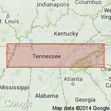
Named from exposures at Inman, Marion Co., central TN. Restricted to synclinal belt in southwestern Lincoln Co. and east-central Giles Co. and in similar belt in Franklin and Moore Cos. that is connected with the formation as exposed in Sequatchie Valley.
Source: US geologic names lexicon (USGS Bull. 1200, p. 1870).

- Usage in publication:
-
- Inman Formation*
- Modifications:
-
- Revised
- Areal extent
- AAPG geologic province:
-
- Appalachian basin
Summary:
The Inman Formation is assigned to the Chickamauga Group in the Chickamauga terrane in AL, as used by Drahovzal and Neathery (1971). It overlies the Nashville Formation and underlies the Leipers Limestone, both of the Chickamauga Group. Age is Late Ordovician.
Source: GNU records (USGS DDS-6; Reston GNULEX).

- Usage in publication:
-
- Inman Formation*
- Modifications:
-
- Overview
- AAPG geologic province:
-
- Cincinnati arch
Summary:
The Inman Formation in central Tennessee consists of greenish-gray, calcareous shale and zones of red shale interbedded with greenish-gray to light-gray, fine-grained, dense, fenestral limestone. Contains a sparse fauna of brachiopods and bryozoans. Thickness ranges from 40 to 70 feet. Overlies the Catheys Formation of the Nashville Group and underlies the Leipers Formation. The environment of deposition is considered to be quiet, shallow, subtidal to intertidal with the red shales representing the first incursion of the Queenston delta facies. The Inman is of Late Ordovician age, probably Edenian but possibly Maysvillian in the extreme uppermost part of the unit.
Source: GNU records (USGS DDS-6; Reston GNULEX).
For more information, please contact Nancy Stamm, Geologic Names Committee Secretary.
Asterisk (*) indicates published by U.S. Geological Survey authors.
"No current usage" (†) implies that a name has been abandoned or has fallen into disuse. Former usage and, if known, replacement name given in parentheses ( ).
Slash (/) indicates name conflicts with nomenclatural guidelines (CSN, 1933; ACSN, 1961, 1970; NACSN, 1983, 2005, 2021). May be explained within brackets ([ ]).

