

- Usage in publication:
-
- Inglefield sandstone
- Modifications:
-
- Original reference
- Dominant lithology:
-
- Sandstone
- Shale
- AAPG geologic province:
-
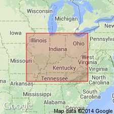
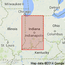
- Illinois basin
Summary:
Inglefield sandstone. Massive sandstone with thin shale partings; 20 or more feet thick. Underlain by Ditney formation and overlain by Pleistocene glacial deposits. Age is Pennsylvanian. [Later reports give thickness up to 150 feet.]
Source: US geologic names lexicon (USGS Bull. 896, 1013).

- Usage in publication:
-
- Inglefield sandstone
- Modifications:
-
- Not used
- AAPG geologic province:
-
- Illinois basin
Summary:
Inglefield sandstone. Supposed equivalent of Merom sandstone and name was dropped by E.R. Cumings, 1922 (Handbook Indiana Geol., pt. 4, Sep. Pub., no. 21, p. 525).
Source: US geologic names lexicon (USGS Bull. 896, p. 1013).
- Usage in publication:
-
- Inglefield sandstone
- Modifications:
-
- Overview
- AAPG geologic province:
-
- Illinois basin
Summary:
Pg. 87. Inglefield sandstone. Massive sandstone between Wabash above and Ditney formations; later [latter?] erroneously correlated with Merom sandstone. Age is Late Pennsylvanian.
Source: US geologic names lexicon (USGS Bull. 1200, p. 1868-1869).

- Usage in publication:
-
- Inglefield sandstone
- Modifications:
-
- Revised
- AAPG geologic province:
-
- Illinois basin
Summary:
Chart 6 (column 25). Inglefield sandstone. Shown on Pennsylvanian correlation chart as overlying Ditney formation and separated from overlying Parker limestone by Parker coal. Age is Late Pennsylvanian. Present in southwestern Indiana.
Source: US geologic names lexicon (USGS Bull. 1200, p. 1868-1869).
- Usage in publication:
-
- Inglefield formation
- Modifications:
-
- Revised
- AAPG geologic province:
-
- Illinois basin
Summary:
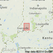
Pg. 131. Inglefield formation. Part of Fuller's Inglefield formation (as mapped in Ditney and Patoka folios, [southwestern Indiana]) is included in Dicksburg Hills sandstone. Age is Late Pennsylvanian.
Source: US geologic names lexicon (USGS Bull. 1200, p. 1868-1869).
- Usage in publication:
-
- Inglefield Sandstone Member
- Modifications:
-
- Revised
- AAPG geologic province:
-
- Illinois basin
Summary:
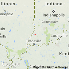
Pg. 75-76 (article by C.E. Wier). Inglefield Sandstone Member of Patoka Formation. Restricted Fuller and Ashley's (USGS Geol. Atlas of the US, Ditney folio, no. 84, 1902) Inglefield to the sandstone above Ditney Coal Member and below Hazelton Bridge Coal Member (Wier, in prep.); in lower part of Inglefield Sandstone of Fuller and Clapp, 1904 (USGS Geol. Atlas of the US, Patoka folio, no. 105). Gray to tan, cross-bedded, thin- to thick-bedded, fine-grained sandstone that grades laterally into a sandy shale. Thickest in subsurface of Vanderburgh and Posey Counties, southwestern Indiana, where it ranges from 20 to 80 feet. Thins north of Knox County; maximum thickness 20 feet. Miscorrelated with Merom Sandstone Member of Mattoon Formation by some early workers. Age is Pennsylvanian.
Wier (in prep.) [= Stratigraphy of the Carbondale and McLeansboro Groups in southwestern Indiana, Indiana Geol. Survey Bull. XX, 171 p., unpub. ms., ca. 1961; available online through Indiana Univ. Scholarworks http://hdl.handle.net/2022/3612, accessed September 18, 2009].
Source: Publication.
For more information, please contact Nancy Stamm, Geologic Names Committee Secretary.
Asterisk (*) indicates published by U.S. Geological Survey authors.
"No current usage" (†) implies that a name has been abandoned or has fallen into disuse. Former usage and, if known, replacement name given in parentheses ( ).
Slash (/) indicates name conflicts with nomenclatural guidelines (CSN, 1933; ACSN, 1961, 1970; NACSN, 1983, 2005, 2021). May be explained within brackets ([ ]).