

- Usage in publication:
-
- Ilion shale
- Modifications:
-
- Named
- Dominant lithology:
-
- Shale
- Dolomite
- AAPG geologic province:
-
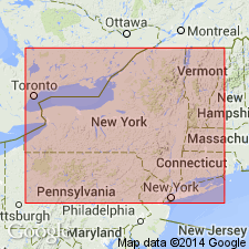
- Appalachian basin
Summary:
Ilion shale, named in this report, consists of about 60 ft of sparsely fossiliferous calcareous gray-black shale with interbedded dolomite layers containing stromatoporoids. Overlies Herkimer sandstone; underlies Vernon shale. Age is Middle Silurian (Lockportian).
Source: GNU records (USGS DDS-6; Reston GNULEX).
- Usage in publication:
-
- Ilion Formation, Shale
- Modifications:
-
- Revised
- AAPG geologic province:
-
- Appalachian basin
Summary:
Farmers Mills Bed (new name) occurs in the uppermost Ilion [misspelled Illion] Formation, transitional into the overlying Vernon Formation of the Salina Group in eastern NY. The black shale horizon contains a rich eurypterid fauna identical to that found in the type region of the Pittsford Bed of the Vernon Formation, western NY. Author transfers this uppermost portion of the Ilion Formation to the Salina Group and suggests that perhaps the entire Ilion should be included in the Salina. . [Usage of the Ilion in this report is in conflict with Art. 28(b) of the NACSN, which states "* * * a formation or its parts may not be assigned to two vertically adjacent groups."]
Source: GNU records (USGS DDS-6; Reston GNULEX).
For more information, please contact Nancy Stamm, Geologic Names Committee Secretary.
Asterisk (*) indicates published by U.S. Geological Survey authors.
"No current usage" (†) implies that a name has been abandoned or has fallen into disuse. Former usage and, if known, replacement name given in parentheses ( ).
Slash (/) indicates name conflicts with nomenclatural guidelines (CSN, 1933; ACSN, 1961, 1970; NACSN, 1983, 2005, 2021). May be explained within brackets ([ ]).