The National Geologic Map Database is migrating to a new infrastructure. We apologize for any service disruptions during this process.
|
|---|


- Usage in publication:
-
- Iles formation*
- Modifications:
-
- Named
- Dominant lithology:
-
- Sandstone
- Shale
- Coal
- AAPG geologic province:
-
- Green River basin
Summary:
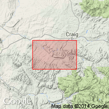
Named as the lower of two formations of Mesaverde group for Iles Mountain, a conspicuous topographic feature north of the Axial Basin, Moffat Co, CO in the Greater Green River basin. Makes up nearly all of Iles Mountain. Crops out in a narrow belt in basin between Mancos shale below and Williams Fork formation (new) of Mesaverde group above. Upper contact placed at top of Trout Creek sandstone member of Iles, a 75 ft thick white sandstone. Lowest bed in measured section on Milk Creek is a 33 ft thick sandstone. Consists of alternation of brown sandstone and brown to black sandy shale, and coal beds near base and top. Some shale beds carbonaceous. Is about 1,350 ft thick. Marine invertebrate fossils (listed) collected; few fossil plants identified. Cretaceous age.
Source: GNU records (USGS DDS-6; Denver GNULEX).
- Usage in publication:
-
- Iles Formation
- Modifications:
-
- Revised
- Age modified
- AAPG geologic province:
-
- Piceance basin
Summary:
Fig. 3 is correlation of measured sections along Grand Hogback from North Thompson Creek, Pitkin Co, Eagle basin, northward to White River, Rio Blanco Co, Piceance basin. Sandstone that is probably equivalent to Sego Member (revised) of Mesaverde Formation (revised) appears to correlate with lowermost sandstone of Iles of Mesaverde Group at Rifle Gap and north to White River. [Sego not specifically assigned to Iles.] At White River section, Corcoran and Cozzette Members (both revised) of Mesaverde are present and assigned to nonmarine part of Iles. Rollins Sandstone Member (revised) of Mesaverde is lithogenetic equivalent of Trout Creek Member of Iles. Name Rollins is used as far north as New Castle and name Trout Creek is used north of New Castle along Grand Hogback. Overlies Mancos Shale; underlies Williams Fork Formation of Mesaverde Group. BACULITES cf. B. CORRUGATUS collected 50 ft below base of Trout Creek at Piceance Creek section suggests that fossil is in EXITELOCERAS JENNEYI zone indication a Campanian (Late Cretaceous) age.
Source: GNU records (USGS DDS-6; Denver GNULEX).
- Usage in publication:
-
- Iles Formation*
- Modifications:
-
- Overview
- AAPG geologic province:
-
- Green River basin
Summary:
Correlation of the Upper Cretaceous Pierre Shale (and its Hygiene, Terry, Rocky Ridge, and Larimer Sandstone Members) near Boulder, CO with the Pierre Shale (and its Sharon Springs, Kremmling, Muddy Buttes, Hygiene, Carter and Gunsight Pass Members) near Kremmling, CO, and with the upper part of the Mancos Shale (and its Morapos and Loyd Sandstone Members) and with the Iles Formation (and its Tow Creek and Trout Creek Sandstone Members) and Williams Fork Formation (and its Twentymile Sandstone Member), the last two are formations of the Mesaverde Group of the Hamilton area, Moffat Co., in Greater Green River basin, shown on fig. 2.
Source: GNU records (USGS DDS-6; Denver GNULEX).
- Usage in publication:
-
- Iles Formation
- Modifications:
-
- Revised
- Overview
- AAPG geologic province:
-
- Piceance basin
- Eagle basin
Summary:
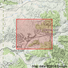
Sego? Sandstone and Rollins Sandstone Members reassigned to Iles of Mesaverde Group. Measured sections along Grand Hogback, western CO, from Coal Basin area, Pitkin Co, Eagle basin, north to White River, near Meeker, Rio Blanco Co, Piceance basin (Mancos Shale and Iles parts of sections are taken from Warner (1964)) (plate 2). Iles varies from predominantly nonmarine unit at White River to almost entirely marine at Coal Basin. Thickness ranges from 1600 ft at White River to 890 ft at Four Mile Creek; variability due to appearance of new basal sandstone members and to thickness of intervening marine tongues of Mancos. Iles consists of 4 members (ascending): Sego?, Corcoran Sandstone, Cozzette Sandstone, and Rollins (or its equivalent Trout Creek) Members. Iles-Mancos contact is at base of first significant sandstone unit in Mancos. At White River this is an unnamed sandstone that pinches out between White River and Piceance Gap where Sego? becomes basal sandstone until it pinches out between Harvey Gap and New Castle and Corcoran becomes basal sandstone until it pinches out between South Canyon and Four Mile Creek and Cozzette becomes basal sandstone. Cozzette remains as basal sandstone to somewhere south of Coal Basin where it passes by facies change into Mancos Shale and Rollins makes up all of Iles. Nomenclature chart; geologic map. Overlies Mancos; underlies Williams Fork Formation of Mesaverde Group. Late Cretaceous age.
Source: GNU records (USGS DDS-6; Denver GNULEX).
- Usage in publication:
-
- Iles Formation*
- Modifications:
-
- Overview
- AAPG geologic province:
-
- Green River basin
Summary:
Is lower formation of Mesaverde Group in southeast Sand Wash basin, Moffat and Routt Cos, CO (part of Greater Green River basin). Includes Tow Creek Sandstone Member at base and Trout Creek Sandstone Member at top. [Change in nomenclature of units within Mesaverde occurs in Sand Wash basin due to facies changes from nonmarine to marginal marine strata southeastward.] Approximate geographic boundary of nomenclature change located between gas well (station 6, sec 13, T10N, R94W) and dry oil and gas drillhole (station 7, sec 13, T8N, R93W) in Moffat Co, CO. Delta-plain, delta-front, prodelta, and shelf deposits of Iles shown correlative with Rock Springs Formation (in part) and Ericson Sandstone (in part) to the northwest. Late Cretaceous age.
Source: GNU records (USGS DDS-6; Denver GNULEX).
For more information, please contact Nancy Stamm, Geologic Names Committee Secretary.
Asterisk (*) indicates published by U.S. Geological Survey authors.
"No current usage" (†) implies that a name has been abandoned or has fallen into disuse. Former usage and, if known, replacement name given in parentheses ( ).
Slash (/) indicates name conflicts with nomenclatural guidelines (CSN, 1933; ACSN, 1961, 1970; NACSN, 1983, 2005, 2021). May be explained within brackets ([ ]).