- Usage in publication:
-
- Ignacio quartzite*
- Modifications:
-
- Incidental mention
- Areal extent
- AAPG geologic province:
-
- San Juan basin
Summary:
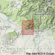
Pg. 8. From section displayed in Animas Valley and at Rico we can assume presence of other sedimentary formations below Dolores formation (oldest exposed) in La Plata dome. These embrace Rico and Hermosa (Carboniferous), the Ouray (Devonian), and the Ignacio (Cambrian), all in apparent structural conformity.
Source: US geologic names lexicon (USGS Bull. 896, Hermosa entry p. 945).
- Usage in publication:
-
- Ignacio quartzite*
- Modifications:
-
- Principal reference
- Dominant lithology:
-
- Quartzite
- Shale
- AAPG geologic province:
-
- San Juan basin
Summary:
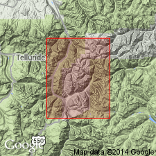
Pg. 35. Ignacio quartzite. Earliest Paleozoic formation of Silverton quadrangle, southwestern Colorado, is a quartzite with some sandy shales 100 to 200 feet thick, which is seen on west side of Animas River from the monzonite contact to Molas Lake, and imperfectly on east side of the Animas. This quartzite has been traced down the Animas to below Rockwood, and is called Ignacio quartzite, from its characteristic development on the bench where lake of that name is situated. A southerly dip carries this quartzite onto south slope of Needle Mountains, where a few indistinct fossils indicate its Cambrian age. The rather shaly beds, often calcareous [Elbert formation], succeeding the quartzite have not yielded fossils. If there are any Silurian strata in this section they are probably represented by these calcareous shales and sandstones. The Ignacio quartzite overlies Algonkian quartzites and slates. [Age is Late Cambrian.]
Source: US geologic names lexicon (USGS Bull. 896, p. 1005).
- Usage in publication:
-
- Ignacio quartzite
- Modifications:
-
- Age modified
- AAPG geologic province:
-
- San Juan basin
- San Juan Mountains province
Summary:
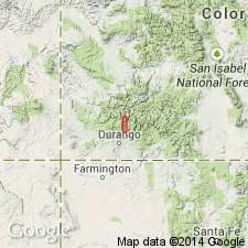
Ignacio Quartzite. Referred to Late Cambrian or Early Ordovician on basis of occurrence of oboloid brachiopods [in a thin sandstone bed 36 feet above base of formation]. This is contrary to recent conclusion of Barnes (1954) but in support of age provisionally assigned by earlier workers. Major unconformity occurs between Ignacio and overlying Elbert of Late Devonian age. Ignacio was deposited on essentially Precambrian terrane. Suggested that rocks underlying Ignacio in Animas Valley are not intrusive into the Ignacio. [Maximum thickness 200 feet.] Locally overlies Twilight granite.
[Measured section in roadcut 2.3 mi south of summit of Coal Bank Hill, Engineer Mountain 15-min quadrangle, San Juan Co., southwestern CO. Consists of interbedded gray to white, fine- to medium-grained, massive quartzite, dark-red, green, and brown, fine- to medium-grained sandstone, and green, purple shale. Thickness 112.5 feet.]
Source: US geologic names lexicon (USGS Bull. 1200, p. 1855); additional information (in brackets) from GNU records (USGS DDS-6; Denver GNULEX).
- Usage in publication:
-
- Ignacio Quartzite*
- Modifications:
-
- Areal extent
- AAPG geologic province:
-
- Black Mesa basin
- Paradox basin
- San Juan basin
Summary:
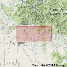
Pg. A5 (fig. 3), A8, A12, A13, A14 (fig. 5, isopach map). Ignacio Quartzite. Mainly white, reddish-brown, and light-brown conglomerate; feldspathic and quartzose sandstone; purple to green, burrowed, micaceous mudstone and siltstone; and minor dolomite. Thickness up to 160 feet in northwestern corner of Reservation. [Not mapped (pl. 1, geol. map).] Unconformably underlies the whitish quartzites of Upper Devonian Elbert Formation (Aneth Formation is absent in this area); unconformably overlies Precambrian granitic and high-grade metamorphic rocks. Age is considered Late Cambrian, based on meager fossil data.
Recognized in the Four Corners region of southwestern Colorado, northwestern New Mexico, northeastern Arizona, and southeastern Utah.
Source: Publication.
- Usage in publication:
-
- Ignacio Quartzite*
- Modifications:
-
- Areal extent
- AAPG geologic province:
-
- Paradox basin
Summary:
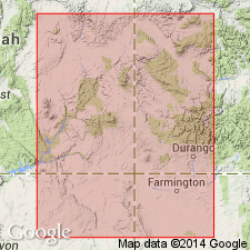
Represents a transgressive clastic deposit at base of Cambrian section in Paradox Basin in central UT. Basal clastic unit is referred to as Ignacio in southwestern CO, Tintic Quartzite in central UT, and as Tapeats Sandstone in northern AZ. Boundary between Ignacio and Tintic is undefined and arbitrary. Ignacio is exposed on southeast side of Paradox Basin; Tintic is present over most of eastern UT, though is not exposed anywhere in Paradox basin. Isopach map of combined Ignacio-Tintic (plate 7); stratigraphic charts; cross sections. Is thickest along zones oriented southwest-northeast along a line connecting Monument upwarp with Naturita, CO, and along a northern trough that extends through Moab, UT. To southeast and east, Ignacio eventually pinches out. Unconformably overlies Precambrian rocks; in Durango, CO, area unconformably underlies McCracken Sandstone Member of Elbert Formation. In the eastern Paradox Basin where name Ignacio is used, basal clastic unit is considered Late Cambrian age; in the west where name Tintic is used, basal unit has been dated as Early and Middle Cambrian.
Source: GNU records (USGS DDS-6; Denver GNULEX).
- Usage in publication:
-
- Ignacio Quartzite
- Modifications:
-
- Revised
- Age modified
- Dominant lithology:
-
- Sandstone
- AAPG geologic province:
-
- San Juan basin
- San Juan Mountains province
McBride, E.F., 2016, Stratigraphy, petrography, and depositional history of the Ignacio Quartzite and McCracken Sandstone Member of the Elbert Formation, southwestern Colorado, U.S.A.: University of Wyoming, Department of Geology and Geophysics, Rocky Mountain Geology, v. 51, no. 2, p. 23-68.
Summary:
Ignacio Quartzite. In the Silverton-Durango area, San Juan and La Plata Counties, southwestern Colorado, subdivided into 2 newly named members (descending): (1) Spud Hill Member, feldspathic sandstone and minor sandy shale, up to 21 m thick; and (2) Tamarron Member, chiefly sandstone, up to 24 m thick. [The Spud Hill and Tamarron replace †/Stag Mesa Member of Campbell and Gonzales, 1996, Utah Geol. Assoc. Gdbk., no. 25.] Total thickness of formation in study area about 32 m. Gradationally underlies Upper Devonian McCracken Member of Elbert Formation, differences based on color, resistance to weathering, and sedimentary structures; contact generally placed where brown, red, or maroon sandstones (Ignacio) are overlain by white, generally better-cemented sandstones (McCracken). Unconformably overlies unnamed Precambrian(?) coarse conglomerate or Precambrian igneous or metamorphic rocks (Bakers Bridge Granite, Twilight Gneiss). Fossils (trace fossil PLANOLITES; oboloid brachiopods, placoderm fish plates). Age is controversial (see p. 44-46); considered Late Cambrian(?) or Late Devonian(?).
Source: Publication.
For more information, please contact Nancy Stamm, Geologic Names Committee Secretary.
Asterisk (*) indicates published by U.S. Geological Survey authors.
"No current usage" (†) implies that a name has been abandoned or has fallen into disuse. Former usage and, if known, replacement name given in parentheses ( ).
Slash (/) indicates name conflicts with nomenclatural guidelines (CSN, 1933; ACSN, 1961, 1970; NACSN, 1983, 2005, 2021). May be explained within brackets ([ ]).

