The National Geologic Map Database is migrating to a new infrastructure. We apologize for any service disruptions during this process.
|
|---|


- Usage in publication:
-
- Ice Box [Icebox] shale
- Modifications:
-
- Original reference
- Dominant lithology:
-
- Shale
- AAPG geologic province:
-
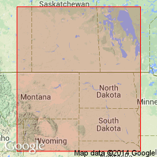
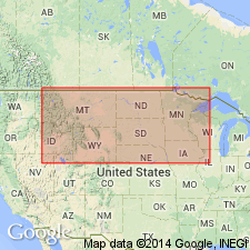
- Williston basin
Summary:
Pg. 45-46. Ice Box [Icebox] shale. Olive-green shale. [=shale member of Whitewood formation of Furnish and others, 1936.] Conformably underlies Roughlock siltstone (new); conformably overlies Aladdin sandstone (new). Fossils. Age is tentatively considered Middle Ordovician (Mohawkian; Black River to early Trenton). [On p. 45 (fig. and text), thickness stated to be 35 to 40 feet (fig.), 30 to 35 feet at type (text), and 30 to 40 feet in outcrop belt (text).]
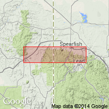
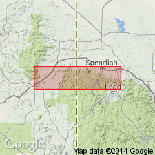
Type section: about 0.5 mi west of junction of U.S. Highways 14 and 85, in secs. 14 and 23, T. 5 N., R. 3 E., [0.5 mi north of Deadwood, Deadwood North 7.5-min quadrangle, Lawrence Co.], western SD.
Named from Ice Box [Icebox] Gulch [approx. 10 mi southwest of type section].
[Icebox Gulch, a tributary of Spearfish Creek, is located east of Cheyenne Crossing, in secs. 22, 23, and 24, T. 4 N., R. 2 E., Lead 7.5-min quadrangle, Lawrence Co., Black Hills National Forest, western SD (USGS GNIS database, USGS historical topographic map collection TopoView). --at Cheyenne Crossing there is also a junction of U.S. Highways 14 and 85, just west of secs. 14 and 23 in T. 4 N., R. 2 E. oh bother.]
Source: Publication.
- Usage in publication:
-
- Icebox shale
- Modifications:
-
- Overview
- AAPG geologic province:
-
- Williston basin
- Powder River basin
Summary:
In the Black Hills, SD and WY, siltstones, shales, and sandstones, which lie beneath the true dolomites of the Whitewood, as defined by Darton and Paige (1925) [Darton, 1925], and above the Deadwood formation, are in descending order: Roughlock siltstone, Icebox shale, and Aladdin sandstone, as proposed by McCoy (1952). Provisionally adopts this nomenclature for the Black Hills in the Williston and Powder River basins, stating that more work needs to be done before the nomenclature can be evaluated or consistently applied, even in the Black Hills. Tentatively considered Middle Ordovician; may eventually prove to be Late Ordovician in age.
Source: GNU records (USGS DDS-6; Denver GNULEX).
- Usage in publication:
-
- Icebox shale
- Modifications:
-
- Overview
- AAPG geologic province:
-
- Williston basin
- Powder River basin
Summary:
Gives detailed type section about 1/2 mi west of junction of U.S. Hwys 14 and 85, secs 14 and 23, T5N, R3E, Lawrence Co, SD in the Williston basin. Consists mostly of olive-green, platy to splintery shale; black chert nodules, above a bentonite bed 1 ft thick, near the top; silty in bottom 20 ft becoming sandy in bottom 1 ft. Thickness 32 ft, not including an estimated 5 ft missing by Quaternary erosion at the top. Overlies the Aladdin sandstone disconformably [shows hiatus in correlation chart]; underlies Roughlock siltstone gradationally. Repeats generalized description (McCoy, 1952) for nearby parts of the northern Black Hills, SD and WY [in the Williston and Powder River basins]. Middle Ordovician (Black River) in age.
Source: GNU records (USGS DDS-6; Denver GNULEX).
- Usage in publication:
-
- Icebox member
- Modifications:
-
- Revised
- AAPG geologic province:
-
- Williston basin
Summary:
Pg. 9 (fig. 2), 10, 11, 15-16, 35-36 (figs. 9-10), 52 (fig. 11), 57 (fig. 15), 58-59; C.G. Carlson, 1958 (1959), Stratigraphy of Deadwood-Winnipeg interval in North Dakota and northwestern South Dakota, 2nd Intl. Williston Basin Symp., p. 20-26. Icebox member of Winnipeg formation. McCoy's (1952) Icebox formation (unit C of Whitewood formation of Butler and others, 1955) revised to member of Winnipeg formation. Consists of greenish noncalcareous shale, thickness up to 145 feet (Nesson anticline, northwestern North Dakota). Gradationally underlies Roughlock member of Winnipeg (=Roughlock formation of McCoy, 1952, unit D of Whitewood formation of Butler and others, 1955). Gradationally overlies Black Island member of Winnipeg or, where absent, unconformably overlies Deadwood formation (revised). Fossils (conodonts). Age is Middle Ordovician (Blackriverian to early Trentonian).
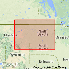
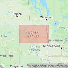
[Discussion is chiefly subsurface of North Dakota, northwestern South Dakota, eastern Montana, and Saskatchewan and Manitoba, Canada.]
Source: Publication.
- Usage in publication:
-
- Icebox shale
- Modifications:
-
- Revised
- AAPG geologic province:
-
- Williston basin
- Powder River basin
Summary:
Assigned as a formation in the Winnipeg group in northern Black Hills in Williston and Powder River basins. The top of the formation at the outcrop in the Black Hills is correlated with a readily identifiable, slightly denser, resistive horizon on electric logs identified as the mid-Winnipeg marker bed (A horizon). Is the lower half of the Winnepeg shale of basin terminology [the part below the A horizon]. Middle Ordovician in age based on correlation with the Simpson or Glenwood shale of OK.
Source: GNU records (USGS DDS-6; Denver GNULEX).
- Usage in publication:
-
- Icebox Shale Member
- Modifications:
-
- Overview
- AAPG geologic province:
-
- Williston basin
- Powder River basin
Summary:
Assigned as a member of the Winnipeg Formation in the Black Hills, SD and WY, in the Williston and Powder River basins, and as a formation in the Winnipeg Group in the subsurface of the Williston basin. Middle Ordovician in age (Trenton and Black River in the Black Hills; Trenton in the subsurface of the Williston basin).
Source: GNU records (USGS DDS-6; Denver GNULEX).
For more information, please contact Nancy Stamm, Geologic Names Committee Secretary.
Asterisk (*) indicates published by U.S. Geological Survey authors.
"No current usage" (†) implies that a name has been abandoned or has fallen into disuse. Former usage and, if known, replacement name given in parentheses ( ).
Slash (/) indicates name conflicts with nomenclatural guidelines (CSN, 1933; ACSN, 1961, 1970; NACSN, 1983, 2005, 2021). May be explained within brackets ([ ]).